- Usage in publication:
-
- Tioga bentonite
- Modifications:
-
- Named
- Dominant lithology:
-
- Bentonite
- Shale
- AAPG geologic province:
-
- Appalachian basin
Summary:
Thin but persistent seam of brown micaceous shale, commonly containing abundant pyrite; constitutes marker in Middle Devonian. Occurs at or near boundary between Hamilton group and Onondaga formation; shale seam appears to be bentonitic and is here called Tioga bentonite.
Source: GNU records (USGS DDS-6; Reston GNULEX).
- Usage in publication:
-
- Tioga Ash Bed*
- Modifications:
-
- Redescribed
- Overview
- Areal extent
- AAPG geologic province:
-
- Appalachian basin
Summary:
Name changed to Tioga Ash Bed. The term "bentonite" is replaced by "ash" in the name because the major component of the ash is not smectite, the clay present in bentonite. The Tioga Ash Bed is found in the Appalachian basin at or near the contact between the following units: Marcellus Shale and Onondaga Limestone, Marcellus Shale and Needmore Shale, Delaware and Columbus Limestones; in NY at contact between the Seneca and Moorehouse Members of the Onondaga Limestone; in subsurface WV in the Huntersville Chert.
Source: GNU records (USGS DDS-6; Reston GNULEX).
- Usage in publication:
-
- Tioga Bentonite
- Modifications:
-
- Revised
- AAPG geologic province:
-
- Appalachian basin
Summary:
As restricted herein, the Tioga Bentonite is at a constant stratigraphic horizon in the eastern U.S. and in southern Ontario. This position is very near, or sometimes at, the base of the Cazenovian Marcellus Shale and its correlatives. It is not found in the Onondaga Limestone near the Seneca-Moorehouse boundary as previously thought. This bentonite near the top of the Moorehouse Member is herein named the Onondaga Indian Nation Bentonite. Therefore, the Seneca Member and the Marcellus Shale are separate and distinct and are not facies of one another. The Seneca is late Onesquethawan and the Marcellus is Cazenovian. In southern IN, the Tioga is near the base of the Speeds Limestone; in central OH, it is near the base of the Dublin "Shale" of the Delaware Formation; in NY, it is near the base of the Union Springs Member or the correlative Bakoven Member of the Marcellus; and in PA, it is near the base of the Marcellus.
Source: GNU records (USGS DDS-6; Reston GNULEX).
- Usage in publication:
-
- Tioga Ash Bed
- Modifications:
-
- Geochronologic dating
- Age modified
- AAPG geologic province:
-
- Appalachian basin
Summary:
The radiometric date of the Tioga Ash Bed near Lewisburg, PA, is the only precise age in the Appalachian basin. Eruption was dated at 390.0+/-0.5 by Roden, Parrish, and Miller (1990). The volcanic source came from near Fredericksburg, VA. This Tioga number is about 9 million years older than the age indicated by the Harland and others (1990) time scale.
Source: GNU records (USGS DDS-6; Reston GNULEX).
- Usage in publication:
-
- Tioga Ash Bed*
- Modifications:
-
- Biostratigraphic dating
- AAPG geologic province:
-
- Appalachian basin
Summary:
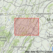
Conodont biostratigraphy indicates that the Tioga Ash Bed in the Winchester 30 X 60 minute quadrangle is of Middle Devonian (Eifelian) age. Conodonts recovered from the unit (at the base of the Marcellus Shale) are indicative of the PO. C. COSTATUS Zone.
Source: GNU records (USGS DDS-6; Reston GNULEX).
For more information, please contact Nancy Stamm, Geologic Names Committee Secretary.
Asterisk (*) indicates published by U.S. Geological Survey authors.
"No current usage" (†) implies that a name has been abandoned or has fallen into disuse. Former usage and, if known, replacement name given in parentheses ( ).
Slash (/) indicates name conflicts with nomenclatural guidelines (CSN, 1933; ACSN, 1961, 1970; NACSN, 1983, 2005, 2021). May be explained within brackets ([ ]).

