- Usage in publication:
-
- Tintic Delmar Latite*
- Modifications:
-
- Named
- Geochronologic dating
- Dominant lithology:
-
- Latite
- Tuff
- AAPG geologic province:
-
- Wasatch uplift
Summary:
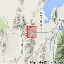
Named as top of three formations of Laguna Springs Volcanic Group (revised; rank raised) for exposures just south of Tintic Delmar mine (from which unit is named) in south-central part of adjacent Allens Ranch quad, W1/2 sec 26, T9S, R2W, Utah Co, UT on Wasatch uplift. Consists of two informal members: 1) a lower tuff member, buff to white, ranging from volcanic ash and lapilli tuff to agglomerate breccia, including abundant boulders and lapilli-sized clasts of the coarse-grained lavas that lie above and below it, as well as fragments of plagioclase, hornblende, biotite, and augite, all imbedded in a matrix of glass shards, comminuted rock, and arkosic sand; and 2) an upper flow member, gray to dark-reddish-brown, medium-grained latite porphyry with imperfectly developed planar structure. Close similarity of mineralogical and chemical composition of porphyritic lavas of Pinyon Queen Latite (new) of Laguna Springs Volcanic Group and this unit leaves little question that they were derived from same magma source. Biotite from flow member dated by K-Ar as 32.2 +/-1 m.y., and hornblende as 32.3 +/-1 m.y. These dates confirm middle Oligocene age and relatively short duration of Oligocene eruptive episode of Tintic volcanic center. Overlies Pinyon Queen Latite of Laguna Springs Volcanic Group; underlies Pinyon Creek Conglomerate (new). Geologic map, measured sections, stratigraphic chart.
Source: GNU records (USGS DDS-6; Denver GNULEX).
For more information, please contact Nancy Stamm, Geologic Names Committee Secretary.
Asterisk (*) indicates published by U.S. Geological Survey authors.
"No current usage" (†) implies that a name has been abandoned or has fallen into disuse. Former usage and, if known, replacement name given in parentheses ( ).
Slash (/) indicates name conflicts with nomenclatural guidelines (CSN, 1933; ACSN, 1961, 1970; NACSN, 1983, 2005, 2021). May be explained within brackets ([ ]).

