

- Usage in publication:
-
- Tinaja beds*
- Modifications:
-
- First used
- Dominant lithology:
-
- Gravel
- Silt
- AAPG geologic province:
-
- Basin-and-Range province
Summary:
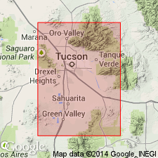
First published use of name [as an informal unit?. Bed as a rank term was usually applied to the smallest ranked unit in rock-stratigraphic terminology, ASC, 1970, art 8(a)]. Intent to name, source of geographic name, and designation of a type not stated. Crop out only along margins of the Tucson basin, Pima Co, AZ in the Basin-and-Range province. Geologic map. Have been mapped in earlier reports as Rillito II and Rillito III, gravel of Nogales, and probably as part of unit 5 of Pantano Formation in various parts of the basin. Tinaja unconformably overlies the Oligocene Pantano and is unconformably overlain by the Pleistocene Fort Lowell Formation. Thought to range from 0 to 2,000+ ft thick; may be as much as 5,000 ft thick. Tinaja is a sedimentary-fill deposited in a subsiding basin. Sandy gravel predominates on the basin margins whereas gypsiferous clayey silt and mudstone predominate in the central part of the basin. Basaltic andesite and dacitic flows present in Sierrita Mountains. Fragments of Catalina Gneiss found in Tinaja in Rillito Creek-Tanque Verde Creek area; granitic fragments found in Tinaja in north and east part of basin; volcanic rocks present as fragments in Tinaja in west part of basin. Many local facies changes. Divisible into two parts that are separated by an unconformity. Assigned a Miocene and Pliocene age [reason for age not stated].
Source: GNU records (USGS DDS-6; Denver GNULEX).
For more information, please contact Nancy Stamm, Geologic Names Committee Secretary.
Asterisk (*) indicates published by U.S. Geological Survey authors.
"No current usage" (†) implies that a name has been abandoned or has fallen into disuse. Former usage and, if known, replacement name given in parentheses ( ).
Slash (/) indicates name conflicts with nomenclatural guidelines (CSN, 1933; ACSN, 1961, 1970; NACSN, 1983, 2005, 2021). May be explained within brackets ([ ]).