The National Geologic Map Database is migrating to a new infrastructure. We apologize for any service disruptions during this process.
|
|---|


- Usage in publication:
-
- Tina limestone member
- Modifications:
-
- Revised
- AAPG geologic province:
-
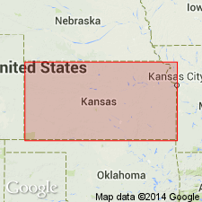
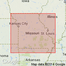
- Forest City basin
- Cherokee basin
Summary:
Revised as basal member (of 3) of Altamont limestone of the Marmaton group in southeastern KS. Extends from Carroll Co, MO far into southeastern KS in the Forest City basin. Is 0.4 ft thick in a measured section in NW1/4 SW1/4 sec 29, T25S, R23E in Bourbon Co, KS in Cherokee basin, and is 6 ft thick in another measured section in Labette Co, KS in Cherokee basin. For many miles along its outcrop, Tina limestone member is not more than 2 ft thick, and generally thickness is less. Consists of mostly gray, buff-weathering, nodular, earthy limestone having a sparse molluscan fauna. Contains much algal material in upper part; gastropods; SQUAMULARIA common. Locally grades laterally into calcareous sandstone. In many exposures is cross-bedded. In southern part of KS line of outcrop, Tina thickens to as much as 16 ft and is a mass of CHAETETES colonies. Overlies Bandera shale of Marmaton group; underlies Lake Neosho shale member (new) of Altamont limestone of Marmaton. Cross section. Of Pennsylvanian, Des Moines age.
Source: GNU records (USGS DDS-6; Denver GNULEX).
- Usage in publication:
-
- Tina [member]†
- Modifications:
-
- Abandoned
Summary:
Abandoned. Replaced by Amoret limestone member (new) which is lower member of Altamont formation of Marmaton group. Name Tina is inappropriate because type section of Tina is actually Higginsville member of Fort Scott formation. Within study area in MO, Amoret outcrops in Bates, Grundy, Sullivan and Putnam Cos, Forest City basin and Adair Co, Lincoln anticline.
Source: GNU records (USGS DDS-6; Denver GNULEX).
For more information, please contact Nancy Stamm, Geologic Names Committee Secretary.
Asterisk (*) indicates published by U.S. Geological Survey authors.
"No current usage" (†) implies that a name has been abandoned or has fallen into disuse. Former usage and, if known, replacement name given in parentheses ( ).
Slash (/) indicates name conflicts with nomenclatural guidelines (CSN, 1933; ACSN, 1961, 1970; NACSN, 1983, 2005, 2021). May be explained within brackets ([ ]).