

- Usage in publication:
-
- Timpoweap member*
- Modifications:
-
- Original reference
- Dominant lithology:
-
- Conglomerate
- Limestone
- Shale
- AAPG geologic province:
-
- Plateau sedimentary province
- South Western Overthrust
Summary:
Pg. 226, 227; H.E. Gregory, 1950, USGS Prof. Paper 220, p. 48 (fig. 24), 52 (table), 60-61. Timpoweap member of Moenkopi formation. Consists of three unlike groups of strata: at base, conglomerates and breccia; higher up limestone; and at top variegated shales. Average thickness 170 feet. Conglomeratic beds unevenly distributed and variable in composition; shales, yellow, white, brown, and red, ferruginous, calcareous, arenaceous, and gypsiferous, includes calcareous sandstone in beds 1 to 3 feet thick. Basal member of formation; separated from overlying Virgin limestone member by 200-foot interval of sandstone termed lower red member; unconformably overlies Kaibab limestone. Age is Early Triassic.
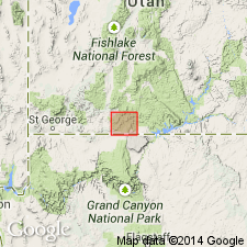
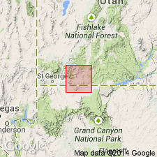
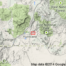
Type locality: near Virgin City, Washington Co., central southern UT. Traced eastward from type locality to Paria River. [River map shows Virgin, Washington Co., and Timpoweap Canyon of Virgin River, Washington Co.]
Source: US geologic names lexicon (USGS Bull. 1200, p. 3892).
- Usage in publication:
-
- Timpoweap member*
- Modifications:
-
- Overview
- AAPG geologic province:
-
- Great Basin province
- Plateau sedimentary province
Summary:
Is the basal member of the Moenkopi formation which unconformably overlies the broad platform made up of the Kaibab limestone. Underlies lower red member of Moenkopi gradationally. Very resistant to erosion. Stratigraphic sections. Measured sections. Is 13 ft thick at Little Creek Mountain, 4 mi north of UT-AZ line where it has a tripartite division of basal conglomerate, middle buff to gray, massive limestone, and upper yellow calcareous shale. Section 138 ft thick measured at Belted Cliffs, Isom Wash, 2.5 mi west of Virgin City where it consists of a basal breccia of gray angular fragments of gray limestone, white quartz, quartzite, gray sandstone, chert, a middle interbedded tan shale and gray limestone, and an upper brown to yellow shale. Moenkopi mapped (geologic map) west part of area, just east of the Hurricane Cliffs, Washington Co, UT in the Great Basin province and southward into north AZ in Mohave Co, Great Basin province, and Coconino Co, Plateau sedimentary province; exact areal limits of Timpoweap not stated.
Source: GNU records (USGS DDS-6; Denver GNULEX).
- Usage in publication:
-
- Timpoweap Member*
- Modifications:
-
- Reference
- AAPG geologic province:
-
- Great Basin province
Summary:
Four reference sections proposed in Washington Co, UT, Great Basin province, for this basal member of Moenkopi Formation--1) NE1/4 SW1/4 SE1/4 sec 19, T41S, R12W at Isom Wash-Virgin River intersection, 2) SW1/4 SW1/4 NE1/4 sec 30, T41S, R12W at Isom Wash-UT Hwy 15 intersection, 3) SW1/4 NE1/4 NE1/4 sec 30, T41S, R12W at first wash east of Isom Creek, 4) NE1/4 NW1/4 NE1/4 sec 29, T41S, R12W. Geologic map; member mapped along Virgin River east of La Verkin to sec 28. Unconformably overlies unit 12 of Harrisburg Member of Kaibab Formation. Contact placed at first appearance of Upper Triassic fossils or, where fossils missing, at topographic unconformity. Underlies lower red member of Moenkopi. Upper contact modified; it is placed at a different horizon than the one chosen by Gregory (1950), or at the top of the calcarenite rather than between the yellow shale (formerly considered Timpoweap) with red shale (formerly basal unit of lower red member) above the calcarenite. Consists of basal conglomerate (of rounded to subrounded pebbles, cobbles, boulders) and cross-bedded sandstone, a middle massive limestone with angular to subangular chert nodules, some poorly sorted oolites, gastropods, and an upper cross-bedded calcarenite whose upper surface has impressions of ammonites and other fossils. Cross sections. Basal units are fluvial origin; upper units are marine. Triassic age.
Source: GNU records (USGS DDS-6; Denver GNULEX).
For more information, please contact Nancy Stamm, Geologic Names Committee Secretary.
Asterisk (*) indicates published by U.S. Geological Survey authors.
"No current usage" (†) implies that a name has been abandoned or has fallen into disuse. Former usage and, if known, replacement name given in parentheses ( ).
Slash (/) indicates name conflicts with nomenclatural guidelines (CSN, 1933; ACSN, 1961, 1970; NACSN, 1983, 2005, 2021). May be explained within brackets ([ ]).