The National Geologic Map Database is migrating to a new infrastructure. We apologize for any service disruptions during this process.
|
|---|


- Usage in publication:
-
- Timpas formation*
- Modifications:
-
- First used
- Dominant lithology:
-
- Limestone
- Shale
- AAPG geologic province:
-
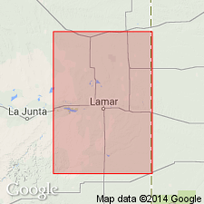
- Las Animas arch
Summary:
First used as basal formation of Niobrara group. Probably named for Timpas Creek, which enters the Arkansas River below Rocky Ford, Otero Co, CO on Las Animas arch. No type locality designated. Composed of a series of limestone beds a few in to 3 ft thick separated by gray shale 1 or 2 in thick in the lower part and light-gray limy shale with occasional thin limestone beds which total 100-125 ft thick in the upper part. Formation is 175 ft thick. Overlies Dakota sandstone; underlies Apishapa formation of Niobrara group. Is fossiliferous (INOCERAMUS, OSTREA, fish). Is of Cretaceous age.
Source: GNU records (USGS DDS-6; Denver GNULEX).
- Usage in publication:
-
- Timpas limestone*
- Modifications:
-
- Areal extent
- Redescribed
- Dominant lithology:
-
- Limestone
- Shale
- AAPG geologic province:
-
- Las Vegas-Raton basin
Summary:
Redescribed from Timpas formation to Timpas limestone. Characterized by soft limestone and calcareous shale, generally 175 ft thick. Is fossiliferous. Extended into the Las Vegas-Raton basin of south-central CO. Is of Late Cretaceous age.
Source: GNU records (USGS DDS-6; Denver GNULEX).
- Usage in publication:
-
- Timpas Limestone†
- Modifications:
-
- Abandoned
Summary:
Abandoned and replaced by term Fort Hays Limestone Member of Niobrara Formation in the Denver and Las Vegas-Raton basins and the Las Animas arch. Timpas Limestone and Apishapa Shale are equivalents of Fort Hays Limestone and Smoky Hill Members of Niobrara. Timpas is equivalent to the Fort Hays Limestone Member and the shale and limestone, lower shale, and lower limestone of the lower part of the Niobrara of this report. Although Timpas and Apishapa were named first, these names have been used only in southeast CO, whereas the names Fort Hays and Smoky Hill have been used regionally.
Source: GNU records (USGS DDS-6; Denver GNULEX).
For more information, please contact Nancy Stamm, Geologic Names Committee Secretary.
Asterisk (*) indicates published by U.S. Geological Survey authors.
"No current usage" (†) implies that a name has been abandoned or has fallen into disuse. Former usage and, if known, replacement name given in parentheses ( ).
Slash (/) indicates name conflicts with nomenclatural guidelines (CSN, 1933; ACSN, 1961, 1970; NACSN, 1983, 2005, 2021). May be explained within brackets ([ ]).