- Usage in publication:
-
- Tijeras Greenstone
- Modifications:
-
- Named
- Dominant lithology:
-
- Greenstone
- AAPG geologic province:
-
- Southwestern Basin-and-Range region
Summary:
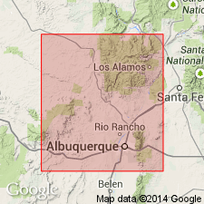
Named. Occurs in Bernalillo Co, NM, Southwestern Basin-and-Range region, in a belt 1 mi wide and 5.5 mi long between the Tijeras fault and Cibola Gneiss (first used) on northwest and Cerro Pelon ridge on southeast. No type locality designated. Noted as present in Ts9 and 10N, R5E, Bernalillo Co. The principal part of the greenstone occurs between Cerro Pelon and Madera Canyon; outlier present east of main mass in Bernalillo Co. Geologic map. Is dark green, nonfoliated to highly schistose, either hornblende or chlorite schist. Consists of epidote, quartz, plagioclase, and calcite. Has lesser amounts of biotite, sericite, actinolite, and opaque minerals. Is "associated with" [but are these parts? of Tijeras] mica schist, quartzite, quartz-mica schist, phyllite, marble, and banded epidote. In contact with Cibola Gneiss (not new). Precambrian age.
Source: GNU records (USGS DDS-6; Denver GNULEX).
For more information, please contact Nancy Stamm, Geologic Names Committee Secretary.
Asterisk (*) indicates published by U.S. Geological Survey authors.
"No current usage" (†) implies that a name has been abandoned or has fallen into disuse. Former usage and, if known, replacement name given in parentheses ( ).
Slash (/) indicates name conflicts with nomenclatural guidelines (CSN, 1933; ACSN, 1961, 1970; NACSN, 1983, 2005, 2021). May be explained within brackets ([ ]).

