The National Geologic Map Database is migrating to a new infrastructure. We apologize for any service disruptions during this process.
|
|---|


- Usage in publication:
-
- Tihvipah limestone*
- Modifications:
-
- Named
- Dominant lithology:
-
- Limestone
- Shale
- AAPG geologic province:
-
- Great Basin province
Summary:
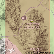
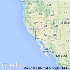
Named for exposure northwest of Tihvipah Spring which is 2 mi northeast of Burro Spring. [Name Tihvipah Spring, in 1938 was used by National Park Service rangers in Death Valley.] Type locality designated on hill east of Rest Spring, north Panamint Range, Inyo Co, CA. Consists mostly of platy light-gray limestone, interbedded, shaly limestone or calcareous shale and some beds 1 to 3 feet thick of fine-grained medium-gray limestone. Shaly rocks range in color from very light gray to pale red or grayish pink. Dark fusulinids and fragments from other fossils form abrupt lenses, in section, as if in filled channels. Is about 200 feet thick. Overlies Rest Spring shale (new). In Quartz Spring area, top part of Tihvipah limestone is eroded. Shown on geologic sketch map and columnar section of Quartz Spring area. Age is Pennsylvanian based on fusulinids identified by L.G. Henbest (written commun., 1952).
Source: GNU records (USGS DDS-6; Menlo GNULEX).
- Usage in publication:
-
- Tihvipah Limestone*
- Modifications:
-
- Areal extent
- Age modified
- AAPG geologic province:
-
- Great Basin province
Summary:
Unit geographically extended into area of report (central Argus Range, Santa Rosa Hills, and southern Darwin Hills. Overall age in these areas is considered to be Early and Middle Pennsylvanian based on Atokan (early Middle Pennsylvanian fusulinids (McAllister, 1953; Hall, 1971; Moore, 1976; Stone, 1984) and Morrowan (Early Pennsylvanian) conodonts identified by H.R. Lane and P.H. Miller (written commun., 1976). Conodonts are exposed few meters above base of unit in southern Darwin Hills and also in Marble Canyon in Cottonwood Mountains. Thus unit age [everywhere] is Early and Middle Pennsylvanian based on stratigraphic correlations.
Source: GNU records (USGS DDS-6; Menlo GNULEX).
For more information, please contact Nancy Stamm, Geologic Names Committee Secretary.
Asterisk (*) indicates published by U.S. Geological Survey authors.
"No current usage" (†) implies that a name has been abandoned or has fallen into disuse. Former usage and, if known, replacement name given in parentheses ( ).
Slash (/) indicates name conflicts with nomenclatural guidelines (CSN, 1933; ACSN, 1961, 1970; NACSN, 1983, 2005, 2021). May be explained within brackets ([ ]).