- Usage in publication:
-
- Tigerton anorthosite
- Modifications:
-
- First used
- Dominant lithology:
-
- Anorthosite
- AAPG geologic province:
-
- Lake Superior region
Summary:
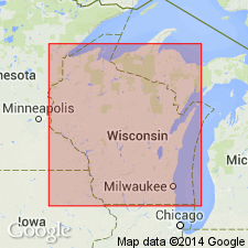
First published use as map unit in vicinity of Tigerton, Shawano Co, WI (Lake Superior region). Type locality not given. Derivation of name not stated; apparently named for Tigerton, WI. Is shown on geologic sketch map (p. 16) to extend as far north as Mattoon, WI. Is surrounded and dissected by Bowler granite (first used). "The anorthosite is altered, with An content of plagioclase varying from An40 to An60 * * * some being clear and some cloudy. The conspicuous mafics are amphibole and biotite, with pyroxene recognizable in some hand specimens and frequently found in thin sections as core of amphiboles. Magnetite and/or ilmenite locally present, as in chlorite. The rock is blue, gray, light gray, or almost black on fresh surfaces, light gray to white on weathered surfaces. Strickly speaking, rocks of many exposures should be called gabbroic anorthosite, anorthositic gabbro, hornblende anorthosite, or some such name, to show that over 10% of the rock is mafic and to reflect variations in mafic and plagioclase composition. * * * unit as a whole is called an anorthosite * * * frequently shows a single or double foliation * * *. On some weathered surfaces an alignment of plagioclase crystals is shown by cleavages on albite twinning * * * does not always agree with mafic foliation. The grain size is variable, with possibility that larger grains are related to alteration either during late stages of emplacement or to granitic invasion." Age is not stated.
Source: GNU records (USGS DDS-6; Reston GNULEX).
For more information, please contact Nancy Stamm, Geologic Names Committee Secretary.
Asterisk (*) indicates published by U.S. Geological Survey authors.
"No current usage" (†) implies that a name has been abandoned or has fallen into disuse. Former usage and, if known, replacement name given in parentheses ( ).
Slash (/) indicates name conflicts with nomenclatural guidelines (CSN, 1933; ACSN, 1961, 1970; NACSN, 1983, 2005, 2021). May be explained within brackets ([ ]).

