

- Usage in publication:
-
- Thurman formation
- Modifications:
-
- Named
- Dominant lithology:
-
- Rhyolite
- Tuff
- Breccia
- Sandstone
- Basalt
- AAPG geologic province:
-
- Orogrande basin
Summary:
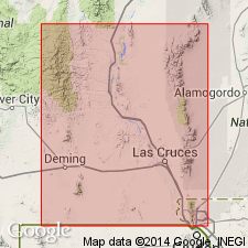
Named for Thurman Arroyo at south end of Caballo Mountains. Type locality designated along the road to Palm Park barite mine in Secs 35 and 36, T18S, R3W, Dona Ana Co, NM, Orogrande basin, where Thurman lies more or less conformably on Palm Park formation (new) and is overlain unconformably by Miocene-Pliocene Santa Fe formation. Widely exposed in vicinity of Thurman Creek and southeastward into Rincon Hills. Also exposed in northern part of Apache Valley and along Garfield Canyon south of Woolfer fault. Also occurs at depth beneath Palomas Valley as indicated in a well log. No detailed section measured. Estimated as 2,100 ft thick at type locality. Most characteristic feature is the white to light-buff color of its outcrops--underlying Palm Park is dark-colored. Basal part of Thurman is a dense, cream- to tan-colored resistant rhyolite tuff-breccia about 50-100 ft thick. Above this bed consists of alternating and intercalated thinner units of pinkish sandy clay (probably in large part volcanic dust), and thicker units of evenly bedded water-laid tuff and tuffaceous sandstone. White, fine- to medium-grained crystal tuff composed chiefly of partly kaolinized feldspar dominates the section. Locally, as at type, a thin flow of dark, locally amygdaloidal basalt is intercalated with the tuffaceous sandstone. Similar in lithology and stratigraphic position to part of Datil, Espinaso and Abiquiu formations elsewhere in NM. Tertiary age.
Source: GNU records (USGS DDS-6; Denver GNULEX).
For more information, please contact Nancy Stamm, Geologic Names Committee Secretary.
Asterisk (*) indicates published by U.S. Geological Survey authors.
"No current usage" (†) implies that a name has been abandoned or has fallen into disuse. Former usage and, if known, replacement name given in parentheses ( ).
Slash (/) indicates name conflicts with nomenclatural guidelines (CSN, 1933; ACSN, 1961, 1970; NACSN, 1983, 2005, 2021). May be explained within brackets ([ ]).