

- Usage in publication:
-
- Thunder Woman Shale Member
- Modifications:
-
- Named
- Dominant lithology:
-
- Shale
- AAPG geologic province:
-
- Iowa shelf
Summary:
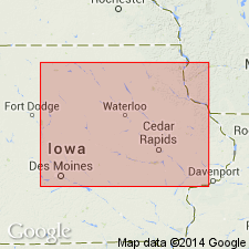
Named as middle member (of 3) of the Lithograph City Formation (new) of Cedar Valley Group (rank raised) in north-central and central IA, Iowa shelf; named after Thunder Woman County Park, northeastern corner of Black Hawk Co. Type section designated at Yokum Quarry about 1 mi to the east of Thunder Woman County Park in NW SW sec 4, T90N, R14W, Black Hawk Co. Occurs in northern Black Hawk, Butler, and southern Floyd Cos; extends to central IA subsurface in Webster Co. Is not regionally extensive. Not present to north in northern Floyd and Mitchell Cos, or south in Scott and Muscatine Cos. At area of occurrence, consists of a light-gray dolomitic shale which varies in thickness from 10 to 20 ft. Overlies Osage Springs Member (new) of Lithograph City Formation of Cedar Valley Group; underlies and tongues out northward into Idlewild Member (new) of Lithograph City Formation of Cedar Valley Group. Cross section; graphic sections; measured section. Fossil list (brachiopods). Horizontal and subvertical burrows common in upper part. Of Devonian age; Middle Devonian-Late Devonian boundary lies somewhere in Lithograph City.
Source: GNU records (USGS DDS-6; Denver GNULEX).
- Usage in publication:
-
- Thunder Woman Shale Member
- Modifications:
-
- Named
- Dominant lithology:
-
- Shale
- Dolomite
- AAPG geologic province:
-
- Iowa shelf
Summary:
Named as a member of Lithograph City Formation (named), one of four formations of Cedar Valley Group (revised). Type locality designated at Yokum Quarry, 1.4 km east of Thunder Woman County Park, NW SW sec 4, T90N, R14W, Black Hawk Co, IA. Present in northern belt of outcrop of Lithograph City and extends into subsurface of central IA on the Iowa shelf. Conformably overlies Osage Springs Member (named) of Lithograph City in northernmost IA. Underlies and intertongues with Idlewild Member (named) in adjacent MN. Ranges between 3-6 m thick. Is about 4+ m thick at type. Erosionally truncated to south with Devonian outcrop belt of eastern IA. Consists of light to medium gray, slightly dolomitic and silty shale, argillaceous dolomite locally, laminated in part with gypsum molds. Shelly fossils absent, but burrows, conodont fragments and fish debris found in subsurface. Probably represents a shale wedge coincident with onset of regional transgression in Late Devonian, Frasnian time. Graphic sections, nomenclature charts. [Frasnian age assigned because underlying Osage Springs in late Givetian and Frasnian.] Formerly part of unit C of Cedar Valley Group or part of Coralville Member of Cedar Valley Formation.
Source: GNU records (USGS DDS-6; Denver GNULEX).
For more information, please contact Nancy Stamm, Geologic Names Committee Secretary.
Asterisk (*) indicates published by U.S. Geological Survey authors.
"No current usage" (†) implies that a name has been abandoned or has fallen into disuse. Former usage and, if known, replacement name given in parentheses ( ).
Slash (/) indicates name conflicts with nomenclatural guidelines (CSN, 1933; ACSN, 1961, 1970; NACSN, 1983, 2005, 2021). May be explained within brackets ([ ]).