

- Usage in publication:
-
- Thomas Fork Formation*
- Modifications:
-
- Named
- Dominant lithology:
-
- Mudstone
- Sandstone
- AAPG geologic province:
-
- Green River basin
Summary:
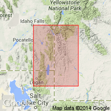
Named for exposures on Thomas Fork, 2 1/2 mi above mouth. Type section selected at SE1/4 NE1/4 NW1/4 sec 26 to SW1/4 SW1/4 NW1/4 sec 25, T28N, R119W, Lincoln Co, WY in the Greater Green River basin. Consists of banded and variegated red, purple, brown, and green mudstone, and gray, tan, and buff sandstone which is conglomeratic in part, with pebbles having diameters of as much as 4 in. Measured sections. Overlies Smiths Formation (a new name); underlies and intertongues with Cokeville Formation (new name). The main body of Thomas Fork is 1,080 ft thick at the type section; the upper tongue is 72 ft thick at type. An Early Cretaceous age is assigned on the basis of fossils in the overlying and underlying units. Intertongues with underlying Smiths Formation and overlying Cokeville Formation, and pinches out in eastern part of the 3 quads. Is equivalent to Bear River Formation. Assigned to the Early Cretaceous.
Source: GNU records (USGS DDS-6; Denver GNULEX).
For more information, please contact Nancy Stamm, Geologic Names Committee Secretary.
Asterisk (*) indicates published by U.S. Geological Survey authors.
"No current usage" (†) implies that a name has been abandoned or has fallen into disuse. Former usage and, if known, replacement name given in parentheses ( ).
Slash (/) indicates name conflicts with nomenclatural guidelines (CSN, 1933; ACSN, 1961, 1970; NACSN, 1983, 2005, 2021). May be explained within brackets ([ ]).