The National Geologic Map Database is migrating to a new infrastructure. We apologize for any service disruptions during this process.
|
|---|


- Usage in publication:
-
- Thirtynine Mile volcanic series
- Modifications:
-
- First used
- Dominant lithology:
-
- Andesite
- Basalt
- AAPG geologic province:
-
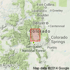
- South Park basin
Summary:
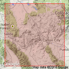
First published use. Intent to name not stated. Present in Park Co, South Park basin on south side of Thirtynine Mile Mountain which is a ridge 6 mi long that forms the watershed between the Park and the drainage southeast. Occurs in southeast corner of Park. Overlies pre-Cambrian. Patches of Cretaceous rocks and of Denver formation protrude beneath the volcanics. Antero and Balfour formations thought to be younger than the volcanics. Composed of a succession of dense, vesicular flows, flow breccias, and agglomerates about 3,000 ft thick. Ranges from andesite to basalt. Is generally fine grained, though porphyritic. Interstitial glass common. Hornblende and augite phenocrysts are rarely large or abundant. Plagioclase varies from labradorite to andesine, and is with olivine, augite, magnetite, and hornblende. Center for these rocks thought to lay near Guffey. Of Oligocene age. Geologic map.
Source: GNU records (USGS DDS-6; Denver GNULEX).
- Usage in publication:
-
- Thirtynine Mile Andesite*
- Modifications:
-
- Named
- Dominant lithology:
-
- Andesite
- AAPG geologic province:
-
- South Park basin
- Denver basin
Summary:
Named for exposures at southern basin of Thirtynine Mile Mountain to its summit in T14S, R73W (the type locality), Guffey quad, Park Co, CO in the South Park basin. Extends east into the Denver basin. Divisible into: 1) lower member, a chaotically stratified, unsorted, well-indurated purple, gray, brown, and black breccias of diverse origin and mode of emplacement. Averages 500 ft thick that covered about 1,000 sq mi; 2) tuff of Stirrup Ranch, a thin tuff in the lower member; and 3) upper member, a unit of stratified andesite flows, lesser amounts of ash-fall breccias, and minor amounts ash-fall tuffs that represent the remnant flanks of a large composite volcano that is about 1,200 ft thick. Overlies Precambrian rocks at type. No younger volcanic units overlap the upper member. A whole rock K-Ar age of 34.1 +/-1.1 obtained from sample of upper member. Formation assigned to the early Oligocene.
Source: GNU records (USGS DDS-6; Denver GNULEX).
For more information, please contact Nancy Stamm, Geologic Names Committee Secretary.
Asterisk (*) indicates published by U.S. Geological Survey authors.
"No current usage" (†) implies that a name has been abandoned or has fallen into disuse. Former usage and, if known, replacement name given in parentheses ( ).
Slash (/) indicates name conflicts with nomenclatural guidelines (CSN, 1933; ACSN, 1961, 1970; NACSN, 1983, 2005, 2021). May be explained within brackets ([ ]).