- Usage in publication:
-
- Theresa formation
- Modifications:
-
- Overview
- AAPG geologic province:
-
- Appalachian basin
Summary:
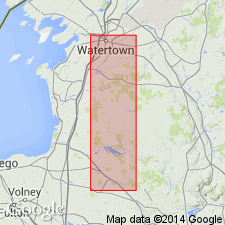
Pg. 11-13. Theresa formation (so-called "passage beds"). A dolomite formation quite like the rocks which elsewhere immediately overlie Potsdam sandstone around the Adirondacks and which have been regarded and mapped as passage beds into Beekmantown formation. Seems to hold a fauna not before recognized in State. Beekmantown is absent in Theresa and Alexandria quadrangles, and Theresa formation is unconformably overlain by Pemelia limestone [of Chazy age].
Source: US geologic names lexicon (USGS Bull. 896, p. 2136-2137).
- Usage in publication:
-
- Theresa formation
- Modifications:
-
- Named
- Dominant lithology:
-
- Dolomite
- Sandstone
- AAPG geologic province:
-
- Appalachian basin
Summary:
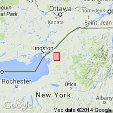
Named Theresa formation in central and eastern NY. Consists of somewhat calcareous, sandy dolomites with interbedded weak sandstones, especially near base. Thickness is 20 to 70 feet. Very closely related to underlying Potsdam sandstone and formerly included in Potsdam but here separated as distinct formation. Base drawn at base of first dolomite layer. Unconformably underlies the Pamelia limestone (of Chazy age) in Theresa and Alexander Bay quadrangles, Jefferson County. The Theresa is of Late Cambrian age.
Named for Theresa Twp., in which it is exposed in its entirety. [Theresa Twp. in Jefferson Co., NY.]
Source: US geologic names lexicon (USGS Bull. 896, p. 2136-2137); GNU records (USGS DDS-6; Reston GNULEX).

- Usage in publication:
-
- Theresa formation
- Modifications:
-
- Overview
- AAPG geologic province:
-
- Appalachian basin
Summary:
In 1910 (New York State Mus. Bull., no. 140, p.11-12) J.M. Clarke applied Galway formation to passage beds between Potsdam sandstone [restricted] and Little Falls dolomite in Broadalbin quadrangle, Fulton and Saratoga Counties, [New York], while on p. 99 and 127 of same Bull. (140) E.O. Ulrich and H.P. Cushing applied Theresa formation to passage beds between the Potsdam sandstone and Little Falls dolomite of Mohawk Valley, which they described as consisting of alternating vitreous sandstone, calcareous sandstone, and gray, usually somewhat sandy dolomites. In New York State Mus. Bull., no. 145, 1910, H.P. Cushing applied Theresa dolomite to beds above Potsdam sandstone in Thousand Islands region, which he stated are overlain, everywhere unconformably by Little Falls dolomite. In 1911 (GSA Bull., v. 22, pl. 27) E.O. Ulrich showed Upper Theresa, as he called it, as = Tribes Hill limestone and separated from typical Theresa by an enormous hiatus representing 5,000 feet of strata deposited elsewhere. The same year (New York State Mus. Bull., no. 153, p. 8-33 and map) W.J. Miller applied Theresa formation to 200 feet of beds between Potsdam sandstone and Little Falls dolomite in Broadalbin quadrangle, which J.M. Clarke in 1910 called Galway formation. In 1914 (New York State Mus. Bull., no. 169) H.P. Cushing and R. Ruedemann transferred to the Theresa formation, under name Hoyt limestone member, the basal 100 feet of Little Falls dolomite, consisting of thick-bedded dolomite and limestone with black oolite, which are "now considered a phase of upper part of Theresa formation." In 1916 (New York State Mus. Bull., no. 191) Cushing included in Theresa formation, toward its top, a sandstone to which G.H. Chadwick had in 1915 applied name Heuvelton (20-foot) sandstone and treated as a formation distinct from underlying "Theresa mixed beds or formation as restricted by Ulrich." But Cushing stated: There is some evidence this Heuvelton sandstone and some overlying beds, as well as 0 to 40 feet of beds underlying this sandstone, will have to be separated from upper part of Theresa formation, but evidence is not yet decisive, and lithologically these beds are much like underlying typical Theresa, although they occupy time interval of Little Falls dolomite. He applied Theresa to the beds beneath these doubtful strata, and stated they seem to be exact equivalent of typical Theresa of Theresa quadrangle. In 1920 (New York State Mus. Bull., nos. 217 and 218) G.H. Chadwick mapped Heuvelton white sandstone as a distinct formation, but stated that it seems linked stratigraphically with Theresa below, though its few fossils suggest a later age, and that in Canton quadrangle it is apparent summit of Theresa formation, and not a lentil in Theresa, as Cushing found to the west. He assigned Theresa to "Upper Cambrian (Saratogan, Ozarkian of Ulrich)," and gave its thickness as probably between 50 and 100 feet. R. Ruedemann, 1929 (GSA Bull., v. 40, no. 2, p. 412, 414), 1930 (New York State Mus. Bull., no. 285, p. 27), and 1933 (16th Intl. Geol. Cong. Gdbk., no. 1, p. 17) did not exclude Hoyt limestone from Theresa formation. But W. Goldring, 1931 (New York State Mus. Hdbk., no. 10, p. 191, 239), excluded Hoyt limestone from Theresa formation and included it in Little Falls dolomite. In 1938 the USGS treated the Hoyt limestone as a member of Theresa dolomite and classified Theresa and overlying Little Falls dolomite as Upper Cambrian.
Source: US geologic names lexicon (USGS Bull. 896, p. 2136-2137).
- Usage in publication:
-
- Theresa
- Modifications:
-
- Not used
- AAPG geologic province:
-
- Appalachian basin
Summary:
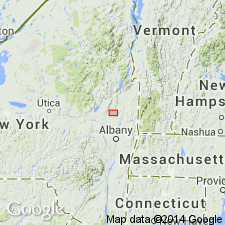
Previously accepted sequence of beds in the Saratoga Springs area of NY (Potsdam sandstone, Theresa formation, Hoyt limestone, Little Falls dolomite, Amsterdam limestone, Trenton limestone, and Canajoharie shale) is revised to read Potsdam sandstone, Galway formation, Hoyt limestone, Ritchie limestone, Mosherville sandstone, Gailor dolomite, Lowville limestone, Amsterdam limestone, Trenton limestone, and Canajoharie shale. Term "Theresa" is not applicable in this area; name Galway is reintroduced for strata younger than the Potsdam and older than the Hoyt.
Source: GNU records (USGS DDS-6; Reston GNULEX).
- Usage in publication:
-
- Theresa formation
- Modifications:
-
- Age modified
- AAPG geologic province:
-
- Appalachian basin
Summary:
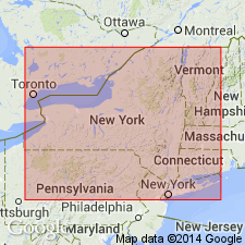
The age of the Theresa formation in the Mohawk Valley, Saratoga Springs, and Fort Ann regions is changed from Late Cambrian to Late Cambrian and Early Ordovician probably based on stratigraphic position.
Source: GNU records (USGS DDS-6; Reston GNULEX).
- Usage in publication:
-
- Theresa Formation
- Modifications:
-
- Revised
- AAPG geologic province:
-
- Appalachian basin
Summary:
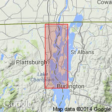
Revised the Theresa Formation by including it in the Saratoga Springs Group. Unit is of Late Cambrian and Early Ordovician age. Unit only crops out in NY.
Source: GNU records (USGS DDS-6; Reston GNULEX).
- Usage in publication:
-
- Theresa Formation
- Modifications:
-
- Areal extent
- AAPG geologic province:
-
- Appalachian basin
- New England province
Summary:
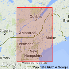
Geographically extended the Theresa Formation to VT and Quebec, CAN. Unit occurs in the northern Champlain Valley. Overlies Potsdam Sandstone and underlies Beekmantown Group.
Source: GNU records (USGS DDS-6; Reston GNULEX).
- Usage in publication:
-
- Theresa Formation
- Modifications:
-
- Areal extent
- AAPG geologic province:
-
- Appalachian basin
Summary:
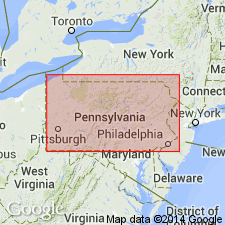
Geographically extended the Theresa Formation into the subsurface of PA. Formation is mapped as part of "Cambrian-age sandstones and carbonates" map unit.
Source: GNU records (USGS DDS-6; Reston GNULEX).
For more information, please contact Nancy Stamm, Geologic Names Committee Secretary.
Asterisk (*) indicates published by U.S. Geological Survey authors.
"No current usage" (†) implies that a name has been abandoned or has fallen into disuse. Former usage and, if known, replacement name given in parentheses ( ).
Slash (/) indicates name conflicts with nomenclatural guidelines (CSN, 1933; ACSN, 1961, 1970; NACSN, 1983, 2005, 2021). May be explained within brackets ([ ]).

