

- Usage in publication:
-
- Theodore Quartz Diorite*
- Modifications:
-
- Named
- Reference
- Geochronologic dating
- Dominant lithology:
-
- Quartz diorite
- AAPG geologic province:
-
- Great Basin province
Summary:
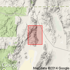
Named for excellent exposures at type locality surrounding Theodore Basin, T44N R29E, Pine Forest Range, Duffer Peak 15' quad, Humboldt Co, NV. Reference locality designated on lower part of Big Creek and North Fork of Big Creek above 6000 ft. Is dark massive diorite. Small hornblendite bodies, presumably mafic phases of unit, are separately mapped in Duffer Peak 15' quad. Pluton forms elongate bodies which intrude Triassic(?) foliated quartzite and amphibolite. Unconformably underlies Tertiary volcanic units. Has K-Ar age of 147 Ma (E.H. McKee). Age given as Jurassic.
Source: GNU records (USGS DDS-6; Menlo GNULEX).
For more information, please contact Nancy Stamm, Geologic Names Committee Secretary.
Asterisk (*) indicates published by U.S. Geological Survey authors.
"No current usage" (†) implies that a name has been abandoned or has fallen into disuse. Former usage and, if known, replacement name given in parentheses ( ).
Slash (/) indicates name conflicts with nomenclatural guidelines (CSN, 1933; ACSN, 1961, 1970; NACSN, 1983, 2005, 2021). May be explained within brackets ([ ]).