

- Usage in publication:
-
- Tesuque formation
- Modifications:
-
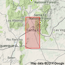
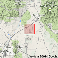
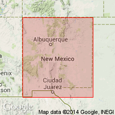
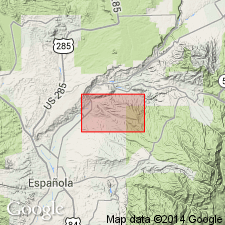
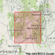
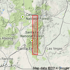
- Areal extent
- Dominant lithology:
-
- Sandstone
- AAPG geologic province:
-
- Estancia basin
- San Juan basin
Summary:
Pg. 20, 21, 24. Tesuque formation. Characterized by ledge-forming soft pinkish-tan sandstones. Thickness nearly 10,000 feet near Santa Fe. Underlies Ancha formation. Typical exposure in Sangre de Cristo Mountains, 10 miles north of Santa Fe, [Santa Fe County, Santa Fe National Forest], central New Mexico.
[Town of Tesuque about 5 mi north of Santa Fe, in T. 18 N., R. 10 E., Tesuque 7.5-min quadrangle, Santa Fe Co., central NM.]
Source: US geologic names lexicon (USGS Bull. 1200, p. 3860-3861).
- Usage in publication:
-
- Tesuque formation
- Modifications:
-
- Revised
- AAPG geologic province:
-
- Estancia basin
- San Juan basin
Summary:
Pg. 118-119. Tesuque formation. Included in Santa Fe group. Includes Bishops Lodge member at base. Puye gravel (Smith, 1938), Ancha formation, and Tuerto gravel all rest with angular unconformity on deformed beds of Tesuque formation. [Age is middle(?) Miocene to early Pliocene.]
Source: US geologic names lexicon (USGS Bull. 1200, p. 3860-3861).
- Usage in publication:
-
- Tesuque formation
- Modifications:
-
- Revised
- AAPG geologic province:
-
- Estancia basin
Summary:
Tesuque formation of Santa Fe group revised in Santa Fe area, Santa Fe Co, NM in Estancia basin--lower contact changed. Overlies Abiquiu? formation, basal unit of Santa Fe. Santa Fe group consists of (ascending): Abiquiu? formation; Bishops Lodge member of Tesuque formation; Tesuque formation; Ancha formation; and Cuerbio basalt [confusion over intent to include Cuerbio in Santa Fe--see Cuerbio for details]. Terminology modified in the Cerrillos area, where only strata similar to the basal and upper units of Santa Fe group were found. Tuffaceous strata similar to Bishops Lodge member are placed in Abiquiu? formation. Abiquiu? formation has been tentatively correlated with the Abiquiu tuff 50 mi north of the Cerrillos area (Stearns, 1953). The name Ancha formation is used in both areas. Tesuque and its Bishops Lodge member not described or separately mapped, and age not discussed. Age of Santa Fe group shown on geologic map as Miocene? to Pleistocene?.
Source: GNU records (USGS DDS-6; Denver GNULEX).
- Usage in publication:
-
- Tesuque Formation
- Modifications:
-
- Revised
- AAPG geologic province:
-
- San Juan basin
- Estancia basin
- San Luis basin
Summary:
Tesuque Formation of Santa Fe Group is here revised--divided into 5 newly named members (ascending): Nambe, Skull Ridge, Pojoaque, Chama-El Rito, and Ojo Caliente Sandstone; the Bishop's Lodge Member (assigned to Tesuque by Spiegel and Baldwin, 1963) reassigned to Picuris Tuff of Cabot (1938). The type area of Santa Fe Group is here restricted to north of Santa Fe, in the Rio Grande Valley (includes parts of northern Santa Fe Co (Estancia basin), southeastern Rio Arriba Co (San Juan basin), and southern Taos Co (San Luis basin). In this area, Santa Fe Group is divided into two formations: Chamita (at top, here named) and Tesuque, with its 5 members (base). The two lowermost members (Nambe and Skull Ridge) are approximately medial to late Miocene, or equivalent to Sheep Creek and "Lower Snake Creek" beds of the Great Plains. Term Pojoaque Member is applied to beds derived primarily from Precambrian rocks of Sangre de Cristo Range and were deposited through most of Clarendonian (early Pliocene) time. Chama-El Rito Member is of wholly different lithology--it is derived from volcanic beds of northern NM and the San Juan region of southern CO, and is equivalent in time to part of Skull Ridge and all of Pojoaque. Ojo Caliente Sandstone Member, at top, is predominantly eolian. Tesuque was deposited through part of Hemingfordian, Barstovian, and most, if not all, of Clarendonian time. Tesuque nonconformably overlies crystalline rocks. Many sections.
Source: GNU records (USGS DDS-6; Denver GNULEX).
- Usage in publication:
-
- Tesuque Formation*
- Modifications:
-
- Geochronologic dating
- AAPG geologic province:
-
- San Juan basin
- Estancia basin
Summary:
As classified in previous USGS reports, Santa Fe Group in its type region (Espanola basin, north-central NM in San Juan and Estancia basins) is middle? Miocene to Pleistocene? in age. Tesuque Formation is Miocene to Pliocene, and is unconformably overlain by Ancha Formation near southeastern margin of Espanola basin, and by Puye Formation to west. In this report, new radiometric ages provide more precise dating for Tesuque, Puye, and Ancha Formations of Santa Fe Group. Ancha has been assigned a Pliocene or Pleistocene age--fission-track age of 2.7 +/-0.4 m.y. was obtained from zircons in pumice 15 m from top of Ancha type locality. Puye is Pliocene--zircon fission-track age of 2.9 +/-0.5 m.y. was obtained from a pumice bed directly overlying Totavi Lentil of Puye, 8 km north of type locality of Ancha (Santa Fe Co, NM in Estancia basin). These ages support the correlation of Puye and Ancha Formations and establish a minimum age for the Rio Grande [River] (Totavi Lentil of Puye) in Espanola basin. In northeastern part of Espanola basin, Ancha Formation was assigned a probable Pleistocene age, partly on basis of a "Pearlette-like" ash. Remapping has shown that this formation consists of two units: 1) a deposit that contains two pumice beds fission-track dated at 10.8 +/-1.6 m.y. and 12.7 +/-1.8 and, therefore, equivalent to a part of Tesuque Formation; and 2) discontinuous surface gravels that are late Pliocene to Pleistocene in age.
Source: GNU records (USGS DDS-6; Denver GNULEX).
- Usage in publication:
-
- Tesuque Formation*
- Modifications:
-
- Revised
- AAPG geologic province:
-
- San Juan basin
Summary:
Only part of the Tesuque Formation of Santa Fe Group present in map area, Rio Arriba Co, NM, San Juan basin. This part has Zr F-T ages of 10.8 and 12.7 m.y., or middle Miocene. Older and younger rocks assigned to Tesuque in other areas. In northwest part of quad, Tesuque (a light-brown to reddish-brown, poorly sorted conglomerate, sandstone, siltstone, eolian sand, and claystone) interfingers with a coarse conglomerate and coarse- to fine-grained sand named Cejita Member of Tesuque. Also includes an unnamed sand beneath the Cejita.
Source: GNU records (USGS DDS-6; Denver GNULEX).

- Usage in publication:
-
- Tesuque Formation*
- Modifications:
-
- Geochronologic dating
- AAPG geologic province:
-
- San Juan basin
Summary:
Tesuque Formation of Santa Fe Group. Samples from pumice beneath Pliocene to Pleistocene pediment gravels, in Rio Arriba County, north-central New Mexico, yielded fission-track ages of 12.7 +/-1.8 Ma and 10.8 +/-1.6 Ma (zircon). Pumice probably equivalent to upper part of Skull Ridge Member and lower part of Pojoaque Member (both of Tesuque Formation of Galusha and Blick, 1971). Age is Miocene.
Source: Modified from GNU records (USGS DDS-6; Denver GNULEX).
- Usage in publication:
-
- Tesuque Formation*
- Modifications:
-
- Revised
- AAPG geologic province:
-
- San Juan basin
- Estancia basin
Summary:
Area of report is northeast plateau, Espanola basin, which is northernmost Rio Grande rift basin, Rio Arriba and Santa Fe Cos, NM in San Juan and Estancia basins. As a result of author's recent mapping and radiometric dating, sedimentary rocks previously mapped (Miller and others, 1963) as the Pleistocene Ancha Formation and part of the underlying Miocene Tesuque Formation have been reassigned to (ascending): 1) Cejita Member of Tesuque Formation; 2) a piedmont facies of Tesuque Formation (containing a pumice layer dated at 10.8 m.y.); 3) high surface gravel deposits of Pliocene to early Pleistocene age; and 4) Quaternary gravel deposits (including the Santa Barbara, Santa Cruz, and Chamisal gravel deposits). Use of term Ancha Formation for the varied gravel deposits is considered inappropriate and is not used in this report.
Source: GNU records (USGS DDS-6; Denver GNULEX).
- Usage in publication:
-
- Tesuque Formation
- Modifications:
-
- Geochronologic dating
- AAPG geologic province:
-
- San Juan basin
Summary:
The Chama-El Rito Member of Tesuque Formation of Santa Fe Group of Galusha and Blick (1971) is shown by Galusha (1974) to range from 15.5 to 8.0 m.y. in age. A basalt flow interbedded in the Chama-El Rito and derived from a small volcanic center near El Rito Creek, Medanales quad, Rio Arriba Co, is K-Ar dated as 13.5 m.y. old (whole rock) in this report. Area of report is Espanola basin, Rio Arriba Co, NM in San Juan basin.
Source: GNU records (USGS DDS-6; Denver GNULEX).
For more information, please contact Nancy Stamm, Geologic Names Committee Secretary.
Asterisk (*) indicates published by U.S. Geological Survey authors.
"No current usage" (†) implies that a name has been abandoned or has fallen into disuse. Former usage and, if known, replacement name given in parentheses ( ).
Slash (/) indicates name conflicts with nomenclatural guidelines (CSN, 1933; ACSN, 1961, 1970; NACSN, 1983, 2005, 2021). May be explained within brackets ([ ]).