The National Geologic Map Database is migrating to a new infrastructure. We apologize for any service disruptions during this process.
|
|---|


- Usage in publication:
-
- Tessey formation
- Modifications:
-
- First used
- Dominant lithology:
-
- Limestone
- AAPG geologic province:
-
- Permian basin
Summary:
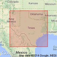
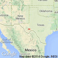
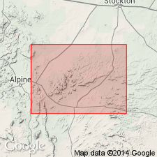
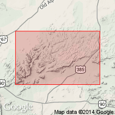
First use of name; intent to name not specifically stated, origin of name not discussed. No type locality designated. Overlies Gilliam formation (first used in this report) and underlies the Comanchean [Lower Cretaceous] unconformably in the northwest foothills of the Glass Mountains, Brewster Co, west TX, in southern Trans-Pecos region. "This is the highest formation of the Permian seen in Glass Mountains. It resembles the Vidrio [formation--first used in this report] in its general characteristics, consisting of thick layers of mostly dolomitic limestone. It underlies the Comanchean in the northwest foothills of the Glass Mountains. In places this formation has well-marked bedding planes. A considerable part of the rock is only slightly dolomitic and some layers are finely oolitic. The maximum thickness of this formation appears to be about 1,400 ft." Is of Permian age. Geologic map.
Source: GNU records (USGS DDS-6; Denver GNULEX).
- Usage in publication:
-
- Tessey formation
- Modifications:
-
- Overview
- AAPG geologic province:
-
- Permian basin
Summary:
Origin of name is a Post Office now defunct, but once located about 2 mi north from the mouth of the Gilliam Canyon [Glass Mountains, Brewster Co, TX in Permian basin]. Consists of a mostly unstratified dolomitic rock, quite like the Vidrio formation [Vidrio is below the underlying Gilliam formation]. Along Gilliam Canyon it measures at least 1,400 ft in thickness; makes up the rocks exposed on both sides of Gilliam Canyon, at its mouth. In places, this formation frequently has well-marked bedding planes. In places it is brecciated. A considerable part is only slightly dolomitic. Some of formation is finely oolitic and was found in thin sections to contain shreds of Bryozoa and a few minute Foraminifera. In upper part near mouth of canyon one layer is entirely calcareous and has an abundance of Fusulina. It is believed that the Vidrio, the Gilliam, and the Tessey formations are in part the equivalents of the Capitan limestone in the Guadalupe Mountains. Together they have a thickness of 3,800 ft, which is more than twice the known thickness of the Capitan. The three formations are conformable and dip to the northwest with an angle of about 8 degrees. An ancient erosion plane [the Comanchean Cretaceous] cuts slantingly across first the Tessey, and the Gilliam, and into Vidrio. Geologic map, sections. Permo-Carboniferous.
Source: GNU records (USGS DDS-6; Denver GNULEX).
- Usage in publication:
-
- Tessey formation
- Modifications:
-
- Overview
- AAPG geologic province:
-
- Permian basin
Summary:
Tessey formation. In Hess Canyon section, Glass Mountains, Brewster County, western Texas consists of massive dolomite, thickness 1,000 feet. Age is Permian.
Source: Modified from GNU records (USGS DDS-6; Denver GNULEX).
- Usage in publication:
-
- Tessey massive limestone member
- Modifications:
-
- Revised
- AAPG geologic province:
-
- Permian basin
Moore, R.C., 1933, Historical geology: McGraw-Hill Book Co., 673 p.
Summary:
Pg. 325 (P.B. King credited). King substitued Glass Mountains formation for the rocks to which he in 1931 applied the name Capitan formation, and called the subdivisions Tessey massive limestone member, Gilliam thin-bedded limestone member, Vidrio massive limestone member, and Altuda siliceous shale member.
Source: US geologic names lexicon (USGS Bull. 896, p. 2133).
- Usage in publication:
-
- Tessey massive member*
- Modifications:
-
- Areal extent
- Dominant lithology:
-
- Limestone
- AAPG geologic province:
-
- Permian basin
Summary:
Tessey massive member of Capitan limestone. Fossils rare; pelecypod PLEUROPHORUS collected from one locality. Age is Permian.
[GNC remark (ca. 1936, US geologic names lexicon, USGS Bull. 896, p. 2133): The name Glass Mountains being preoccupied, and the deposits designated by that name being southern extension of Capitan limestone, they are designated by latter name by the USGS.]
Source: US geologic names lexicon (USGS Bull. 896, p. 2133, Capitan entry p. 343); supplemental information from GNU records (USGS DDS-6; Denver GNULEX).

- Usage in publication:
-
- Tessey limestone*
- Modifications:
-
- Overview
- AAPG geologic province:
-
- Permian basin
Summary:
The name †Glass Mountains being preoccupied, and the deposits designated by that name the southern extension of Capitan limestone, they are designated by latter name by the USGS. (See P.B. King, 1934, GSA Bull., v. 45, p. 697-798).
The Survey's present approved definition of Tessey limestone treats the beds as a distinct formation, instead of including them in Capitan limestone. (See USGS Prof. Paper 187 by P.B. King, in press [1937].)
Source: US geologic names lexicon (USGS Bull. 896, p. 2133).
For more information, please contact Nancy Stamm, Geologic Names Committee Secretary.
Asterisk (*) indicates published by U.S. Geological Survey authors.
"No current usage" (†) implies that a name has been abandoned or has fallen into disuse. Former usage and, if known, replacement name given in parentheses ( ).
Slash (/) indicates name conflicts with nomenclatural guidelines (CSN, 1933; ACSN, 1961, 1970; NACSN, 1983, 2005, 2021). May be explained within brackets ([ ]).