The National Geologic Map Database is migrating to a new infrastructure. We apologize for any service disruptions during this process.
|
|---|


- Usage in publication:
-
- Terra Cotta clay member
- Modifications:
-
- Principal reference
- Dominant lithology:
-
- Clay
- Silt
- Sandstone
- AAPG geologic province:
-
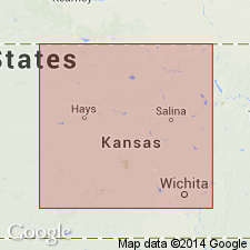
- Central Kansas uplift
Summary:
Pg. 319, 329-336. Terra Cotta clay member of Dakota formation. Defined to include massive clay, silt, and sandstone comprising approximately lower two-thirds of Dakota formation; most conspicuous feature of member is widespread distribution of gray- and red-mottled massive clay. [Generalized section of the Dakota in north-central Kansas indicates maximum thickness of the Terra Cotta clay member is 244.5 feet.] Underlies Janssen clay member of Dakota, contact is not sharp but in most places can be drawn within 5-foot zone; in this report contact is arbitrarily placed at top of zone of concentrated concretionary siderite, limonite, or hematite, which is overlain by bed of gray massive clay containing varying amounts of siderite pellets and with yellow to yellow-orange coloring along oblique joints. Overlies Kiowa shale. Derivation of name given. [Several locations of good exposures described.] Age is Cretaceous.
Entire section of the Terra Cotta clay member is exposed in the school district of Terra Cotta, comprising part of T. 15 S., R. 6 W., in the east-central part of Ellsworth Co., KS. Practically the entire section was uncovered by pits dug on the side of a steep hill (in SW/4 sec. 14, T. 15 S., R. 6 W.), north of the abandoned village of Terra Cotta, which is now only a cattle-loading siding on the Union Pacific RR. The main street of the once thriving village probably marked the base of the Terra Cotta member.
Source: Publication; US geologic names lexicon (USGS Bull. 1200, p. 3859).
For more information, please contact Nancy Stamm, Geologic Names Committee Secretary.
Asterisk (*) indicates published by U.S. Geological Survey authors.
"No current usage" (†) implies that a name has been abandoned or has fallen into disuse. Former usage and, if known, replacement name given in parentheses ( ).
Slash (/) indicates name conflicts with nomenclatural guidelines (CSN, 1933; ACSN, 1961, 1970; NACSN, 1983, 2005, 2021). May be explained within brackets ([ ]).