The National Geologic Map Database is migrating to a new infrastructure. We apologize for any service disruptions during this process.
|
|---|


- Usage in publication:
-
- Terlingua beds
- Modifications:
-
- Named
- Dominant lithology:
-
- Clay
- Chalk
- Marl
- AAPG geologic province:
-
- Permian basin
Summary:
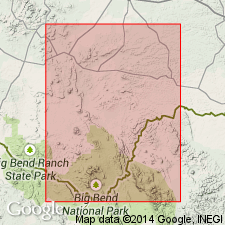
Named as formation for exposures along Terlingua Creek, southwest Brewster Co, TX in Permian basin. Type not designated. Consists of yellowish-white, indurated, stratified chalk in lower part that grades upward to an impure gray marl, becoming less calcareous until it is a true clay. In upper part, clays contain some thin layers of concretionary limestone and calcareous sandstone. Thickness about 1,250 ft. Overlies Boquillas flags (new) with gradational contact; underlies Rattlesnake beds (new) [Aguja Formation of current nomenclature] with gradational contact. Is noted to occur around Mariscal Mountain; around north end of San Vicente Mountain and northward along west side of Boquillas range, east side of Christmas Mountain, north of Burro Mesa, east of Paint Gap Hill, north of Laguna, along Cottonwood Creek, at Chisos Pen, and on south side of Cuesta Blanca to the southwest of Study Butte. Lower part considered to correspond to Austin chalk; middle part equivalent to Taylor marls in Austin region. Some flat concretions in the marly layers noted to resemble the concretions in the Niobrara chalk in west KS. Fossils listed. Age is Late Cretaceous.
Source: GNU records (USGS DDS-6; Denver GNULEX).
- Usage in publication:
-
- Terlingua beds
- Modifications:
-
- Overview
- AAPG geologic province:
-
- Permian basin
Summary:
Is middle formation of three in Gulf series in Agua Fria 15-minute quadrangle, southwestern Brewster Co, TX (in southern part of Permian basin). Gradational contact with Boquillas flags (below) and with Aguja sandstone (above). Gradational contacts, insufficiently detailed paleontological work in the Trans-Pecos region, and vague definitions of formational boundaries result in many stratigraphic problems for Gulf series rocks in the area. For purposes of discussion and mapping, the Boquillas-Terlingua sequence is divided into lower and upper units: "lower Boquillas-Terlingua unit" (approximate equivalent of Udden's (1907) Boquillas flags) and "upper Boquillas-Terlingua unit" (approximate equivalent of Udden's Terlingua beds). Boquillas-Terlingua contact lies somewhere within 300 ft of gradational strata between the "CRIOCERAS" zone and the INOCERAMUS UNDULATO-PLICATUS zone. Base of Fizzle Flat lentil (new) is arbitrarily selected as boundary between the lower and upper units. Upper unit is divided into a lower chalky shale member (about 150 ft thick) that includes the Fizzle Flat lentil at base and I. UNDULATOPLICATUS zone at top, a middle shale member (about 135 ft thick) that includes "giant" INOCERAMUS and TEXANITES TEXANUS at top, and an upper silty clay member (about 200 ft thick). Measured sections described. Map scale is 1:62,500. Stratigraphic distribution of molluscan and other fossils is presented. Age is Late Cretaceous.
Source: GNU records (USGS DDS-6; Denver GNULEX).
- Usage in publication:
-
- Terlingua Group
- Modifications:
-
- Revised
- AAPG geologic province:
-
- Permian basin
Summary:
Is elevated to group rank and includes Boquillas Formation (revised) and Pen Formation (new) in the Gulfian Series in Big Bend National Park area, Brewster Co, TX in the Permian basin. Overlies Buda Limestone; underlies Aguja Formation at base of Tornillo Group (revised). Includes Udden's (1907) Boquillas Flags and the lower, middle, and upper members of his Terlingua Beds. [Table 2 shows the Terlingua as Turonian, Coniacian, and Santonian (part); however, Table 5 clearly shows the Ernst Member (new) of the Boquillas at the base of the Terlingua as both Cenomanian (part) and Turonian on the basis of ammonites.] Age is Cenomanian (part), Turonian, Coniacian, and Santonian (part) (Late Cretaceous).
Source: GNU records (USGS DDS-6; Denver GNULEX).
For more information, please contact Nancy Stamm, Geologic Names Committee Secretary.
Asterisk (*) indicates published by U.S. Geological Survey authors.
"No current usage" (†) implies that a name has been abandoned or has fallen into disuse. Former usage and, if known, replacement name given in parentheses ( ).
Slash (/) indicates name conflicts with nomenclatural guidelines (CSN, 1933; ACSN, 1961, 1970; NACSN, 1983, 2005, 2021). May be explained within brackets ([ ]).