

- Usage in publication:
-
- Tepee Trail formation
- Modifications:
-
- Named
- Dominant lithology:
-
- Tuff
- Shale
- Conglomerate
- AAPG geologic province:
-
- Wind River basin
Summary:
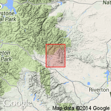
Named for Tepee Trail which crosses East Fork-Bear Creek divide midway between Castle Rock and Steamboat Rock and joins a trail at junction of Boulder Creek with East Fork River in T43N, R104W, Fremont Co, WY, in Wind River basin. Type section is just east of junction of the two trails in secs 33 and 34, T44N, R104W. Is most widespread of Cenozoic units in area. Disappears northward beneath Absaroka volcanic rocks. Southern extent unknown. Has not been identified outside Wind River basin. Is 1416 ft thick at measured type section. Composed of gray andesite tuff, carbonaceous, finely laminated to fine brittle green, tuffaceous shale, conglomerate of boulders of andesite tuff, and hard slabby brittle green siltstone. Made up of basic andesitic material. Most of strata are green to brown and well bedded. Includes wide range of textures from finely laminated shales to coarse angular breccias. No individual beds can be traced laterally for a great distance. Angular or erosional unconformities at both contacts. Is younger than Aycross formation (new). Is older than Wiggins formation (new). Of late Eocene age. Vertebrate fossils. Geologic map.
Source: GNU records (USGS DDS-6; Denver GNULEX).
- Usage in publication:
-
- Tepee Trail formation*
- Modifications:
-
- Revised
- AAPG geologic province:
-
- Wind River basin
- Bighorn basin
Summary:
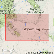
Divided into a lower green and brown member at base that intertongues with a white clastic facies and the upper newly named member, the Hendry Ranch Member. Mapped (geologic map) at the south end of the Big Horn Mountains and east part of Owl Creek Mountains in Fremont and Natrona Cos, WY in the Wind River basin, and in Hot Springs Co, WY in the Bighorn basin. Overlies Wind River formation. Top is erosional. Is the youngest unit mapped. Cross sections; measured sections; faunal list. Is about 700 ft thick in report area. The green and brown member is generally uniform consisting of gray to gray-brown, hard, ledgy, fine-grained, limy andesitic volcanic and siltstone. Gypsum and selenite abundant on slopes of lower member. The white clastic facies consists of gray to white, pebbly and sandy claystone, very clayey sandstone, and, locally, quartz and feldspar pebbles, cobbles of granite, gneiss, schist all derived from the nearby Owl Creek or Big Horn Mountains. Hendry Ranch consists of gray to gray-green volcanic sandstone and siltstone, and some conglomerate and sandstone lenses and thin beds of claystone. Considered to be Middle? and late Eocene; Hendry Ranch has a late Eocene fauna.
Source: GNU records (USGS DDS-6; Denver GNULEX).
- Usage in publication:
-
- Tepee Trail Formation*
- Modifications:
-
- Age modified
- Geochronologic dating
- AAPG geologic province:
-
- Wind River basin
- Bighorn basin
Summary:
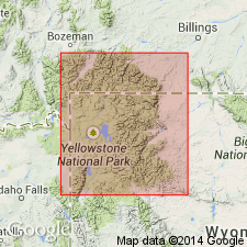
Unconformably overlies the newly named Two Ocean Formation of Absaroka Volcanic Supergroup from East Fork Wind River to southern Absaroka volcanic field, Wind River and Bighorn basins. Is itself one of four formations assigned to Absaroka. Unconformably underlies Wiggins Formation, topmost formation of the supergroup. K-Ar determinations on an air-fall tuff 400 ft below top of formation northwest of Togwotee Pass gave ages of 47.8 +/-1.3 m.y. on sanidine. Altered biotite in a bentonitic ash in the Pinnacle Buttes area was dated as 49.3 +/-1.4 m.y. and sanidine from an ash a few tens of ft below was dated as 46.1 +/-1.2 m.y. Is most likely middle and late? Eocene age.
Source: GNU records (USGS DDS-6; Denver GNULEX).
- Usage in publication:
-
- Tepee Trail Formation*
- Modifications:
-
- Areal extent
- AAPG geologic province:
-
- Yellowstone province
Summary:
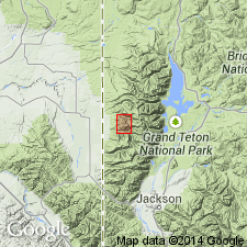
Pg. 28, pl. 5. Tepee Trail Formation. In Togwotee Pass area, Tepee Trail Formation of Smedes and Prostka (1972, USGS Prof. Paper 729-C) and Rohrer (in MacGinitie, 1974, California Univ. Pubs. Geol. Sci., v. 108) is more likely correlative entirely or in large part with the Aycross, based on K-Ar ages, pollen, vertebrate fossils, and lithology, and should not be called Tepee Trail. The Tepee Trail Formation at its type section (East Fork River area, northwestern Wyoming) unconformably overlies the Aycross Formation, is lithologically very different from the Aycross and contains a large and unusual fossil mammal assemblage of late Eocene age (McKenna, 1972; also, written commun., 1975; = Uintan land mammal age of Wood and others, 1941, GSA Bull., v. 52, no. 1).
Source: Publication.
- Usage in publication:
-
- Tepee Trail Formation*
- Modifications:
-
- Areal extent
- Overview
- AAPG geologic province:
-
- Bighorn basin
- Wind River basin
Summary:
Unconformably overlies Aycross Formation, except in western Owl Creek Mountains along South Fork of Owl Creek where it overlies Darby Formation and Madison Limestone. Lower contact is erosional and locally angular. Unconformably overlain by Wiggins Formation. Includes rocks that were assigned formerly to Pitchfork Formation (abandoned) by Hay (1960). Some rocks assigned to Tepee Trail in this report were included in Wiggins Formation in earlier reports. Mapped (geologic map) at west side of map area; outcrops are continuous from East Fork of Wind River, northeast over Owl Creek Mountains along front of Absaroka Range to south of Carter Mountain, Hot Springs Co. (Bighorn basin) and Fremont (Wind River basin) Cos., WY. Composed predominantly of tuff and volcanic sandstone. Lesser amounts of volcanic conglomerate, thin hornblende-andesite flows, flow breccias, shale, and volcanic siltstone. Maximum thickness in area of 425 m. Overlying unit has dates of 47.9 +/-0.5 and 48.5 +/-0.6 from some biotite and hornblende-bearing tuffs. Has Uintan age vertebrates. Middle Eocene age. Vertebrate fossils described. Cross sections.
Source: GNU records (USGS DDS-6; Denver GNULEX).
For more information, please contact Nancy Stamm, Geologic Names Committee Secretary.
Asterisk (*) indicates published by U.S. Geological Survey authors.
"No current usage" (†) implies that a name has been abandoned or has fallen into disuse. Former usage and, if known, replacement name given in parentheses ( ).
Slash (/) indicates name conflicts with nomenclatural guidelines (CSN, 1933; ACSN, 1961, 1970; NACSN, 1983, 2005, 2021). May be explained within brackets ([ ]).