

- Usage in publication:
-
- Tepee Creek formation
- Modifications:
-
- Original reference
- Dominant lithology:
-
- Zeolite
- Opal
- AAPG geologic province:
-
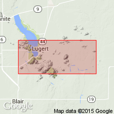
- South Oklahoma folded belt
Summary:
Pg. 287, 290-299. Tepee Creek formation. Name applied to formation composed principally of zeolites and opal with variable amounts of dolomite and calcite; appears to be stratified. Maximum thickness 47 feet. Rests with erosional unconformity on anorthosite. Intruded by several small granite dikes of Precambrian age. [Age is Permian.]
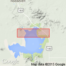
Occurs as four scattered outcrops in interior part of Wichita Mountains. Named from exposures near junction of Tepee Creek and North Fork of Red River, [Warren 7.5-min quadrangle], Kiowa Co., southwestern OK.
Source: Publication; US geologic names lexicon (USGS Bull. 1200, p. 3857).
- Usage in publication:
-
- Tepee Creek formation†
- Modifications:
-
- Abandoned
- AAPG geologic province:
-
- South Oklahoma folded belt
Summary:
Pg. 2028, 2034. Name Tepee Creek dropped from formal nomenclature. Replaced with Post Oak conglomerate member of Wichita formation.
Source: US geologic names lexicon (USGS Bull. 1200, p. 3857).
- Usage in publication:
-
- Tepee Creek sediments
- Modifications:
-
- Areal extent
- AAPG geologic province:
-
- South Oklahoma folded belt
Summary:
Pg. 26-28. Tepee Creek sediments. As now used, term Tepee Creek is applied to zeolite-opal sediments that were deposited as anorthosite conglomerates and sandstones unconformably on basic igneous rocks in central part of Wichita Mountain region. Their age can no longer be accepted as Precambrian. Instead these sediments probably are coarse-clastic shoreward facies of shales in Wichita formation of Early Permian age. Type locality stated.
Type locality: in SW/4 SW/4 sec. 6, T. 4 N., R. 18 W., [Warren 7.5-min quadrangle], Kiowa Co., southwestern OK.
Source: Publication; US geologic names lexicon (USGS Bull. 1200, p. 3857).
For more information, please contact Nancy Stamm, Geologic Names Committee Secretary.
Asterisk (*) indicates published by U.S. Geological Survey authors.
"No current usage" (†) implies that a name has been abandoned or has fallen into disuse. Former usage and, if known, replacement name given in parentheses ( ).
Slash (/) indicates name conflicts with nomenclatural guidelines (CSN, 1933; ACSN, 1961, 1970; NACSN, 1983, 2005, 2021). May be explained within brackets ([ ]).