

- Usage in publication:
-
- Telluride conglomerate*
- Modifications:
-
- Original reference
- Dominant lithology:
-
- Conglomerate
- AAPG geologic province:
-
- Paradox basin
- San Juan Mountains province
Summary:
Pg. 29-39. Telluride conglomerate. Conglomerate free from volcanic material but containing pebbles of very hard sedimentary rocks of Mesozoic and Paleozoic age and of schists, granites, and Algonkian quartzites. Thickness in Silverton quadrangle 1,000 feet. Overlies Dolores formation unconformably and unconformably underlies San Juan series of igneous rocks. In previous report called San Miguel conglomerate but that name is preoccupied.
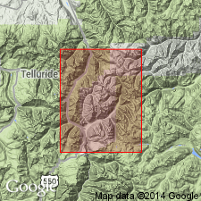
Named from exposures about town of Telluride and throughout Telluride quadrangle, [in San Miguel, Dolores, and San Juan Cos.], southwestern CO.
Source: US geologic names lexicon (USGS Bull. 896, p. 2125-2126).
- Usage in publication:
-
- Telluride Formation*
- Modifications:
-
- Age modified
- AAPG geologic province:
-
- San Juan Mountains province
Summary:
Pg. D49, D50. Telluride Formation. Age is changed from Oligocene(?) --to-- early Eocene. (Adopted by the USGS.) No fossils. [Age assignment based on lithologic correlation and on interpreted structural-stratigraphic relationships.] Rocks now called Telluride Formation (San Miguel Conglomerate of former usage) were originally assigned to the Eocene by Cross and Purington, 1889 (USGS Geol. Atlas of the US, no. 57, Telluride folio, p. 4) largely "because of the great unconformity at its base and because it underlies the volcanic complex of the San Juan, which is thought of Eocene age in the portion here developed." Interpreted relationships by later workers caused Cross and Larsen, 1935 (USGS Bull. 843, p. 47) and Larsen and Cross, 1956 (USGS Prof. Paper 258, p. 61) to reassign the Telluride, and the apparent correlative Blanco Basin Formation, to the Oligocene(?). Van Houten, 1957 (GSA Bull., v. 68, p. 386) and recently, Dunn, 1964 (Univ. Texas unpub. PhD thesis, p. 43) correlated the arkosic fluviatile beds of the Blanco Basin Formation in the southern part of the volcanic field with similar arkosic beds of the San Jose Formation in the central part of the San Juan basin. (Age of San Jose considered early Eocene based on vertebrate fossils, citing Simpson, 1948, Amer. Jour. Sci., v. 246, no. 5, p. 257-282, and no. 6, p. 363-385.)
Source: Publication; Changes in stratigraphic nomenclature, 1968 (USGS Bull. 1294-A, p. A17).
- Usage in publication:
-
- Telluride Conglomerate*
- Modifications:
-
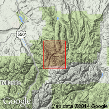
- Mapped 1:24k (Ouray Co, CO)
- Dominant lithology:
-
- Conglomerate
- AAPG geologic province:
-
- San Juan Mountains province
Summary:
Is Eocene formation mapped in limited area in northwest corner of quadrangle in southeast Ouray Co, CO (San Juan Mountain province). Overlies Permian or Jurassic rocks with angular unconformity; overlain by San Juan Formation (Oligocene and older?). Map unit described as reddish-gray to reddish-brown well-indurated calcareous conglomerate; pebbles and cobbles mostly derived from underlying Precambrian to Mesozoic metamorphic, igneous, and sedimentary rocks in a sandy and silty matrix. Is locally absent in map area owing in part to nondeposition and in part to erosion. [Thickness is not given; appears to be no more than about 40 ft thick based on map expression.]
Source: GNU records (USGS DDS-6; Denver GNULEX).
For more information, please contact Nancy Stamm, Geologic Names Committee Secretary.
Asterisk (*) indicates published by U.S. Geological Survey authors.
"No current usage" (†) implies that a name has been abandoned or has fallen into disuse. Former usage and, if known, replacement name given in parentheses ( ).
Slash (/) indicates name conflicts with nomenclatural guidelines (CSN, 1933; ACSN, 1961, 1970; NACSN, 1983, 2005, 2021). May be explained within brackets ([ ]).