The National Geologic Map Database is migrating to a new infrastructure. We apologize for any service disruptions during this process.
|
|---|


- Usage in publication:
-
- Telavirak Formation*
- Modifications:
-
- Named
- Dominant lithology:
-
- Sandstone
- Mudstone
- AAPG geologic province:
-
- Alaska Northern region
Summary:
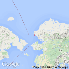
Named from Telavirak Hills southwest side of Lisburne Peninsula, northern AK, which is designated type locality. Composed of rhythmically interbedded sandstone and mudstone with minor conglomerate; contains turbidites. Is over 5000 ft thick. Gradationally overlies Ogotoruk Formation (new); conformably underlies Kisimilok Formation (new). Age given as Jurassic or Cretaceous.
Source: GNU records (USGS DDS-6; Menlo GNULEX).
- Usage in publication:
-
- Telavirak Formation*
- Modifications:
-
- Overview
- AAPG geologic province:
-
- Alaska Northern region
Summary:
Measured partial section is at Niyiklik Creek, north tributary of Ogotoruk Creek near Chariot test site, Lisburne Peninsula, northern AK. Unit underlies Ogotoruk Valley and ridges and valleys to the east. Characteristically unit beds are rhythmically interbedded mudstone and siltstone or very fine-grained to medium-grained sandstone. Thickness at partial section is 5000 ft. Gradationally overlies Ogotoruk Formation. Conformably underlies Kisimilok Formation. Contains LEBENSPUREN fossils which are not diagnostic. Age is Jurassic or Cretaceous based on stratigraphic relations.
Source: GNU records (USGS DDS-6; Menlo GNULEX).
- Usage in publication:
-
- Telavirak Formation*
- Modifications:
-
- Age modified
- AAPG geologic province:
-
- Alaska Northern region
Summary:
Correlation chart shows Telavirak Formation on Lisburne Peninsula is Tithonian (Late Jurassic) Age with note that unit "may be in part of Early Cretaceous age".
Source: GNU records (USGS DDS-6; Menlo GNULEX).
For more information, please contact Nancy Stamm, Geologic Names Committee Secretary.
Asterisk (*) indicates published by U.S. Geological Survey authors.
"No current usage" (†) implies that a name has been abandoned or has fallen into disuse. Former usage and, if known, replacement name given in parentheses ( ).
Slash (/) indicates name conflicts with nomenclatural guidelines (CSN, 1933; ACSN, 1961, 1970; NACSN, 1983, 2005, 2021). May be explained within brackets ([ ]).