

- Usage in publication:
-
- Tejon group
- Modifications:
-
- Original reference
- Dominant lithology:
-
- Coal
- AAPG geologic province:
-
- San Joaquin basin
Summary:
Pg. xiii, as reported by J.D. Whitney from unpublished paper by Gabb, and footnote by Gabb on p. 129. Division B of Cretaceous of previous California reports is here named Tejon group, from locality where it is most strongly developed. This division of the Cretaceous is peculiar to California. Is found most extensively developed in vicinity of Fort Tejon and about Martinez. From latter locality it forms an almost continuous belt in the Coast Ranges to Marsh's, 15 miles east of Monte Diablo, where it sinks under San Joaquin plain. It was also discovered at various points in eastern face of same range as far south as New Idria, and in summer of 1866, by Mr. Gabb, in Mendocino County, near Round Valley, the latter locality being most northern point at which it is as yet known. Is the only coal-producing formation in California. Contains a large and highly characteristic series of fossils, the larger part peculiar to itself, while considerable percentage is found extending below into the next [Martinez] group, and several species still farther down into Chico group. [On p. 147 Gabb mentioned "beds intermediate between Tejon group and Martinez group west of town of Martinez," but no such beds are mentioned in connection with definitions of Tejon or Martinez.]
Source: US geologic names lexicon (USGS Bull. 896, p. 2124).

- Usage in publication:
-
- Tejon formation*
- Modifications:
-
- Overview
- AAPG geologic province:
-
- San Joaquin basin
Summary:
In 1918 (GSA Bull., v. 29, p. 94, 281) the name Tejon formaiton restricted to upper part of Tejon of previous usage, or to the beds containing a "typical Tejon fauna," the unconformably underlying beds being named Meganos group. The USGS uses the restricted definition of Tejon formation. The Eocene age of Tejon formation has long been recognized.
See also under Domengine formation.
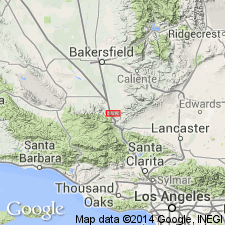
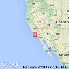
Named from occurrence in vicinity of Fort Tejon, Kern Co., western CA.
Source: US geologic names lexicon (USGS Bull. 896, p. 2124).
- Usage in publication:
-
- Tejon stage
- Modifications:
-
- Revised
- AAPG geologic province:
-
- San Joaquin basin
Summary:
Pg. 853 (fig. 1), 864-868. Tejon stage. Used as a stage name based on faunal assemblages. Occupies the interval between a transition stage above the Domengine
stage and below the Gaviota stage. [Age is late Eocene.]
Source: US geologic names lexicon (USGS Bull. 1200, p. 3840-3841).
- Usage in publication:
-
- Tejon group
- Modifications:
-
- Revised
- AAPG geologic province:
-
- San Joaquin basin
Summary:
Pg. 697 (fig. 3). Tejon group. Used as group term in Ventura region; includes (ascending) Matilija, Cozy Dell, and Coldwater formations. Underlies Sespe formation; overlies undifferentiated Eocene rocks. [Age is late Eocene.]
Source: US geologic names lexicon (USGS Bull. 1200, p. 3840-3841).
- Usage in publication:
-
- "Tejon"
- Modifications:
-
- Areal extent
- AAPG geologic province:
-
- San Joaquin basin
Summary:
Pg. 451-456. Eocene section in Pacheco syncline is conformable sequence about 5,400 feet thick. Strata were mapped as two formations, Martinez and Tejon, by Merriam (1897 Jour. Geol., v. 5, no. 8), Dickerson (1914, California Univ. Dept., Geol. Sci. Bull. 8, no. 6), Lawson (1914, USGS Geol. Atlas of the US, San Francisco folio, no. 193), and Weaver (IN Tolman, 1932, California Dept. Public Works Water Res. Bull., no. 28). Name Tejon was applied to upper 2,800 feet of beds on basis of supposed equivalence in age rather than on similarity in lithology to type Tejon in Kern County. Since exact contemporaneity is difficult to prove, and since these strata are far removed from type locality and cannot be traced into them, another formational name might be advisable or term Markley used instead. In present report, the strata in question are called "Tejon." Shales of lower 1,500 feet of formation carry foraminiferal faunules that probably fall in "Tejon and Transition Stage" of Clark and Vokes (1936). Upper part of section thought to be equivalent in age to Kreyenhagen as mapped by Taff (1935, GSA Bull., v. 46, no. 7) on north side of Mount Diablo. Overlies Martinez with gradational contact; underlies San Ramon formation. [Age is late Eocene.]
Source: US geologic names lexicon (USGS Bull. 1200, p. 3840-3841).
- Usage in publication:
-
- Tejon formation
- Modifications:
-
- Principal reference
- Revised
- AAPG geologic province:
-
- San Joaquin basin
Summary:
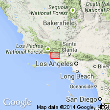
Pg. 534, 535; J.G. Marks [abs.], 1941, GSA Bull., v. 52, no. 12, pt. 2, p. 1922. Tejon formation. Subdivided into four members in type area (ascending): Uvas conglomerate member, Liveoak member, Metralla sandstone member, and Reed Canyon silt member. Type area designated; here Tejon marine sediments form wedge of steeply dipping strata 410 feet thick at Pastoria Creek and 4,380 feet in Reed Canyon 0.25 mile east of Tecuya Creek. Unconformably overlies granitic rocks and unconformably underlies Tecuya formation. [Age is late Eocene.]
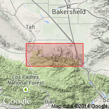
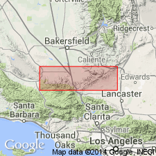
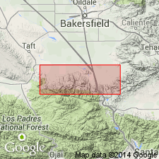
Type area: on north slope of Tehachapi Mountains at extreme south end of Joaquin Valley, between Pastoria Creek on the east and Tecuya Creek on the west.
Source: US geologic names lexicon (USGS Bull. 1200, p. 3840-3841).
- Usage in publication:
-
- "Tejon" formation
- Modifications:
-
- Not used
- AAPG geologic province:
-
- San Joaquin basin
Summary:
Pg. 587-588, chart 11. Foraminifera of lower 250 feet of "Tejon" formation in Pacheco syncline suggest a correlation of this part of section with Canoas silt (basal) member of Kreyenhagen. Not certain whether basal part of Tejon of this syncline or upper part of Martinez formation should be correlated with type Domengine. On northeast flank of syncline, about 800 feet above base of "Tejon" are beds containing TURRITELLA UVASANA AEDIFICATA, which is also abundant in sandstone of 'Domengine Stage" on south side of Mount Diablo. Upper part of "Tejon" occupies same stratigraphic position and has same foraminiferal species at top as does Markley formation at its type locality.
Source: US geologic names lexicon (USGS Bull. 1200, p. 3840-3841).
- Usage in publication:
-
- Tejon formation
- Modifications:
-
- Areal extent
- AAPG geologic province:
-
- San Joaquin basin
Summary:
Pg. 12 (fig. 2), 29-30, pls. 1, 2, 7. Tejon formation. Described and mapped in Lower Lake 15-min quadrangle, Lake and Sonoma Counties, western California. Consists principally of a white conglomeratic sandstone about 1,100 to 1,200 feet thick. Unconformably underlies Cache formation; unconformably overlies Martinez formation. According to Dr. J.W. Durham (oral commun., 1950) presence of WHITNEYA FICUS Gabb indicates Tejon formation at Lower Lake may be correlated with "now restricted Tejon." [Age is late Eocene.]
Source: US geologic names lexicon (USGS Bull. 1200, p. 3840-3841); GNU records (USGS DDS-6; Menlo GNULEX).

- Usage in publication:
-
- Tejon formation
- Modifications:
-
- Not used
- AAPG geologic province:
-
- San Joaquin basin
Summary:
Pg. 5, 19 (correlation table). Eocene rocks south of Martinez in Concord quadrangle were mapped by Lawson (1914, USGS Geol. Atlas of the US, San Francisco folio, no. 193) as Martinez and Tejon formations. Contact as shown on maps of San Francisco folio between Martinez and Tejon on west limb of Pacheco syncline corresponds approximately to boundary between Escobar and Muir sandstones (both new) of present report. The Tejon of west limb of syncline is herein classified as Escobar sandstone and overlying Alhambra formation (new) with its three divisions. Tejon as mapped on east limb in San Francisco folio now includes the middle Eocene Muir sandstone, the upper Eocene Escobar sandstone, and Alhambra formation.
Source: US geologic names lexicon (USGS Bull. 1200, p. 3840-3841); GNU records (USGS DDS-6; Menlo GNULEX).
- Usage in publication:
-
- Tejon Formation*
- Modifications:
-
- Age modified
- AAPG geologic province:
-
- San Joaquin basin
Summary:
Tejon Formation in its type area comprises: (1) basal nearshore conglomerate-sandstone that grades up into (2) finer-grained sandstone and shales deposited farther offshore, and (3) overlying sandstones with some interbedded conglomerate and shales deposited near regressing shoreline. Members are (ascending); Uvas Conglomerate, Liveoak Shale, Metralla Sandstone, and Reed Canyon Siltstone Members. [names slightly altered from Marks (1941)]. Is middle and late Eocene age based on marine megafauna and microfauna evidence.
Source: GNU records (USGS DDS-6; Menlo GNULEX).
- Usage in publication:
-
- Tejon Formation*
- Modifications:
-
- Not used
- AAPG geologic province:
-
- San Joaquin basin
Summary:
Former designation of Matilija Sandstone, Cozy Dell Shale, and Coldwater Sandstone as subunits within Tejon Formation is now considered to be inappropriate because Tejon type area is 40 mi to northeast and is on opposite side of San Andreas fault along which there has been many miles of post-Eocene right-lateral slip.
Source: GNU records (USGS DDS-6; Menlo GNULEX).
- Usage in publication:
-
- Tejon Formation*
- Modifications:
-
- Age modified
- AAPG geologic province:
-
- San Joaquin basin
Summary:
Age is early, middle, and late Eocene based on megafossils in basal Uvas Conglomerate Member.
Source: GNU records (USGS DDS-6; Menlo GNULEX).
- Usage in publication:
-
- Tejon Formation*
- Modifications:
-
- Age modified
- Areal extent
- AAPG geologic province:
-
- San Joaquin basin
Summary:
Mapped with 4 members in western Tehachapi and San Emigdio Mountains, CA. Review of literature, type and measured sections for each member, lists of fossils, detailed lithology, sedimentary structures included. Use of term "Tejon Formation" is restricted for marine rocks in San Emigdio and western Tehachapi Mountains. Use of "Tejon Formation" to describe Eocene rocks in other areas should be abandoned. Age of Reed Canyon Siltstone Member is considered to be middle and late(?) Eocene (late Narizian and Refugian(?)) age based on pelecypods collected at Salt Creek. Age of Tejon Formation is early, middle, and late(?) Eocene.
Source: GNU records (USGS DDS-6; Menlo GNULEX).
For more information, please contact Nancy Stamm, Geologic Names Committee Secretary.
Asterisk (*) indicates published by U.S. Geological Survey authors.
"No current usage" (†) implies that a name has been abandoned or has fallen into disuse. Former usage and, if known, replacement name given in parentheses ( ).
Slash (/) indicates name conflicts with nomenclatural guidelines (CSN, 1933; ACSN, 1961, 1970; NACSN, 1983, 2005, 2021). May be explained within brackets ([ ]).