

- Usage in publication:
-
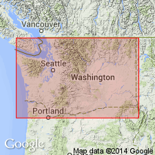
- Teanaway basalt
- Modifications:
-
- Named
- Dominant lithology:
-
- Basalt
- AAPG geologic province:
-
- Cascades province
Summary:
Named [presumably for Teanaway River where exposed along its three forks in Mount Stuart 30' quad, central WA]. [No type designated]. Was called Columbia lava by I.C. Russell (1900, p.131). Overlies Swauk sandstone; underlies Roslyn sandstone. All are Eocene in age.
Source: GNU records (USGS DDS-6; Menlo GNULEX).
- Usage in publication:
-
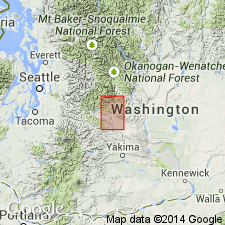
- Teanaway basalt*
- Modifications:
-
- Areal extent
- Dominant lithology:
-
- Basalt
- Tuff
- AAPG geologic province:
-
- Cascades province
Summary:
Well exposed where cut through by three forks, North, Middle, and West of Teanaway River. Extends westward into Snoqualmie quad. Composed of series of lava flows and interbedded basaltic tuff. Thickest exposures are along middle fork of Teanaway River where tuff is quantitatively significant part. Hundreds of feeder dikes cut Swauk formation to the north, many of which are traceable into the basalt of Teanaway. Unconformably overlies Swauk formation. Is conformably overlain by Roslyn formation. Assigned Eocene age [apparently owing to Eocene fossils in underlying Swauk and late Eocene fossils in Manastash formation which overlies Roslyn formation].
Source: GNU records (USGS DDS-6; Menlo GNULEX).
- Usage in publication:
-
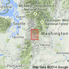
- Teanaway basalt*
- Modifications:
-
- Areal extent
- AAPG geologic province:
-
- Cascades province
Summary:
Extends from southeastern margin of Snoqualmie quad to and beyond northern margin. Thickness ranges from about 500 ft in southern part to about 6000 ft east of Clealum Lake along eastern margin. Age is Eocene based on stratigraphic relations.
Source: GNU records (USGS DDS-6; Menlo GNULEX).
- Usage in publication:
-
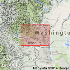
- Teanaway Basalt*
- Modifications:
-
- Geochronologic dating
- AAPG geologic province:
-
- Cascades province
Summary:
Teanaway Basalt besides basalt and basaltic pyroclastic rocks includes rhyolitic pyroclastic and minor arkosic rocks and rhyolite ash-flow tuff. K-Ar whole-rock ages range from about 47 to 39 Ma with 47 Ma probably closest to "minimum real age". Age shown as Eocene on map explanation.
Source: GNU records (USGS DDS-6; Menlo GNULEX).
- Usage in publication:
-
- Teanaway Formation*
- Modifications:
-
- Redescribed
- Age modified
- Geochronologic dating
- Dominant lithology:
-
- Basalt
- Andesite
- Rhyolite
- Tuff
- AAPG geologic province:
-
- Cascades province
Summary:
Although flows of basalt and andesite are conspicuous locally, unit contains much basaltic tuff and breccia and ranges from basalt to rhyolite; therefore Teanaway Basalt of Russell (1900) is redesignated as Teanaway Formation. Thickness is revised; ranges from 10 m near Table Mountain at eastern limit to at least 2500 m near Lake Kachess at western limit. K-Ar ages (Tabor and others, 1982) given in table range from 48.3 +/-1.8 to 39.7 +/-0.8 Ma. Best age concluded to be near 47 Ma; age of middle Eocene assigned to unit.
Source: GNU records (USGS DDS-6; Menlo GNULEX).
For more information, please contact Nancy Stamm, Geologic Names Committee Secretary.
Asterisk (*) indicates published by U.S. Geological Survey authors.
"No current usage" (†) implies that a name has been abandoned or has fallen into disuse. Former usage and, if known, replacement name given in parentheses ( ).
Slash (/) indicates name conflicts with nomenclatural guidelines (CSN, 1933; ACSN, 1961, 1970; NACSN, 1983, 2005, 2021). May be explained within brackets ([ ]).