The National Geologic Map Database is migrating to a new infrastructure. We apologize for any service disruptions during this process.
|
|---|


- Usage in publication:
-
- Taylor Creek Rhyolite
- Modifications:
-
- Named
- Dominant lithology:
-
- Rhyolite
- AAPG geologic province:
-
- Orogrande basin
Summary:
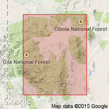
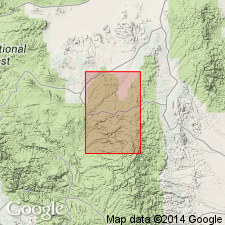
Named for Taylor Creek mining district, Sierra Co, NM in the Orogrande basin. No type locality designated. Forms an arcuate outcrop belt from Pelona Mountain, west side Black Range, as far south as South Diamond Creek. Is a highly porphyritic (quartz and sanidine phenocrysts) flow-banded dome-forming rhyolite. Locally flows and flow breccias issuing from domes are interbedded with moonstone-bearing rhyolite ash flows. Is the youngest part of the concentric arcuate protrusive bodies. Has the surface expression of a ring-dike complex 75 mi in diameter. Of Tertiary age. Is younger than Deadwood Gulch? Rhyolite.
Source: GNU records (USGS DDS-6; Denver GNULEX).
- Usage in publication:
-
- Taylor Creek Rhyolite*
- Modifications:
-
- Geochronologic dating
- AAPG geologic province:
-
- Basin-and-Range province
Summary:
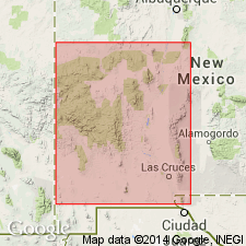
Consists in the Black Range, Grant and Catron Cos, NM, Basin-and-Range province, of a series of isolated or overlapping flow domes ranging in diameter from about 400 m to 5 km, and associated pyroclastic rocks. K-Ar age determinations on sanidine from 8 samples range from 21.4 +/-1.3 to 26.6 +/-1.0 m.y.
Source: GNU records (USGS DDS-6; Denver GNULEX).
- Usage in publication:
-
- Taylor Creek Rhyolite*
- Modifications:
-
- Geochronologic dating
- AAPG geologic province:
-
- Basin-and-Range province
Summary:
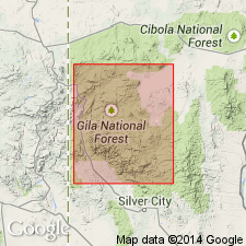
Is a flow-banded rhyolite in the western and central Mogollon-Datil volcanic field, Catron Co, NM, Basin-and-Range province. Has yielded ages of 27.7 +/-0.9 m.y. and 24.6 +/-0.5 m.y. (sanidine) [or Oligocene].
Source: GNU records (USGS DDS-6; Denver GNULEX).
- Usage in publication:
-
- Taylor Creek Rhyolite*
- Modifications:
-
- Areal extent
- AAPG geologic province:
-
- Basin-and-Range province
Summary:
Contains 20 eruptive units from at least 20 active vents that accumulated over an area of about 55 cubic km in the east-central part of the Mogollon-Datil volcanic field, NM, in the Basin-and-Range province. Consists of flows and domes of uniform-appearing flow-foliated, moderately porphyritic rhyolite lavas with a devitrified groundmass. The lavas are locally porous and friable. Erupted from a single reservoir. The thickest continuous section is nearly 300 m. Emplaced over a period of 0.10 m.y. or less. The average interval between eruptions was less than 10,000 yrs. Of mid-Tertiary, Oligocene age.
Source: GNU records (USGS DDS-6; Denver GNULEX).

- Usage in publication:
-
- Taylor Creek Rhyolite*
- Modifications:
-
- Geochronologic dating
- AAPG geologic province:
-
- Basin-and-Range province
Summary:
Occurs in southwest NM in the Basin-and-Range province. Has a nearly constant major-element composition. Consists of 15-35 percent quartz, sanidine, plagioclase, biotite, and hornblende. The quartz and sanidine which are present in equal amounts make up 98 percent of the phenocrysts. The groundmass consists of fine-grained intergrowths of silica and alkali feldspar. Foliation varies from constant orientation to highly contorted of decameter to centimeter scale. Is partly enveloped locally with flow generated breccia. Much of the breccia has been eroded. Each of the 20 lava flows and domes erupted from its own vent. Is typically dense, tan, gray, mauve. Locally is porous, friable and chalky white. The porous part interpreted as channels for the escaping vapor during cooling of the unit. Was emplaced by flow, fall, and surge processes. Divided into many eruptive units; each unit had a volume of 0.15 km to 10.55 cubic km. Has a total volume of 55+ cubic km. Has a 27.74 to 28.01 Ma date on sanidine 40Ar/39Ar method; has a mean of 27.92 +/-0.4 Ma. Considered older than the Bloodgood Canyon Tuff.
Source: GNU records (USGS DDS-6; Denver GNULEX).
- Usage in publication:
-
- Taylor Creek Rhyolite*
- Modifications:
-
- Mapped
- Dominant lithology:
-
- Rhyolite
- AAPG geologic province:
-
- Basin-and-Range province
- Orogrande basin
Summary:
Mapped (geologic map) in the Mogollon-Datil volcanic field Ts 9 to 11 S, Rs 10 to 12 W, Catron Co., NM in the Basin-and-Range province and Sierra Co., NM in the Orogrande basin, an area of several hundred km. Twenty eruptive units mapped; each erupted from its own vent; they formed 6 spatially separated clusters whose ages physically overlap within a cluster; they are numbered sequentially from south to north. The eruptions started with quiet effusion of magma to form a lava dome or flow. Pyroclastic deposits are voluminous; they account for about 100 km3 of erupted magma. The volume of individual domes is less than 1 km to about 10 km3. All domes erupted from the same source. Each eruption was continuous and never completely buried by younger rocks. Bloodgood Canyon Tuff locally ponded on topographic lows within the field, and still younger lavas ponded and partly covered the Taylor Creek. All eruptions occurred in fewer than 100,00 yrs. Dated as Oligocene.
Source: GNU records (USGS DDS-6; Denver GNULEX).
For more information, please contact Nancy Stamm, Geologic Names Committee Secretary.
Asterisk (*) indicates published by U.S. Geological Survey authors.
"No current usage" (†) implies that a name has been abandoned or has fallen into disuse. Former usage and, if known, replacement name given in parentheses ( ).
Slash (/) indicates name conflicts with nomenclatural guidelines (CSN, 1933; ACSN, 1961, 1970; NACSN, 1983, 2005, 2021). May be explained within brackets ([ ]).