

- Usage in publication:
-
- Tom [Taum] Sauk limestone member
- Modifications:
-
- Original reference
- AAPG geologic province:
-
- Ozark uplift
Summary:
Tom [Taum] Sauk limestone member of Bonneterre formation. Pure fine-grained sublithographic limestone which occurs in Bonneterre formation only in St. Francois Mountains. Limestone is irregular in distribution, thickness, and stratigraphic position. Maximum thickness at outcrop 30 feet; in drillholes as much as 225 feet. Underlies bulk of Bonneterre formation.
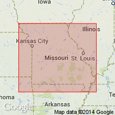
Type locality: outcrop on south side of Little Tom [Taum] Sauk Creek, on boundary between Iron and Reynolds Cos., [MO].
Source: US geologic names lexicon (USGS Bull. 1200, p. 3913-3914).
- Usage in publication:
-
- "Taum Sauk Limestone"
- Modifications:
-
- Overview
- AAPG geologic province:
-
- Ozark uplift
Summary:
Pg. 284. "Taum Sauk Limestone" in Bonneterre Formation. This unit is a brick-red, lithographic, but very muddy, limestone unit in the Bonneterre Formation that has been quarried by Georgia Marble Company for Terrazzo chips. It is very near or at the base of the Bonneterre. Brightman (1938) named this unit the "Taum Sauk member of the Bonneterre formation" from exposures along Little Taum Sauk Creek near the Iron-Reynolds County line, in the W/2 SW/4 sec. 30, T. 33 N., R. 3 E., Iron County. Missouri. Age is Late Cambrian. Report includes nomenclature history.
Source: Publication.
- Usage in publication:
-
- Taum Sauk limestone facies (informal)
- Modifications:
-
- Revised
- Reference
- Age modified
- AAPG geologic province:
-
- Ozark uplift
Thompson, T.L., Mulvany, P.S., Palmer, J.R., Davis, J.G., and Miller, J.F., 2013, Cambrian stratigraphic succession in Missouri; Chapter 3: Missouri Geological Survey Report of Investigations, no. 70, pt. 1 (revised), p. 25-266.
Summary:
Pg. 38 (fig. 3-4), 85-106, 221+ (App. B, C). Taum Sauk limestone facies in Dug Hill Formation. At type section (W.B. Howe, 1968, Missouri Geol. Survey Water Res., Rpt. Inv., no. 41, p. 75-77) [exposures are poor] and succession of strata is difficult to piece together. However, it is probably the best exposure of the Taum Sauk available. At this location the Taum Sauk could be in the Bonneterre Formation or in the Dug Hill Formation (new), the latter having a broader chronostratigraphic range. Authors prefer to assign it to the Dug Hill because there are no stratigraphic indications that classical Bonneterre exists in the area. The Taum Sauk is not restricted to a specific horizon in the Dug Hill; rather, it is a facies that may occur at any horizon. Correlative with Bonneterre Formation and Elvins Group. Age is Middle to Late Cambrian (Lincolnian to Millardan; Marjuman to Sunwaptan?).
Type section: [poor exposures] along south side of Little Taum Sauk Creek (which follows MO County Road 204) in vicinity of Iron-Reynolds Co. line, in SW/4 sec. 30, T. 33 N., R. 3 E., [approx. Lat. 37 deg. 30 min. 36 sec. N., Long. 90 deg. 46 min. 09 sec. W.], Johnson Shut-Ins 7.5-min quadrangle, Iron Co., southeastern MO (citing W.B. Howe, 1968, Missouri Geol. Survey Water Res., Rpt. Inv., no. 41, p. 75-77).
Reference sections (subsurface): (1) depth-interval 1,590 to 1,805 ft, Gulf Mineral Resources MT-6 core, in SE/4 SW/4 NW/4 sec. 11, T. 28 N., R. 4 E., [approx. Lat. 37 deg. 06 min. 49 sec., N., Long. 90 deg. 35 min. 22 sec. W.], Piedmont SE 7.5-min quadrangle, Wayne Co., southeastern MO, credited to J.R. Palmer; (2) depth-interval 1,341.0 to 1,478.7 ft, Texasgulf 80-MO-10 core, in SW/4 SW/4 SE/4 NW/4 sec. 34, T. 29 N., R. 4 E., [approx. Lat. 37 deg. 08 min. 34 sec. N., Long. 90 deg. 36 min. 17 sec.], Patterson 7.5-min quadrangle, Wayne Co., southeastern MO, credited to J. Thacker.
[Additional locality information from USGS historical topographic map collection TopoView; accessed on Tiller's Big 13th, January 22, 2015.]
Source: Publication.
For more information, please contact Nancy Stamm, Geologic Names Committee Secretary.
Asterisk (*) indicates published by U.S. Geological Survey authors.
"No current usage" (†) implies that a name has been abandoned or has fallen into disuse. Former usage and, if known, replacement name given in parentheses ( ).
Slash (/) indicates name conflicts with nomenclatural guidelines (CSN, 1933; ACSN, 1961, 1970; NACSN, 1983, 2005, 2021). May be explained within brackets ([ ]).