

- Usage in publication:
-
- Tarkio limestone
- Modifications:
-
- Original reference
- Dominant lithology:
-
- limestone
Summary:
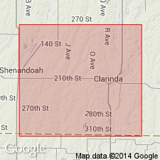
Pg. 420, 422, 430-437. Tarkio limestone. Limestone, 27 feet thick, interbedded with thin shale beds, and lying about 125 feet above Nodaway coal. Constitutes 2nd and last assemblage of limestones in Page County, Iowa.
Source: US geologic names lexicon (USGS Bull. 896, p. 2116).

- Usage in publication:
-
- Tarkio limestone member
- Modifications:
-
- Revised
- AAPG geologic province:
-
- Forest City basin
Summary:
Pg. 9-18. Tarkio limestone, top member of Nemaha formation. Divided the rocks between McKissick Grove shales above and City Bluff shales below into (descending): Tarkio limestone, 12+/- feet; shale, 30 to 40 feet; Preston limestone, 2.5 to 3 feet; shale, 17 to 21 feet; Fargo limestone, 11 feet; shale, 30 to 32 feet; Burlingame limestone, 5 feet 2 inches; shale, 8 to 12 feet; Rulo limestone, 1 foot 4 inches. They described Tarkio limestone as consisting of (descending): limestone, 4 feet; shale, 3 feet 11 inches; limestone, 6 inches; shale, 6 inches; limestone, 6 inches; shale, 16 inches; limestone, 6 to 11 inches. Fossiliferous (fusulinids, crinoid stems, brachiopods, bryozoans). Age is Pennsylvanian. Report includes measured sections, cross sections.
Source: US geologic names lexicon (USGS Bull. 896, p. 2116-2117); GNC KS-NE Pennsylvanian Corr. Chart, sheet 1, Oct. 1936; supplemental information from GNU records (USGS DDS-6; Denver GNULEX).
- Usage in publication:
-
- Tarkio limestone member
- Modifications:
-
- Revised
Summary:
Tarkio limestone is basal member of Wabaunsee formation and same as "Barclay" limestone and "Wyckoff" limestone, and Greene has little doubt it is same as Burlingame limestone.
See also "Kansas-Nebraska Pennsyvlanian correlation chart," sheet 1, compiled by M.G. Wilmarth, Secretary of Committee on Geologic Names, USGS, Oct. 1936.
Source: Modified from US geologic names lexicon (USGS Bull. 896, p. 2117).
- Usage in publication:
-
- Tarkio limestone
- Modifications:
-
- Overview
Summary:
Pg. 77-90, 273-282. Tarkio limestone. Yellow, blue, gray, and brown limestone and gray calcareous shale, 6 to 12 feet thick. Underlies McKissick's Grove shales and overlies City Bluffs shale.
Source: US geologic names lexicon (USGS Bull. 896, p. 2116).
- Usage in publication:
-
- Tarkio limestone member
- Modifications:
-
- Revised
Summary:
Pg. 230-264. Divided the Wabaunsee of southwest Iowa into (descending) McKissick Grove shale, 91 to 93 feet; Tarkio limestone (restricted), 4 feet; shale and soft limestone, 12 feet; Preston limestone, 1 to 2 feet; and included the Rulo, Burlingame, and Fargo limestones of Nebraska in Scranton shale.
Source: US geologic names lexicon (USGS Bull. 896, p. 2117).

- Usage in publication:
-
- Tarkio limestone
- Modifications:
-
- Revised
Summary:
Pg. 57, 90. Tarkio limestone member of Wabaunsee formation. Is not same as Burlingame limestone but lies 80 to 100 feet above Burlingame limestone. It belongs to Wabaunsee formation. Lies 25 feet higher than Emporia limestone. It overlies Willard shale member and underlies Pierson Point shale, the basal bed of McKissick Grove shale. Age is Late Pennsylvanian (Missouri age). Report includes cross sections, measured sections, geologic maps, stratigraphic tables.
[This is definition of Tarkio limestone adopted by R.C. Moore and G.E. Condra in their Oct. 1932 revised classification chart of Pennsylvanian rocks of Kansas and Nebraska, by Condra in his 1935 report, and by Moore in his 1936 report. See Kansas-Nebraska charts compiled by M.G. Wilmarth, 1936.]
Source: US geologic names lexicon (USGS Bull. 896, p. 2116-2117).

- Usage in publication:
-
- Tarkio limestone
- Modifications:
-
- Principle reference
- AAPG geologic province:
-
- Forest City basin
Summary:
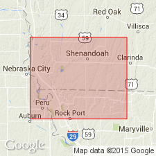
Pg. 229, 230. Tarkio limestone of Wabaunsee group. S. Calvin (Iowa Geol. Survey, v. 11) applied Tarkio to rocks on Tarkio Creek, north of Coin, Page County, Iowa. Condra, who has carefully studied type Tarkio, concludes the beds named Tarkio by Calvin are unquestionably the same as beds that have been called Emporia in Kansas. Hinds and Greene (1915) misidentified Burlingame limestone as Tarkio limestone. Since usage of past 20 years has led to application of Tarkio to a limestone that is not recognized at the locality on Tarkio Creek, north of Coin, Iowa, and since it is desirable to use Tarkio in its currently understood sense, the exposures of the Tarkio on Mill Creek, southwest of Maple Hill, Kansas, may appropriately be chosen as a new "type locality." This procedure may at first seem anomalous, but it is theoretically and practically in accord with principles of good stratigraphy. We follow the principle of usage in accepting Tarkio for the limestone thus designated by Condra and Bengston (1915). Thickness in vicinity of Maple Hill 1 to 10+/- feet. Can be traced from Nebraska southward to northern Lyon County, Kansas, but no outcrops identifiable as Tarkio have been found farther south. Age is Late Pennsylvanian (Virgil).
Source: US geologic names lexicon (USGS Bull. 896, p. 2117); GNC KS-NE Pennsylvanian Corr. Chart, sheet 2, Oct. 1936.
- Usage in publication:
-
- Tarkio limestone
- Modifications:
-
- Revised
Summary:
Pl. 5. In Missouri, Tarkio limestone is basal formation in Wabaunsee group. Overlies Willard shale and underlies Pierson Point shale.
Source: US geologic names lexicon (USGS Bull. 1200, p. 3825-3826).
- Usage in publication:
-
- Tarkio limestone
- Modifications:
-
- Revised
Summary:
Pg. 16-17. In 1910 Condra, traced Swallow's (1866 [1867], Amer. Assoc. Adv. Sci. Proc., v. 15) so-called "Chocolate" limestone through outcrops in Mill Creek and Kansas River valleys of Kansas, also in southeastern Nebraska and northwestern Missouri and into division 1 of Calvin's section near Coin, Iowa. After it was realized that all of Calvin's "Tarkio," except the thin to missing top division, had been named in Kansas, Condra and Bengston (1915, Nebraska Acad. Sci. Pub., v. 9, no. 2) applied name Tarkio to top subdivision of Nemaha "formation," now called a subgroup [informal]. After it was realized that Chocolate limestone is not a geographic name and that name Tarkio could be applied to the "Chocolate" limestone, Condra (1935) [compiler unable to locate this reference] designated a type locality for the revised Tarkio, where the formation is well exposed in section extending from the Maple Hill limestone down to below the Reading limestone. Moore (1936, Kansas Geol. Survey Bull. 22) selected a type locality in Kansas. The Tarkio is a distinctive unit from northwestern Missouri and southeastern Nebraska to south-central Kansas. Thickness ranges between 2 and 11 feet, being greatest in east-central Kansas. The Tarkio, as redefined by Condra, is distinctive unit in east-central Kansas, in Richardson and Pawnee Counties, Nebraska, and in Missouri River bluffs north of Corning County, Missouri, but grades into sandy shale at McKissick Grove, Iowa, and Nebraska City, Nebraska. Elmont limestone, as exposed in the two northern locations cited above closely resembles the type Tarkio and has been erroneously correlated as Tarkio by some earlier workers. In Nebraska, underlies Pierson Point (Wamego) formation; overlies Willard shale.
["Subgroup" not recognized as a formal stratigraphic rank term (CSN, 1933; ACSN, 1961, 1970; NACSN, 1983, 2005, 2021). Considered informal and should not be capitalized.]
Source: US geologic names lexicon (USGS Bull. 1200, p. 3826).

- Usage in publication:
-
- Tarkio limestone
- Modifications:
-
- Revised
- AAPG geologic province:
-
- Forest City basin
Summary:
Pg. viii (fig. 4), 19, 20. Wabaunsee group is redefined for Missouri to accord with interstate agreement. Tarkio limestone overlies Willard shale and underlies Wamego shale.
Source: US geologic names lexicon (USGS Bull. 1200, p. 3826).

- Usage in publication:
-
- Tarkio limestone member*
- Modifications:
-
- Revised
- AAPG geologic province:
-
- Forest City basin
Summary:
Pg. 2274 (fig. 1), 2276. Tarkio limestone member of Zeandale limestone. Rank reduced to member status in Zeandale limestone (new). Underlies Wamego shale member; overlies Willard shale. Age is Late Pennsylvanian (Virgilian).
Source: US geologic names lexicon (USGS Bull. 1200, p. 3825-3826).

- Usage in publication:
-
- Tarkio limestone
- Modifications:
-
- Revised
- AAPG geologic province:
-
- Forest City basin
Summary:
Pg. 12, fig. 5. Tarkio limestone of Wabaunsee group. The three formations immediately below Table Creek shale are not generally recognized in area of this report. In N/2 SE/4 SW/4 sec. 36, T. 70 N., R. 43 W., Fremont County, beds are exposed which are tentatively correlated with a part of Table Creek shale-Willard shale interval. At top of this section, 3.5 feet of green and gray shale is identified as basal part of Pierson Point shale. Below this is Tarkio limestone, recognized as two limestone beds with an intervening fossiliferous gray shale. Overlies Willard shale. Tarkio described here is in accordance with Kansas usage and not Tarkio as described by Calvin. Age is Late Pennsylvanian (Virgilian).
Source: US geologic names lexicon (USGS Bull. 1200, p. 3826).
For more information, please contact Nancy Stamm, Geologic Names Committee Secretary.
Asterisk (*) indicates published by U.S. Geological Survey authors.
"No current usage" (†) implies that a name has been abandoned or has fallen into disuse. Former usage and, if known, replacement name given in parentheses ( ).
Slash (/) indicates name conflicts with nomenclatural guidelines (CSN, 1933; ACSN, 1961, 1970; NACSN, 1983, 2005, 2021). May be explained within brackets ([ ]).