


- Usage in publication:
-
- Tar Springs sandstone
- Modifications:
-
- First used
- Dominant lithology:
-
- Sandstone
- AAPG geologic province:
-
- Illinois basin
Summary:
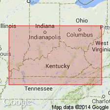
First mentioned as sandstone at Tar Springs. Breckinridge Co., KY.
Source: GNU records (USGS DDS-6; Reston GNULEX).
- Usage in publication:
-
- Tar Springs sandstone
- Modifications:
-
- Named
- Dominant lithology:
-
- Sandstone
- Shale
- AAPG geologic province:
-
- Illinois basin
Summary:
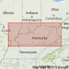
Named Tar Springs sandstone. About 55 ft thick at Cloverport, Breckinridge Co., KY. Springs of petroleum issue from base. Brown in lower part due to petroleum staining, snowy white in places in upper part.
Source: GNU records (USGS DDS-6; Reston GNULEX).
- Usage in publication:
-
- Tar Springs sandstone
- Modifications:
-
- Overview
- AAPG geologic province:
-
- Illinois basin
Summary:
Tar Springs sandstone adopted in KY for use by the U.S. Geological Survey.
Source: GNU records (USGS DDS-6; Reston GNULEX).
- Usage in publication:
-
- Tar Springs Sandstone*
- Modifications:
-
- Overview
- AAPG geologic province:
-
- Illinois basin
Summary:
Designated Tar Springs Sandstone. "Sandstone and shale: Sandstone is yellowish gray, fine grained, moderately well sorted with subround to round grains * * *. Mostly massive and cliff forming, but upper 15 feet shaly and less resistant. Lower part is medium-gray shale, rarely exposed." Thickness is 40 to 80 ft. Underlain by Glen Dean Limestone; overlain by Buffalo Wallow Formation. One of many geologic quadrangle maps mapped by the U.S. Geological Survey in KY, between 1962 and 1978, that contains Tar Springs Sandstone.
Source: GNU records (USGS DDS-6; Reston GNULEX).
- Usage in publication:
-
- Tar Springs Sandstone Member*
- Modifications:
-
- Revised
- AAPG geologic province:
-
- Illinois basin
Summary:
Reduced in rank to Tar Springs Sandstone Member of the Leitchfield Formation in area of report.
Source: GNU records (USGS DDS-6; Reston GNULEX).

- Usage in publication:
-
- Tar Springs Sandstone
- Modifications:
-
- Overview
- AAPG geologic province:
-
- Illinois basin
Summary:
Current (1975) usage of Illinois Geological Survey is Tar Springs Sandstone. In IL, thickness commonly 75 to 130 ft, composed of sandstone and shale. Underlain by Glen Dean Limestone; overlain by Vienna Limestone.
Source: GNU records (USGS DDS-6; Reston GNULEX).

- Usage in publication:
-
- Tar Springs Formation
- Modifications:
-
- Overview
- AAPG geologic province:
-
- Illinois basin
Summary:
Current (1986) usage of the Indiana Geological Survey is Tar Springs Formation. In IN, it is primarily shale but also contains scattered thin beds of limestone and massive local lenses of sandstone that on outcrop are differentiated as the Tick Ridge Sandstone Member. Formation commonly 65 ft thick but reaches 100 ft. Recognized on surface in Indiana from southwestern Orange Co. southward to the Ohio River. Overlies Glen Dean Limestone, conformably in most places. Overlain conformably by Vienna Limestone Member of Branchville Formation, where present, or higher rocks in Branchville where not present. Unconformably overlain by Manchester Formation (Morrowan) where overlying Mississippian rocks absent at Mississippian-Pennsylvanian unconformity.
Source: GNU records (USGS DDS-6; Reston GNULEX).
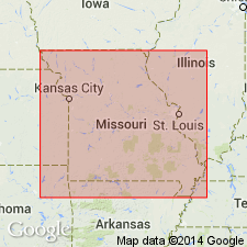
- Usage in publication:
-
- Tar Springs Sandstone
- Modifications:
-
- Overview
- AAPG geologic province:
-
- Illinois basin
Summary:
Current (1986) usage of Missouri Geological Survey is Tar Springs Sandstone. In MO, consists chiefly of sandstone and contains shale and shaly sandstone near middle of unit. About 90 ft thick. Underlain by Glen Dean Limestone; overlain by Vienna Limestone.
Source: GNU records (USGS DDS-6; Reston GNULEX).
- Usage in publication:
-
- Tar Springs Sandstone
- Modifications:
-
- Revised
- AAPG geologic province:
-
- Illinois basin
Summary:
The Pope Group, here revised from Megagroup and apparently reinstated, comprises strata from the base of the Aux Vases Sandstone to the top of the Kinkaid Formation, which includes the Tar Springs Sandstone. According to authors, "The Pope Group is a lithostratigraphic unit distinct from its chronostratigraphic counterpart, the Chesterian Series." The lower boundaries of the two differ slightly. The group is about 1,425 ft thick in the Waltersburg quad, but the lowermost formations, from the Aux Vases Sandstone up to the Fraileys Shale Member of the Golconda Formation do not crop out. This interval is 384 ft thick in the Austin Roberts No. 1 Well. [See subunit list in index portion of Pope summary record. Publication does not name the units between the Aux Vases and the Fraileys and therefore these have not been included in the list.]
Source: GNU records (USGS DDS-6; Reston GNULEX).
For more information, please contact Nancy Stamm, Geologic Names Committee Secretary.
Asterisk (*) indicates published by U.S. Geological Survey authors.
"No current usage" (†) implies that a name has been abandoned or has fallen into disuse. Former usage and, if known, replacement name given in parentheses ( ).
Slash (/) indicates name conflicts with nomenclatural guidelines (CSN, 1933; ACSN, 1961, 1970; NACSN, 1983, 2005, 2021). May be explained within brackets ([ ]).