

- Usage in publication:
-
- Tapeats sandstone*
- Modifications:
-
- Original reference
- Dominant lithology:
-
- Sandstone
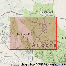
- AAPG geologic province:
-
- Plateau sedimentary province
Summary:
Tapeats sandstone of Tonto group. Brown slabby, cross-bedded sandstone; basal part contains lenses of conglomerate having rounded pebbles. Thickness 0 to 285 feet. Is basal formation of Tonto group. Rests, with great visible angular unconformity, on Dox sandstone, top formation of Unkar group (Algonkian), and, in places upon the still older Vishnu schist (Archean). Conformably overlain by Bright Angel shale. A marine deposit; contains fossil SCOLITHUS. Age is Middle Cambrian. Report includes geologic map.
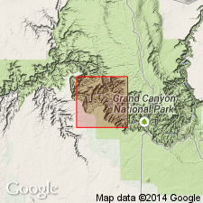
Typical section measured and described in Shinumo quadrangle, Coconino Co., Grand Canyon, northern AZ. Named from Tapeats Creek, Kaibab quadrangle, Coconino Co., Grand Canyon, northern AZ, below mouth of which, just north of Shinumo quadrangle, the bed of Colorado River lies within this sandstone.
Source: US geologic names lexicon (USGS Bull. 896, p. 2116); supplemental information from GNU records (USGS DDS-6; Denver GNULEX).
- Usage in publication:
-
- Tapeats sandstone
- Modifications:
-
- Overview
- AAPG geologic province:
-
- Plateau sedimentary province
Summary:
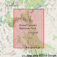
Pg. 15-17, 38-39. Tapeats sandstone, basal formation of Tonto group. Present in Grand Canyon, Mohave and Coconino Counties, northwestern Arizona. Coarse-grained sandstone is by far the most extensive of the several lithologic facies represented in Tapeats sandstone. Fairly uniform in character throughout eastern Grand Canyon, although locally variable, and normally weathers into single sheer cliff of chocolate-brown color. Near Grand Wash Cliffs, western Grand Canyon, consists of a purple to buff, coarse-grained, thick-bedded, cross-laminated quartzite to quartzitic sandstone massive part, and a brown, coarse-grained, thin-bedded, ledge-forming, cream to brown quartzite or sandstone transition zone; thickness 174 to 179 feet. Unconformably overlies Precambrian Vishnu schist, Dox sandstone, Archean schist, and Archean granite, depending on locality. Age is Early Cambrian. Report includes cross sections, measured sections.
Source: US geologic names lexicon (USGS Bull. 1200, p. 3823-3824); supplemental information from GNU records (USGS DDS-6; Denver GNULEX).
- Usage in publication:
-
- Tapeats Sandstone*
- Modifications:
-
- Areal extent
- AAPG geologic province:
-
- Plateau sedimentary province
Summary:
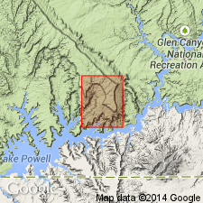
The Lower and Middle Cambrian Tapeats Sandstone geographically extended northward from AZ in the subsurface of Kane Co, UT in the Plateau sedimentary province. Tapeats shown as unconformable on the Precambrian and as beneath the Bright Angel Shale of Middle Cambrian age. The Tapeats is 290 ft thick. It consists of gray to red-brown, medium- to coarse-grained, feldspathic, glauconitic, pebbly sandstone and some thin red and green shale. A marginal marine deposit.
Source: GNU records (USGS DDS-6; Denver GNULEX).
- Usage in publication:
-
- Tapeats Sandstone*
- Modifications:
-
- Revised
- Areal extent
- AAPG geologic province:
-
- Basin-and-Range province
Summary:
Upper unit of Tapeats removed and assigned to the newly named Chino Valley Formation. Former upper unit recognized between Partridge Creek southeast in the Chino Valley and south to the Jerome area, Yavapai Co, AZ in the Basin-and-Range province, an area of about 75 km. Of Cambrian age. Stratigraphic diagrams.
Source: GNU records (USGS DDS-6; Denver GNULEX).
- Usage in publication:
-
- Tapeats Sandstone*
- Modifications:
-
- Overview
- AAPG geologic province:
-
- Basin-and-Range province
Summary:
Is predominately a very coarse grained sandstone to granule conglomerate, the initial deposit of a transgressing Cambrian sea. Composition ranges from quartzarenite to arkose. Grains are rounded to subrounded. Ranges from 0 to 8 m thick. Rests unconformably over Precambrian rocks. East of Juniper area, the major area of this report, Yavapai Co, AZ, Basin-and-Range province, Tapeats is overlain by Chino Valley Formation. The Tapeats and Chino Valley are separated by a major stratigraphic break. Is unfossiliferous, except for trace fossils. Is divisible on basis of grain size, bedding thickness, sedimentary structures, and trace fossils into 6 facies. Facies A and B were intertidal sand bars, C was deposited on a beach by shoaling waters, D and E are tidal flat deposits, and F is a bedload stream deposit. Western part of area mainly sandy intertidal regime. Eastern part of area mainly fluvial system.
Source: GNU records (USGS DDS-6; Denver GNULEX).
- Usage in publication:
-
- Tapeats Quartzite*
- Modifications:
-
- Redescribed
- Dominant lithology:
-
- Quartzite
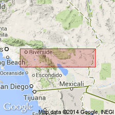
- AAPG geologic province:
-
- Salton basin
Summary:
Names applied in Grand Canyon area, northern AZ, extended geographically to sequence in Big Maria Mountains, CA in the Salton basin with a change in lithic designation. Cambrian Tapeats Sandstone redescribed as Tapeats Quartzite. Tapeats consists of impure quartzite that varies in grain size, is gray (fresh), buff to brown (weathered), cross-bedded locally, and a cliff-former. Is 0-30 m thick. Overlain by Bright Angel Schist (redefined). Equivalent to Bolsa Quartzite of southern CA. This part of CA was part of the stable craton of North America in Paleozoic and Mesozoic time. Rocks were intruded by Middle Jurassic granodiorite and metamorphosed in Cretaceous time.
Source: GNU records (USGS DDS-6; Denver GNULEX).
For more information, please contact Nancy Stamm, Geologic Names Committee Secretary.
Asterisk (*) indicates published by U.S. Geological Survey authors.
"No current usage" (†) implies that a name has been abandoned or has fallen into disuse. Former usage and, if known, replacement name given in parentheses ( ).
Slash (/) indicates name conflicts with nomenclatural guidelines (CSN, 1933; ACSN, 1961, 1970; NACSN, 1983, 2005, 2021). May be explained within brackets ([ ]).