The National Geologic Map Database is migrating to a new infrastructure. We apologize for any service disruptions during this process.
|
|---|


- Usage in publication:
-
- Tamaha sandstone member*
- Modifications:
-
- Named
- Dominant lithology:
-
- Sandstone
- AAPG geologic province:
-
- Arkoma basin
- Chautauqua platform
Summary:
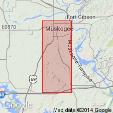
Named as basal member (of 6 named members) of Savanna sandstone. Savanna is one of five formations assigned to rocks formerly included in Winslow formation in this area. [Preferred usage for Winslow as a result of this study not clearly stated.] Named for exposures at Tamaha, Haskell Co, OK in the Arkoma basin. No type locality designated. Area of this report is in Muskogee Co, OK on the Chautauqua platform. In a composite section of the Savanna sandstone in the southern part of Muskogee Co, Tamaha sandstone member shown as consisting of brown, greenish brown and gray, dark brown, thin-bedded, rarely massive sandstone with regular bedding and fine to medium texture; contains much mica and many dark, argillaceous streaks; ripple marks abundant; is 20 ft thick; separated from overlying Keota sandstone member (new) of Savanna by 70 ft of usually concealed shale of the Savanna. In a composite section of the Savanna sandstone in the northern part of Muskogee Co, Tamaha shown as 10 ft thick separated from overlying Keota sandstone member of Savanna by 35 ft of shale. Overlies McAlester shale. Columnar section. Stratigraphic table. Of Early Pennsylvanian age.
Source: GNU records (USGS DDS-6; Denver GNULEX).
For more information, please contact Nancy Stamm, Geologic Names Committee Secretary.
Asterisk (*) indicates published by U.S. Geological Survey authors.
"No current usage" (†) implies that a name has been abandoned or has fallen into disuse. Former usage and, if known, replacement name given in parentheses ( ).
Slash (/) indicates name conflicts with nomenclatural guidelines (CSN, 1933; ACSN, 1961, 1970; NACSN, 1983, 2005, 2021). May be explained within brackets ([ ]).