The National Geologic Map Database is migrating to a new infrastructure. We apologize for any service disruptions during this process.
|
|---|


- Usage in publication:
-
- Tallahatta formation*
- Modifications:
-
- Original reference
- Dominant lithology:
-
- Limestone
- AAPG geologic province:
-
- Mid-Gulf Coast basin
Summary:
Pg. 344, and chart opp. p. 334; also published in 1897 as House Doc. 5, 55th Cong., 2nd sess. Tallahatta or Orangeburg formation. Hitherto known as the Buhrstone, a local term used for the rough siliceous rocks belonging to lower Eocene of the Carolinas, Georgia, Alabama, etc., adopted by Lyell in 1845 (Quart. Jour. Geol. Soc. London, v. 1, p. 435) for a formation which he regarded as newer than the white limestone [Vicksburg group]. Buhrstone had been used by Finch and others as early as 1823 (Amer. Jour. Sci., 1st ser., v. 7, p. 38), but the term is of a colloquial rather than a distinctive character. Owing to very great objections to these qualitative mineralogical terms as names for formations, and loose way in which present one has been used in the literature, it has been thought best to propose a geographical name for the original group. The name selected is that of Orangeburg district of South Carolina, the typical locality of the Buhrstone, as defined by Tuomey (Geology of South Carolina, 1848, p. 149), in correcting Lyell's stratigraphy. It was in Orangeburg district that Tuomey found the fossils which fixed the horizon, and also the thickest and finest exposures. For the exposures of nearly same age, but of different fauna and lithologic character, in Alabama, E.A. Smith suggests Tallahatta, from the local name of the hills containing them.
[GNC remark (ca. 1936, US geologic names lexicon, USGS Bull. 896, p. 2111): Tallahatta formation. Basal formation of Claiborne group. Underlies Lisbon formation and overlies Hatchetigbee formation, of Wilcox group. Age is middle Eocene. Named from development in Tallahatta Hills, Choctaw Co., southern AL.]
Source: US geologic names lexicon (USGS Bull. 896, p. 2111).
- Usage in publication:
-
- Tallahatta Formation
- Modifications:
-
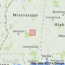
- Areal extent
- AAPG geologic province:
-
- Mid-Gulf Coast basin
Summary:
Tallahatta Formation of Claiborne Group in Newton Co., MS, is divided into a lower Basic City Shale Member and an upper Neshoba Sand Member. The Tallahatta disconformably overlies the Meridian Sand, basal formation of the Claiborne and underlies the Winona Formation of the Claiborne. The Basic City reaches a maximum thickness in the study area of 130 ft, while the Neshoba's maximum thickness is only 15 ft. Depositional environment of the Basic City interpreted to be marine shelf and strandplain. Environment of the Neshoba was deltaic and strandplain. Age is Eocene. Measured sections. Geologic map. Stratigraphic column.
Source: GNU records (USGS DDS-6; Reston GNULEX).

- Usage in publication:
-
- Tallahatta Formation
- Modifications:
-
- Overview
- AAPG geologic province:
-
- Mid-Gulf Coast basin
Summary:
According to the usage of the AL Geological Survey, the Tallahatta Formation of the Claiborne Group is white to very light-greenish-gray thin-bedded to massive siliceous claystone interbedded with thin layers of clay, sandy clay, and glauconitic sand and sandstone. The Tallahatta thins to the east where the siliceous claystone becomes less prominent and clayey sand, sandy clay and limestone dominate. In southwest AL, the lower 8 to 10 ft is the Meridian Sand Member [apparently the only member recognized in AL], a white to light-greenish-gray fine to coarse sand and fine gravel. The thickness of the Tallahatta ranges from 125 ft in southwest AL to 57 ft in southeast AL. Age is early and middle Eocene (late Ypresian-early Lutetian).
Source: GNU records (USGS DDS-6; Reston GNULEX).
- Usage in publication:
-
- Tallahatta Formation
- Modifications:
-
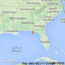
- Areal extent
- AAPG geologic province:
-
- South Georgia sedimentary province
Summary:
According to author, differentiation of middle Eocene Tallahatta and Lisbon Formations in Gulf Co. is not possible using lithologic criteria and so the two units are grouped into Tallahatta/Lisbon Formations undifferentiated. Because Gulf Co. lies in a transitional area of the FL panhandle over the axis of the Apalachicola Embayment, there may be constituents characteristic of the carbonate Avon Park Formation, the eastern facies equivalent of the Tallahatta and Lisbon.
Source: GNU records (USGS DDS-6; Reston GNULEX).
For more information, please contact Nancy Stamm, Geologic Names Committee Secretary.
Asterisk (*) indicates published by U.S. Geological Survey authors.
"No current usage" (†) implies that a name has been abandoned or has fallen into disuse. Former usage and, if known, replacement name given in parentheses ( ).
Slash (/) indicates name conflicts with nomenclatural guidelines (CSN, 1933; ACSN, 1961, 1970; NACSN, 1983, 2005, 2021). May be explained within brackets ([ ]).