

- Usage in publication:
-
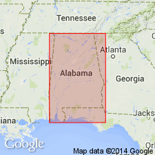
- Talladega group
- Modifications:
-
- Named
- AAPG geologic province:
-
- Piedmont-Blue Ridge province
Summary:
Talladega group is used in table for rocks between Ladiga (Potsdam) sandstone above and Archean crystalline schists below. No description.
Source: GNU records (USGS DDS-6; Reston GNULEX).
- Usage in publication:
-
- Talladega schist
- Modifications:
-
- Not used
- AAPG geologic province:
-
- Piedmont-Blue Ridge province
Summary:
Name Hurricane graywacke (new) in GA replaces rocks called Gilmer schist by Hayes (unpub. folio) and included by Crickmay in Talladega series. In AL, rocks mapped as Talladega schist by Butts (1926) in Corbin anticline are now called Hurricane.
Source: GNU records (USGS DDS-6; Reston GNULEX).

- Usage in publication:
-
- Talladega Group*
- Modifications:
-
- Revised
- AAPG geologic province:
-
- Piedmont-Blue Ridge province
Summary:
In the Rome thrust sheet in northern AL, Talladega Group is used as defined by Tull (1982). It includes the Lay Dam Formation and its Cheaha Quartzite Member, Butting Ram Sandstone, and Jemison Chert. Talladega Group rocks belong with Valley and Ridge province rocks in the Talladega thrust slice in the Rome thrust sheet, and have been overthrust by Great Smoky Group rocks in the Bill Arp thrust sheet. Age is Early and Middle Devonian.
Source: GNU records (USGS DDS-6; Reston GNULEX).
For more information, please contact Nancy Stamm, Geologic Names Committee Secretary.
Asterisk (*) indicates published by U.S. Geological Survey authors.
"No current usage" (†) implies that a name has been abandoned or has fallen into disuse. Former usage and, if known, replacement name given in parentheses ( ).
Slash (/) indicates name conflicts with nomenclatural guidelines (CSN, 1933; ACSN, 1961, 1970; NACSN, 1983, 2005, 2021). May be explained within brackets ([ ]).