- Usage in publication:
-
- Talihina chert*
- Modifications:
-
- Named
- Dominant lithology:
-
- Chert
- Shale
- Limestone
- AAPG geologic province:
-
- Arkoma basin
- Ouachita folded belt
Summary:
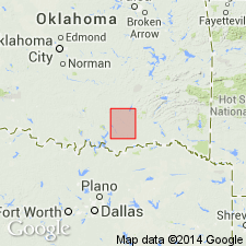
Named for town of Talihina in Tuskahoma quad, Le Flore Co, OK in Ouachita tectonic belt province. No type locality designated. Occurs in northeast part Atoka quad and more extensively to east in Tuskahoma quad, from which the lithologic description is summarized. Forms rounded, smooth, knobby ridges. Is composed of three members: 1) lowest member, 600 ft thick, of interstratified flint, chert, black and bluish shales, and lentils of dense limestone; 2) middle member, 300 ft thick, of fissile shales and thin cherty layers; and 3) upper member, 300 ft thick, of interbedded chert and shale like the lowest member. Total thickness 1,200 ft. Overlies Stringtown shale (new); underlies, with gradual transition, Standley shale (first used). Geologic map. Columnar section. Age, based on fossils, is Silurian (Late Ordovician). Correlates with Viola limestone to west.
Source: GNU records (USGS DDS-6; Denver GNULEX).
For more information, please contact Nancy Stamm, Geologic Names Committee Secretary.
Asterisk (*) indicates published by U.S. Geological Survey authors.
"No current usage" (†) implies that a name has been abandoned or has fallen into disuse. Former usage and, if known, replacement name given in parentheses ( ).
Slash (/) indicates name conflicts with nomenclatural guidelines (CSN, 1933; ACSN, 1961, 1970; NACSN, 1983, 2005, 2021). May be explained within brackets ([ ]).

