The National Geologic Map Database is migrating to a new infrastructure. We apologize for any service disruptions during this process.
|
|---|


- Usage in publication:
-
- Talbot formation
- Modifications:
-
- Original reference
- Dominant lithology:
-
- Clay
- AAPG geologic province:
-
- Atlantic Coast basin
Summary:
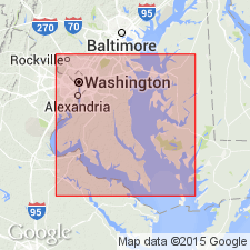
Pg. 73-75. Talbot formation of Columbia group. Is developed as a bench of variable width around edges of Wicomico terrace, and frequently separated from it in many places by a low scarp line. Occasionally this scarp, which is the ancient sea cliff of Talbot sea, attains height of 30 to 40 feet, notably in Kent County, Maryland, but there are places where the scarp seems to be entirely lacking, and it is probable that in these places it has been destroyed. Carries same sort of detritus as underlying Wicomico and Sunderland formations, but possesses a greater proportion of loam and a smaller proportion of decayed materials, and contains numerous lenses of greenish-blue clay, which frequently carry plant remains and are regarded as swamp deposits, formed in mouths of ponded streams and buried by advancing beach of Talbot sea. Base of Talbot terrace is irregular, sometimes lying above tide and sometimes below, but the top, where it borders its sea cliff, is usually limited by the 45- or 50-foot contour. Is top formation of Columbia group. Overlies Wicomico formation unconformably. [Age is Pleistocene.]
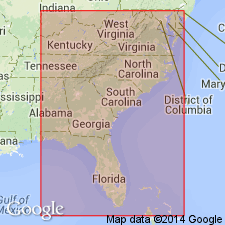
Named from Talbot Co., eastern shore of MD. [Recognized in Atlantic Coastal Plain from DE to FL.]
Source: US geologic names lexicon (USGS Bull. 896, p. 2109).
- Usage in publication:
-
- Talbot formation*
- Modifications:
-
- Revised
- AAPG geologic province:
-
- Atlantic Coast basin
Summary:
Talbot formation is here restricted to the deposits on 42-foot level, which are same as typical "Chowan" formation, here abandoned. Pamlico formation is here extended northward and applied to the deposits on the 25-foot level, which have heretofore been included in Talbot formation. [Age is Pleistocene.]
[This is present (ca. 1936) accepted definition of the USGS.]
Source: US geologic names lexicon (USGS Bull. 896, p. 2109).

- Usage in publication:
-
- Talbot formation*
- Modifications:
-
- Overview
- AAPG geologic province:
-
- Atlantic Coast basin
Summary:
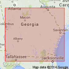
Talbot formation of Columbia group. The terrace formations of Columbia group (including the Talbot) now [ca. 1936] recognized by Cooke from Delaware to southern Georgia, and probably into Florida, are enumerated herein under Columbia group. Age is Pleistocene.
Source: US geologic names lexicon (USGS Bull. 896, p. 2109).
- Usage in publication:
-
- Talbot formation*
- Modifications:
-
- Areal extent
- AAPG geologic province:
-
- Florida platform
Summary:
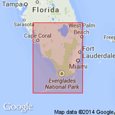
Pg. 75-77, pls. 2, 3. Talbot formation of Columbia group. In southern Florida, the Talbot, Penholoway, and Wicomico formations comprise a conformable sequence of deposits whose differentiation is based mainly on location of their respective shore lines --42, 70, and 100 feet above present sea level. The Talbot merges downward into the Penholoway and Wicomico successively. Sequence unconformably overlies Caloosahatchee marl and is likewise separated by stratigraphic break from Pamlico formation, which fringes around it. Boundary between Talbot and Pamlico very inconspicuous. Age is Pleistocene.
Well exposed in FL along Highway 18, the Childs-Okeechobee Road and west of Lake Okeechobee; also present on Immokalee Island.
Source: US geologic names lexicon (USGS Bull. 1200, p. 3811).
- Usage in publication:
-
- Talbot Formation†
- Talbot terrace
- Modifications:
-
- Abandoned
- AAPG geologic province:
-
- Atlantic Coast basin
- Florida platform
- South Georgia sedimentary province
Summary:
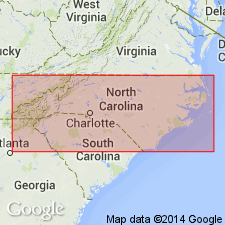
Concept of Talbot Formation is invalid and should be abandoned in the lithostratigraphic sense along with Silver Bluff, Princess Anne, Pamlico, Penholoway, Wicomico, Sunderland, Coharie, and Brandywine Formations. Though name is retained as a terrace, it is inappropriate because Talbot was originally used as a formation name. "Talbot" terrace is directly underlain by Cypresshead Formation (new name), which also underlies the Penholoway, and "Wicomico" terraces
Source: GNU records (USGS DDS-6; Reston GNULEX).
- Usage in publication:
-
- Talbot Formation
- Modifications:
-
- Not used
- AAPG geologic province:
-
- Atlantic Coast basin
Summary:
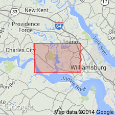
Talbot Formation, as mapped by Wentworth (1930) in southeastern VA, now called Tabb Formation.
Source: GNU records (USGS DDS-6; Reston GNULEX).
- Usage in publication:
-
- Talbot Formation*
- Modifications:
-
- Mapped
- AAPG geologic province:
-
- Atlantic Coast basin
Summary:
[This manuscript was reviewed by GNU in 1973, but was not published until 1990. Field work for this study was done in the late 1960's. The nomenclature in this report may not reflect current usage.]
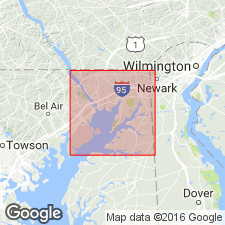
As mapped in this report, the Talbot is adjacent or close to the present shoreline, but is also found in the valleys of Big and Little Elk Creeks nearly 5 mi inland. Much of the town of Elkton and part of the town of Perryville lie on the Talbot terrace. Talbot is divided into two facies. Lower fine-grained silt and fine sand is locally glauconitic and ranges in thickness from 25 to 50 ft. The upper facies is coarse-grained and gravelly at base, with finer grained sand and loam in the upper part. Clasts of crystalline rock in the gravel range in size to boulders 8 ft across. Thickness of upper facies ranges from 7 to 15 ft. Talbot unconformably overlies formations ranging from the Potomac Group to the Monmouth. To the north the unit rests upon crystalline rocks of the Piedmont.
Source: GNU records (USGS DDS-6; Reston GNULEX).
- Usage in publication:
-
- Talbot Formation
- Modifications:
-
- Geochronologic dating
- Age modified
- AAPG geologic province:
-
- Atlantic Coast basin
Summary:
The material analyzed in this study consisted of long-ranging, nondiagnostic fossil shells and sandy, glauconitic limestones. Phosphatic materials gave inconsistent results. The age of deposition for each unit was assigned by comparing 87Sr/86Sr results with the seawater strontium curve. Twelve determinations were made on shells from the Talbot. Seawater value is indistinguishable from modern seawater. Data indicate a young age for the Talbot--either Holocene or Pleistocene.
Source: GNU records (USGS DDS-6; Reston GNULEX).
For more information, please contact Nancy Stamm, Geologic Names Committee Secretary.
Asterisk (*) indicates published by U.S. Geological Survey authors.
"No current usage" (†) implies that a name has been abandoned or has fallen into disuse. Former usage and, if known, replacement name given in parentheses ( ).
Slash (/) indicates name conflicts with nomenclatural guidelines (CSN, 1933; ACSN, 1961, 1970; NACSN, 1983, 2005, 2021). May be explained within brackets ([ ]).