

- Usage in publication:
-
- Tahoka Formation
- Modifications:
-
- Mapped 1:250k
- Dominant lithology:
-
- Clay
- Silt
- Sand
- Gravel
- AAPG geologic province:
-
- Permian basin
Summary:
Pamphlet [p. 3]. Tahoka Formation. Lacustrine clay, silt, sand, and gravel, locally calcareous, selenitic. Clay and silt, sandy, indistinctly bedded to massive, weakly coherent, various shades of light gray and bluish gray. Sand, fine- to coarse-grained quartz, indistinctly bedded to massive, friable, gray, grades to gravel at margins of deposits. Molluscan and vertebrate fossils. Age is Pleistocene (Wisconsinan), [based on fossils].
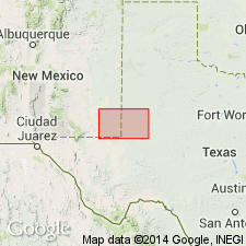
[Mapped in Andrews, Dawson, Gaines, and Martin Cos., TX, and Eddy and Lea Cos., NM.]
Source: Publication.

- Usage in publication:
-
- Tahoka Formation
- Modifications:
-
- Mapped 1:250k
- Dominant lithology:
-
- Clay
- Silt
- Sand
- Gravel
- AAPG geologic province:
-
- Permian basin
Summary:
Is Pleistocene formation mapped in southwestern part of map sheet in vicinity of Tahoka, Lynn Co, TX and adjacent southwestern Garza Co, TX (northeastern Permian basin). Map unit described as lacustrine clay, silt, sand, and gravel, coarser toward margins of deposits, locally calcareous, selenitic. Clay and silt, sandy, indistinctly bedded to massive, weakly coherent, various shades of light gray and bluish gray. Sand, fine- to coarse-grained quartz, indistinctly bedded to massive, friable, gray, grades to gravel at margins of deposits. Molluscan and vertebrate fossils. Thickness 25 ft, feathers out laterally. (Wisconsinan)
Source: GNU records (USGS DDS-6; Denver GNULEX).
For more information, please contact Nancy Stamm, Geologic Names Committee Secretary.
Asterisk (*) indicates published by U.S. Geological Survey authors.
"No current usage" (†) implies that a name has been abandoned or has fallen into disuse. Former usage and, if known, replacement name given in parentheses ( ).
Slash (/) indicates name conflicts with nomenclatural guidelines (CSN, 1933; ACSN, 1961, 1970; NACSN, 1983, 2005, 2021). May be explained within brackets ([ ]).