The National Geologic Map Database is migrating to a new infrastructure. We apologize for any service disruptions during this process.
|
|---|


- Usage in publication:
-
- Tahlequah member
- Modifications:
-
- Named
- Dominant lithology:
-
- Limestone
- AAPG geologic province:
-
- Arkoma basin
- Chautauqua platform
Summary:
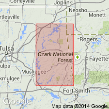
Name applied to the lower glauconitic facies and basal member of Moorefield formation, basal formation of Mayes group (rank raised) for exposures on south side of small creek south of city limits of town of Tahlequah, Cherokee Co., OK on the Chautauqua platform; these exposures are the type locality. This new name is used in preference to name Ruddell in OK. Mapped with Moorefield on 5 geologic maps --1.) Vinita-Pensacola area, 2.) Pryor-Salina area. 3.) Hulbert-Parkhill area, 4.) Tenkiller Ferry area, and 5.) Stillwell area. These maps cover all or parts of Craig, Mayes, Cherokee, Adair, Muskogee, and Sequoyah Cos., OK -all on the Chautauqua platform and in the Arkoma basin. Member consists of massive, gray, medium crystalline glauconitic limestone. Large scale cross-beds locally. Some nodules and stringers of chert. Locally characterized by large crinoid stems. Westward, [member becomes] a black crinoidal limestone. Ranges between 0-30 ft thick. Overlies "Boone" chert unconformably south of Tahlequah. At other localities, it rests on Reeds Springs chert or Short Creek oolite. Overlying unit not stated; is in fault contact with younger units of Moorefield at type. Underlies Hindsville formation in one measured section. Underlies Bayou Manard member (newly named) of Moorefield in another measured section. Other measured sections. Assigned to the [Upper] Mississippian, Meramecian.
Source: GNU records (USGS DDS-6; Denver GNULEX).
For more information, please contact Nancy Stamm, Geologic Names Committee Secretary.
Asterisk (*) indicates published by U.S. Geological Survey authors.
"No current usage" (†) implies that a name has been abandoned or has fallen into disuse. Former usage and, if known, replacement name given in parentheses ( ).
Slash (/) indicates name conflicts with nomenclatural guidelines (CSN, 1933; ACSN, 1961, 1970; NACSN, 1983, 2005, 2021). May be explained within brackets ([ ]).