

- Usage in publication:
-
- Table Rock Road Rhyolite
- Modifications:
-
- Named
- Dominant lithology:
-
- Rhyolite
- AAPG geologic province:
-
- Snake River basin
Summary:
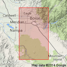
Probably named for local road near Table Rock. Assigned to Miocene Idavada Group (revised). Occurs as small exposure (<300 sq m) northwest of Table Rock in northeast margin of western Snake River Plain near Boise, Ada Co, southwestern ID. No petrographically similar unit has been found in the Boise front nor in deep geothermal well cuttings, suggesting very small areal extent. Consists of glassy, phyric rhyolite (5-10% plagioclase, 10-15% sanidine), which differentiates it from sparsely phyric Miocene Cottonwood Creek Rhyolite (new). Its phenocryst assemblage and its geochemistry show possible common magma source with the Cottonwood Creek, but both units remain unique. Owing to limited exposure, it cannot be discerned if the Table Rock Road is a lava flow, lava dome, or densely welded ash flow tuff. Thickness not stated. Underlying unit not known. Unconformably overlain by lower basalts of Miocene Boise basalt volcanic assemblage [informal] (Burnham and Wood, in press). The Boise dates K-Ar 13.5+/-0.9 Ma from modified whole rock. Table Rock Road age is inferred to be Miocene based on the overlying Boise as well as correlation with the Cottonwood Creek. Report includes geologic map and stratigraphic column.
Source: GNU records (USGS DDS-6; Denver GNULEX).
For more information, please contact Nancy Stamm, Geologic Names Committee Secretary.
Asterisk (*) indicates published by U.S. Geological Survey authors.
"No current usage" (†) implies that a name has been abandoned or has fallen into disuse. Former usage and, if known, replacement name given in parentheses ( ).
Slash (/) indicates name conflicts with nomenclatural guidelines (CSN, 1933; ACSN, 1961, 1970; NACSN, 1983, 2005, 2021). May be explained within brackets ([ ]).