The National Geologic Map Database is migrating to a new infrastructure. We apologize for any service disruptions during this process.
|
|---|


- Usage in publication:
-
- Tabbyune Creek Tongue
- Modifications:
-
- Named
- Dominant lithology:
-
- Sandstone
- Mudstone
- AAPG geologic province:
-
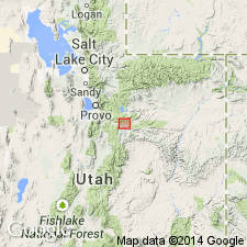
- Wasatch uplift
Summary:
Named as a tongue of the Colton Formation that lies above the Middle Fork Tongue (new name) of the Green River Formation and beneath the Soldier Summit Member (new name) of the Green River. Both contacts are gradational; the base and top of the Tabbyune Creek placed "at lowest and highest fluviatile beds." Type section [also called type locality] is south of Tabbyune Creek and northeast of Colton, E1/2 sec 14, T11S, R8E, Utah Co, UT on the Wasatch uplift. Consists of gray, thin-bedded to massive sandstone, brown (tan weathering) mudstone with some carbonaceous matter. Type measured. Is 312 ft thick at type; thins westward. Is about 260 ft thick in canyon of Left Fork. Relationship to main body of Colton not determined in present study. May be equivalent to the Renegade Tongue of Wasatch Formation. Stratigraphic chart. Eocene age.
Source: GNU records (USGS DDS-6; Denver GNULEX).
For more information, please contact Nancy Stamm, Geologic Names Committee Secretary.
Asterisk (*) indicates published by U.S. Geological Survey authors.
"No current usage" (†) implies that a name has been abandoned or has fallen into disuse. Former usage and, if known, replacement name given in parentheses ( ).
Slash (/) indicates name conflicts with nomenclatural guidelines (CSN, 1933; ACSN, 1961, 1970; NACSN, 1983, 2005, 2021). May be explained within brackets ([ ]).