- Usage in publication:
-
- Sykesville granite*
- Modifications:
-
- Named
- Dominant lithology:
-
- Monzonite
- AAPG geologic province:
-
- Piedmont-Blue Ridge province
Summary:
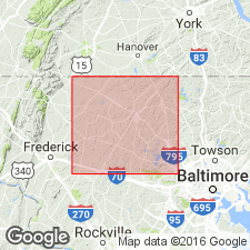
Named Sykesville granite for town in Carroll Co., MD. Consists of schistose biotite-quartz monzonite and is considered of Precambrian age.
Source: GNU records (USGS DDS-6; Reston GNULEX).
- Usage in publication:
-
- Sykesville Formation
- Modifications:
-
- Reinstated
- Revised
- AAPG geologic province:
-
- Piedmont-Blue Ridge province
Summary:
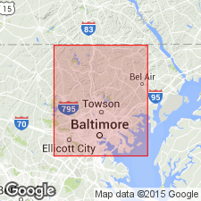
Author agrees with Fisher's (1963) usage of the name Sykesville, though Southwick and Fisher (1967) recommended abandonment of the term. Reinstatement of Sykesville as a formally recognized formation is strongly urged in this report. Rocks of the Sykesville in Baltimore Co., MD, are continuous with the Sykesville Granite and Peters Creek Formation of Jonas (1928) in Carroll Co. Unit is informally divided into a gneiss member and a schist member, which are probably facies equivalent. It is areally more extensive than formerly recognized. It has been traced northeastward to the vicinity of Reisterstown on the northwest flank of the Baltimore-Washington anticlinorium, where it feathers out but is present as sparse lenses of metadiamictite in the Piney Run for another 7 km. On the southeast flank of the anticlinorium it has been mapped as a string of discontinuous lenses, each in direct contact with the Baltimore Mafic Complex. The Sykesville is assigned to the Wissahickon Group, which is raised in rank in this report and divided into six formations, five of them newly named: the Loch Raven Schist (new), the Oella Formation (new), the Piney Run Formation (new), the Sykesville Formation, the Pleasant Grove Schist (new), and the Prettyboy Schist (new). The Sykesville is locally correlative with the upper part of the Piney Run and the lower part of the Pleasant Grove. The Wissahickon is assigned to the Glenarm Supergroup, raised in rank in this report, along with the underlying Setters Formation and Cockeysville Marble. The Sykesville was interpreted as a submarine slide mass by Hopson (1964). Age of the Wissahickon Group is given as Cambrian and Ordovician(?).
Source: GNU records (USGS DDS-6; Reston GNULEX).
- Usage in publication:
-
- Sykesville Formation
- Modifications:
-
- Revised
- AAPG geologic province:
-
- Piedmont-Blue Ridge province
Summary:
Sykesville Formation interpreted as upper part of major tectonostratigraphic unit here named the Liberty Complex. Structurally overlies Morgan Run Formation (new name) from which it received coarse metamorphic detritus during collision and uplift. Sykesville was deposited after initial metamorphism of the Morgan Run Formation as a sequence of mass-flow and slide deposits characteristic of sedimentary melanges. Up to 3,000 m thick. Age of the Liberty Complex is shown as Cambrian to Early Ordovician. Both the Morgan Run and Sykesville were strongly deformed, locally interleaved, and regionally metamorphosed during final suturing of the arc to the continental margin during the Taconic Orogeny.
Source: GNU records (USGS DDS-6; Reston GNULEX).
- Usage in publication:
-
- Sykesville Formation*
- Modifications:
-
- Revised
- AAPG geologic province:
-
- Piedmont-Blue Ridge province
Summary:
Soldiers Delight Ultramafite (new) lies tectonically between Late Proterozoic and (or) Early Cambrian Loch Raven Schist (revised) and Early Cambrian Sykesville Formation.
Source: GNU records (USGS DDS-6; Reston GNULEX).
- Usage in publication:
-
- Sykesville Formation*
- Modifications:
-
- Overview
- AAPG geologic province:
-
- Piedmont-Blue Ridge province
Summary:
The Sykesville Formation in the mapped area consists of mesoscopic olistoliths of amphibolite, metagabbro, different types of ultramafic rock, and rocks of the Mather Gorge Formation.
Source: GNU records (USGS DDS-6; Reston GNULEX).
- Usage in publication:
-
- Sykesville Formation*
- Modifications:
-
- Revised
- Age modified
- AAPG geologic province:
-
- Piedmont-Blue Ridge province
Summary:
Contains deformed olistoliths of Mather Gorge Formation (new name) as well as of ultramafic rocks, gabbro, and mafic rocks. Intruded by Kensington Tonalite (revised) which is dated at 543 Ma (Sinha and others (1979). Therefore, age of Sykesville must be older than Middle Cambrian.
Source: GNU records (USGS DDS-6; Reston GNULEX).
For more information, please contact Nancy Stamm, Geologic Names Committee Secretary.
Asterisk (*) indicates published by U.S. Geological Survey authors.
"No current usage" (†) implies that a name has been abandoned or has fallen into disuse. Former usage and, if known, replacement name given in parentheses ( ).
Slash (/) indicates name conflicts with nomenclatural guidelines (CSN, 1933; ACSN, 1961, 1970; NACSN, 1983, 2005, 2021). May be explained within brackets ([ ]).

