- Usage in publication:
-
- Sykes Mountain formation
- Modifications:
-
- Named
- Dominant lithology:
-
- Siltstone
- Sandstone
- Shale
- AAPG geologic province:
-
- Bighorn basin
Summary:
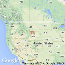
Named for exposures near Sykes Mountain, Big Horn Co, WY, in Bighorn basin where well exposed. Recognized from Red Dome, Carbon Co, MT south to Hyattville area, Big Horn Co, WY. Type section designated northwest of Sykes Mountain between Crooked and Gypsum Creeks, NE1/4 sec 25, T58N, R96W where formation 135 ft thick, and where it overlies variegated claystone of Himes member (new) of Cloverly formation, and underlies black shale of Thermopolis shale. Upper contact placed where sandstone, siltstone, and ironstone more prominent than black or dark gray shale. Includes beds formerly assigned to rusty beds, Dakota silt, Dakota sandstone, and Greybull member of Cloverly. [Reason for not assigning this formation to Greybull not stated except that Cloverly used for lake and swamp deposits, whereas Sykes Mountain is a tidal flat and shallow water deposit.] Ranges from 100-300 ft thick. Consists of thinly interbedded limonite-stained, brown siltstone, gray to black shale, gray to brown quartz sandstone, and ironstone beds. Most of beds are 1/8 to 3/4 of an inch thick. Bedding disturbed by burrowing animals suggesting tidal-flat environment. One or two sandstone beds present locally. Is very distinctive from Thermopolis. Few fossils. Upper age limit placed as late Albian because of presence of an ammonite of late Albian age found in overlying Thermopolis. Measured section. Nomenclature chart. Cross section. Of Early Cretaceous age.
Source: GNU records (USGS DDS-6; Denver GNULEX).
For more information, please contact Nancy Stamm, Geologic Names Committee Secretary.
Asterisk (*) indicates published by U.S. Geological Survey authors.
"No current usage" (†) implies that a name has been abandoned or has fallen into disuse. Former usage and, if known, replacement name given in parentheses ( ).
Slash (/) indicates name conflicts with nomenclatural guidelines (CSN, 1933; ACSN, 1961, 1970; NACSN, 1983, 2005, 2021). May be explained within brackets ([ ]).

