The National Geologic Map Database is migrating to a new infrastructure. We apologize for any service disruptions during this process.
|
|---|


- Usage in publication:
-
- Swisher Mountain Tuff*
- Modifications:
-
- Named
- Dominant lithology:
-
- Tuff
- AAPG geologic province:
-
- Snake River basin
- Great Basin province
Summary:
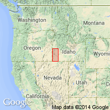
Named for exposures on Swisher Mountain, Owyhee Co, ID in the Snake River basin. Type locality designated as northern wall of Wood Canyon in SE1/4 sec 29, T5S, R5W where the tuff is 50 m thick. Rests on tuffaceous sedimentary rocks of Sucker Creek Formation. Is overlain by fan gravels and fanglomerate of late Pliocene or Quaternary age. Is a densely welded, simple cooling unit at type. Becomes a compound cooling unit westward into OR. Areal distribution map. Source area was at or near Juniper Mountain where it is about 200 m thick. Some of the vitrophyres are flow brecciated; others are massive. Has an average age (K-Ar on sanidine) of 13.85, or Miocene.
Source: GNU records (USGS DDS-6; Denver GNULEX).
For more information, please contact Nancy Stamm, Geologic Names Committee Secretary.
Asterisk (*) indicates published by U.S. Geological Survey authors.
"No current usage" (†) implies that a name has been abandoned or has fallen into disuse. Former usage and, if known, replacement name given in parentheses ( ).
Slash (/) indicates name conflicts with nomenclatural guidelines (CSN, 1933; ACSN, 1961, 1970; NACSN, 1983, 2005, 2021). May be explained within brackets ([ ]).