The National Geologic Map Database is migrating to a new infrastructure. We apologize for any service disruptions during this process.
|
|---|


- Usage in publication:
-
- Swauk Prairie Member
- Modifications:
-
- Named
- Dominant lithology:
-
- Till
- Gravel
- AAPG geologic province:
-
- Cascades province
Summary:
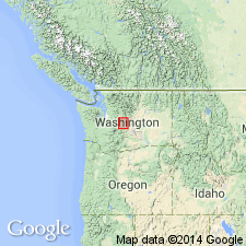
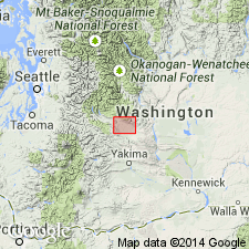
Named as lower member of Kittitas Drift (new). [Name Swauk Prairie Member first used by Porter (1975).] Type locality designated as till facies: roadcut HWY 97 at northwest end of Swauk Prairie SE/4 NW/4 sec.28 T20N R17E and canal cut on Thorp Prairie, SW/4 NE/4 sec.30 T19N R17E; outwash facies: roadcut near distal margin of Thorp Prairie moraine SE/4 SW/4 sec.32 T19N R17E, upper Yakima River drainage basin, Kittitas Co, WA. Composed of stony till and gravel in till and outwash facies. Forms moraine complex mantled by loess. Overlies Thorp Drift (new); underlies Indian John Member (new) (Kittitas Drift). Is Pleistocene age.
Source: GNU records (USGS DDS-6; Menlo GNULEX).
- Usage in publication:
-
- Swauk Prairie Member†
- Modifications:
-
- Abandoned
- AAPG geologic province:
-
- Cascades province
Summary:
Swauk Prairie Member of Kittitas Drift of Porter (1975, 1976) here reinterpreted to be phase of accumulation during single glaciation. Name is abandoned and redesignated informal Swauk Prairie phase of Kittitas Drift.
Source: GNU records (USGS DDS-6; Menlo GNULEX).
For more information, please contact Nancy Stamm, Geologic Names Committee Secretary.
Asterisk (*) indicates published by U.S. Geological Survey authors.
"No current usage" (†) implies that a name has been abandoned or has fallen into disuse. Former usage and, if known, replacement name given in parentheses ( ).
Slash (/) indicates name conflicts with nomenclatural guidelines (CSN, 1933; ACSN, 1961, 1970; NACSN, 1983, 2005, 2021). May be explained within brackets ([ ]).