

- Usage in publication:
-
- Swartz rhyolite
- Modifications:
-
- Named
- Dominant lithology:
-
- Rhyolite
- AAPG geologic province:
-
- Basin-and-Range province
Summary:
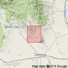
Named as the upper unit of the "Upper volcanic series" for an abandoned town near junction of Tom Brown Canyon and the Mimbres River, Grant Co., NM in the Basin-and-Range province. No type locality designated. An angular unconformity separates it from the underlying Bear Springs basalt and the overlying Santa Fe fanglomerates. Known only in secs. 26, 27, 34, 35, 36, T 18 S, R 10 W, Grant Co. Geologic map. Consists of alternating brown and gray bands about 3 mm wide, containing crystals of sanidine, quartz, and plagioclase. Flow folds common. Tertiary age assigned.
Source: GNU records (USGS DDS-6; Denver GNULEX).
For more information, please contact Nancy Stamm, Geologic Names Committee Secretary.
Asterisk (*) indicates published by U.S. Geological Survey authors.
"No current usage" (†) implies that a name has been abandoned or has fallen into disuse. Former usage and, if known, replacement name given in parentheses ( ).
Slash (/) indicates name conflicts with nomenclatural guidelines (CSN, 1933; ACSN, 1961, 1970; NACSN, 1983, 2005, 2021). May be explained within brackets ([ ]).