The National Geologic Map Database is migrating to a new infrastructure. We apologize for any service disruptions during this process.
|
|---|


- Usage in publication:
-
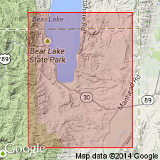
- Swan Peak quartzite*
- Modifications:
-
- Named
- Dominant lithology:
-
- Quartzite
- AAPG geologic province:
-
- Wasatch uplift
Summary:
Named for Swan Peak in the Bear River Range 1 1/2 mi south of the ID boundary, Rich Co, UT in the Wasatch uplift. No type locality designated. Is a fine-textured, massive to thin-bedded, white to gray, fossiliferous quartzite about 500 ft thick. Conformably overlies Garden City limestone (new); underlies Fish Haven dolomite. Assigned to the Ordovician. Contains a Chazy? fauna.
Source: GNU records (USGS DDS-6; Denver GNULEX).
- Usage in publication:
-
- Swan Peak quartzite*
- Modifications:
-
- Areal extent
- AAPG geologic province:
-
- Wasatch uplift
Summary:
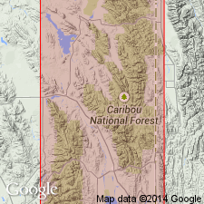
Geographically extended into southeast ID north of its type locality. Mapped (geologic maps) along west side of Montpelier quad and in southwest corner of Slug Gulch quad, Bear Lake Co, ID on the Wasatch uplift. Consists of about 500 ft of white quartzite, locally stained buff to red on weathered surfaces, in beds 6 inches to 4 ft thick. Fossils (listed) tentatively of Chazy age. Overlies Garden City limestone. Unconformably underlies Fish Haven dolomite. Of Early Ordovician age. Stratigraphic charts.
Source: GNU records (USGS DDS-6; Denver GNULEX).
- Usage in publication:
-
- Swan Peak formation
- Modifications:
-
- Overview
- AAPG geologic province:
-
- Wasatch uplift
Summary:
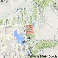
Consists of three thin persistent members in Logan quad. Section 339 ft thick measured in sec 20, T12N, R2E, Cache Co, UT on the Wasatch uplift where the formation overlies the Ordovician Garden City limestone and unconformably underlies Fish Haven dolomite. Is divided in the measured section into a lower member of black shale and thin, widely interspersed, brown, sandy limestone beds 174 ft thick; middle thin-bedded brown quartzite beds separated by thin gray shale beds 28 ft thick; and an upper thick-bedded gray or buff quartzite 137 ft thick. Is thicker in northeast corner of quad. Thought to be Canadian age on basis of graptolites and brachiopods. Considered Ordovician, Champlainian age in this report. Geologic map.
Source: GNU records (USGS DDS-6; Denver GNULEX).
- Usage in publication:
-
- Swan Peak quartzite
- Modifications:
-
- Revised
- AAPG geologic province:
-
- Great Basin province
Summary:
A sandstone body in west-central UT, Great Basin province, thought to be a tongue of the Swan Peak quartzite of northern UT and southeast ID, is named Watson Ranch tongue of Swan Peak. Isopach map. Cross sections. Measured sections. [For lithologic description of Watson Ranch which is the only part of the Swan Peak present in west-central UT, see Watson Ranch.] Overlies and intertongues with Lehman formation. Underlies the newly named Crystal Peak dolomite. Middle Ordovician age.
Source: GNU records (USGS DDS-6; Denver GNULEX).
- Usage in publication:
-
- Swan Peak formation*
- Modifications:
-
- Areal extent
- Overview
- AAPG geologic province:
-
- Great Basin province
Summary:
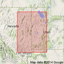
Geographically extended from northern UT south to exposures at Spor Mountain and west side of Dugway Range, Tooele Co, UT in the Great Basin province. Overlies Garden City formation; underlies Fish Haven dolomite. Is 470 ft thick on southeast side of Castle Mountain. Composed of brownish-green shale interbedded with thin beds of limestone, quartzite, and dolomite in lower part, and thick to massive white quartzite in upper part. Fossils found (listed) in lower part, chiefly brachiopods and trilobites, and also bryozoans and ostracodes. Of Middle Ordovician age. Geologic map. Stratigraphic sections.
Source: GNU records (USGS DDS-6; Denver GNULEX).
For more information, please contact Nancy Stamm, Geologic Names Committee Secretary.
Asterisk (*) indicates published by U.S. Geological Survey authors.
"No current usage" (†) implies that a name has been abandoned or has fallen into disuse. Former usage and, if known, replacement name given in parentheses ( ).
Slash (/) indicates name conflicts with nomenclatural guidelines (CSN, 1933; ACSN, 1961, 1970; NACSN, 1983, 2005, 2021). May be explained within brackets ([ ]).