- Usage in publication:
-
- Surrett Canyon Formation*
- Modifications:
-
- Named
- Dominant lithology:
-
- Limestone
- AAPG geologic province:
-
- Snake River basin
Summary:
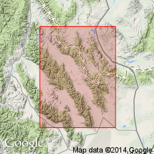
Named as upper formation (of four newly named formations) assigned to White Knob Group (rank raised). Named for exposures (the type section) at East Canyon on east flank, Lemhi Range, Butte Co, ID, Snake River basin. Geographic name taken from Surrett Canyon, east flank Lemhi Range. Overlies South Creek Formation (new) of White Knob; lower contact is a change from thin-bedded limestone (South Creek) with massive limestone (Surrett Canyon). Overlain by an unnamed quartzite-carbonate sequence of Pennsylvanian and Permian age. Consists in the Lemhis of 220 ft of dark-gray to black massive limestone that has a finely crystalline black groundmass and scattered bioclastic grains. Echinoderm and productid fragments of granule and sand size are embedded in the black matrix. The massive beds are separated by thin, light-brown weathering, fine-grained limestone with quartz silt. Horn coral CANINIA EXCENTRICA is characteristic of the formation. Is 600 ft thick in the Upper Pahsimeroi, Lost River Range. Thins to 200+ ft in the Beaverhead Range. Tentatively interpreted as a shallow-water, mud-bottom environment that could sustain horn corals, echinoderms, brachiopods, and gastropods. Columnar section. Present in miogeosynclinal area; absent in transition zone and cratonic area. Mississippian age.
Source: GNU records (USGS DDS-6; Denver GNULEX).
- Usage in publication:
-
- Surrett Canyon Formation*
- Modifications:
-
- Reference
- Biostratigraphic dating
- Dominant lithology:
-
- Limestone
- Chert
- AAPG geologic province:
-
- Snake River basin
Summary:
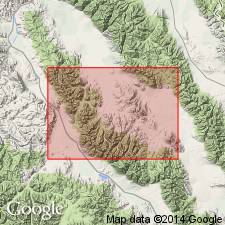
Reference section about 1,020 ft thick designated in NW1/4 NW1/4 to SE1/4 SE1/4 sec 25, T9N, R26E, Butte Co, ID, Snake River basin, where it consists of chert and limestone. Overlies South Creek Formation. Basal contact placed at base of lowest prominent limestone ledge. Underlies unnamed sandstone unit of Pennsylvanian age. Upper contact gradational. [Term White River Group (Huh, 1967) not used.] Ranges from 850 to 1,000 ft thick in the Doublespring and Hawley Mountains areas. Belongs to Foraminifera Zones 17, 18, and 19 which are Namurian or Chester in age. Foram fossils for Zones 17, 18, 19 listed. Coral-brachiopod fauna (Zone K) identified in lower 400 ft. Upper 450 ft contains brachiopod assigned to megafossil Zone post-K. Correlation chart; cross section.
Source: GNU records (USGS DDS-6; Denver GNULEX).
- Usage in publication:
-
- Surrett Canyon Formation*
- Modifications:
-
- Revised
- AAPG geologic province:
-
- Idaho Mountains province
- Snake River basin
Summary:
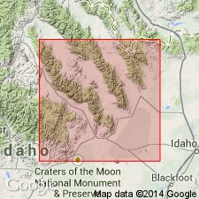
Pg. 2, 5, 11, figs. 1, 4. Surrett Canyon Formation. Present in southern White Knob Mountains, southern Lost River Range-Arco Hills, southern Lemhi Range, and southern Beaverhead Mountains, south-central Idaho. Consists of thick-bedded limestones. Upper contact revised; underlies Arco Hills Formation (new) in southern Lemhi Range (at type area of Surrett Canyon), southern Lost River Range, and Blue Dome area of southern Beaverhead Mountains; underlies Bluebird Mountain Formation (new) in southern White Knob Mountains. In southern Beaverhead Mountains, intertongues with Big Snowy Formation. In southern White Knob Mountains, limestone beds equivalent in age to Arco Hills Formation are mapped with the Surrett Canyon. Age is Late Mississippian (Chesterian).
Source: Publication.
- Usage in publication:
-
- Surrett Canyon Formation*
- Modifications:
-
- Biostratigraphic dating
- AAPG geologic province:
-
- Idaho Mountains province
Summary:
Upper part of Surrett Canyon Formation assigned to the Late Mississippian (Chesterian) ADETOGNATHUS UNICORNIS conodont zone in the White Knob Mountains of Custer Co, ID in the Idaho Mountains province. Columnar sections.
Source: GNU records (USGS DDS-6; Denver GNULEX).
- Usage in publication:
-
- Surrett Canyon Formation*
- Modifications:
-
- Overview
- AAPG geologic province:
-
- Idaho Mountains province
- Snake River basin
Summary:
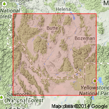
Is equivalent to Lombard Limestone (new) of Snowcrest Range Group (new) of southwest MT of the Montana folded belt province and to Railroad Canyon Formation (new) of Beaverhead Range, MT-ID of the Montana folded belt and Idaho Mountains provinces. [Surrett Canyon used in the Lost River and Lemhi Ranges, ID, Snake River basin and in the White Knob and Beaverhead Mountains, Idaho Mountains province.]
Source: GNU records (USGS DDS-6; Denver GNULEX).
For more information, please contact Nancy Stamm, Geologic Names Committee Secretary.
Asterisk (*) indicates published by U.S. Geological Survey authors.
"No current usage" (†) implies that a name has been abandoned or has fallen into disuse. Former usage and, if known, replacement name given in parentheses ( ).
Slash (/) indicates name conflicts with nomenclatural guidelines (CSN, 1933; ACSN, 1961, 1970; NACSN, 1983, 2005, 2021). May be explained within brackets ([ ]).

