

- Usage in publication:
-
- Sur series
- Modifications:
-
- Original reference
Summary:
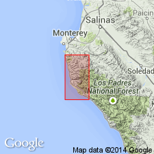
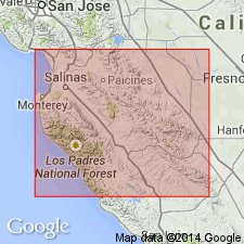
Sur series. The term Santa Lucia series was first applied to the crystalline complex of Santa Lucia Range by J.P. Smith in 1909 (Sci., n.s., v. 30, p. 347). [Name used but not defined in publication cited.] The name Santa Lucia, however, had been previously applied by Lawson (1893, [The geology of Carmelo Bay, California Univ. Pub. Geol. Sci. Bull., v. 1, p. 1-59]) to the granite at north end of Santa Lucia Range. It is very evident that the crystalline schists, since, by priority, Santa Lucia should be given to the granite and quartz diorite. The name Sur series is proposed as a comprehensive name for the schist series of Southern Coast Ranges, which is particularly well developed along Sur River. Age unknown. [Lexicon states age is pre-Franciscan, possibly pre-Cambrian.] No fossils have yet been found in this series. It is intruded by Santa Lucia quartz diorite, of pre-Chico age. It consists chiefly of sedimentary rocks now metamorphosed into quartzites, marbles, mica schists, paragneisses, and in part into injection gneiss. It includes the limestones that have been named Gabilan limestone.
Named from Sur River.
Source: US geologic names lexicon (USGS Bull. 896, p. 2090-2091).
- Usage in publication:
-
- Sur series
- Modifications:
-
- Overview
Summary:
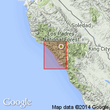
Pg. 116-132, geologic map. Name Sur series was applied by Trask (1926) to metamorphic rocks of Santa Lucia Range. Previous to that time, these rocks had been known variously as part of Santa Lucia formation and of Coast complex, although associated plutonic material had been distinguished by Lawson as Santa Lucia formation [Santa Lucia granite]. Present report uses Trask's term Sur series, but Trask's perpetuation of name Gabilan for the marbles, which occur at various horizons, spaced irregularly over several thousands of feet stratigraphically, seems ill advised. Series in Santa Lucia quadrangle comprises variety of generally phanerocrystalline metamorphic rocks including quartzose schists and gneisses, quartz biotite schists, marbles, and plagioclase amphibolites. Series crops out over much of northern Santa Lucia Range; similar rocks are exposed in northern part of Gavilan [Gabilan] Range, and sporadic areas have been mapped in Santa Cruz Mountains. Thickness uncertain because of possibility of unrecognized structural complexities. Assuming homoclinal structure with average dip of 35 degrees, there must be minimum of 7,000 feet near northwest corner of quadrangle. If Sur series east of Coast Ridge fault is not repetition of rocks of this northwest area, total thickness may be approx. 10,000 feet. Age is Paleozoic(?).
Source: US geologic names lexicon (USGS Bull. 1200, p. 3779-3780).
- Usage in publication:
-
- Sur series
- Modifications:
-
- Areal extent
Summary:
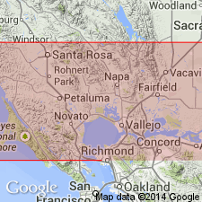
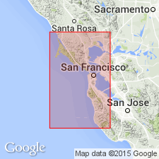
Pg. 18-19, pl. 9 (geol. map). Term Sur series used to include pre-Franciscan schist and quartzite and pre-Franciscan limestone on Point Reyes Peninsula. Two exposures of quartzite and schist, each less than 2 acres, occur associated with quartz diorite along an intrusive contact. One exposure is about 7,000 feet southwest of Inverness on northeastern slope of Pont Reyes Mountain and is less than 30 feet thick. The other exposure, which is on western shore of Tomales Bay about 1.25 miles north of Inverness, consists of a narrow strip of banded quartz-mica schist about 500 feet long and 25 feet thick. It rests upon quartz diorite and dips at a low angle eastward beneath Tomales Bay and supposedly abuts San Andreas fault. A belt of crystalline limestone a little less than 1,000 feet wide lies about 1 mile west of Point Reyes Station. It is faulted into quartz diorite so that the eastern side abuts the quartz diorite and western side passes beneath Miocene sandstone. Southern tip of belt wedges into igneous rock. Age is Paleozoic(?).
Source: US geologic names lexicon (USGS Bull. 1200, p. 3779-3780).
- Usage in publication:
-
- Sur series
- Modifications:
-
- Overview
Summary:
Pg. 118. Names Sur series, Gabilan limestone, and Santa Lucia granodiorite are essentially petrographic and not formational in usual sense since rocks of very different ages might be included under any one of the names.
Source: US geologic names lexicon (USGS Bull. 1200, p. 3779-3780).
- Usage in publication:
-
- Sur series
- Modifications:
-
- Areal extent
Summary:
Pg. 1676. An 8,200-foot section of strongly metamorphosed sediments of Sur series is exposed astride Freemont Peak 10 miles northeast of Salinas at north end of Gabilan Range. Homoclinal sequence strikes east and dips 70 deg. N. Three units recognized: 1,400-foot upper schist; 3,300-foot middle carbonate schist; and 3,500-foot lower schist. Neither top nor bottom of sequence exposed; boundaries have been obliterated by quartz monzonite intrusions. Fremont Peak section is within 5,000- to 10,000-foot range of thickness suggested by Reiche and Trask for series in Lucia and Point Sur quadrangles of Santa Lucia Mountains. Indistinct forms in limestone suggestive of cup corals together with clastic debris possibly derived from round-section crinoids, observed one-half mile west of Fremont Peak on Rocky Ridge, yield only age-suggestive features of series. Age of part of sequence is possibly Paleozoic.
Source: US geologic names lexicon (USGS Bull. 1200, p. 3779-3780).
For more information, please contact Nancy Stamm, Geologic Names Committee Secretary.
Asterisk (*) indicates published by U.S. Geological Survey authors.
"No current usage" (†) implies that a name has been abandoned or has fallen into disuse. Former usage and, if known, replacement name given in parentheses ( ).
Slash (/) indicates name conflicts with nomenclatural guidelines (CSN, 1933; ACSN, 1961, 1970; NACSN, 1983, 2005, 2021). May be explained within brackets ([ ]).