The National Geologic Map Database is migrating to a new infrastructure. We apologize for any service disruptions during this process.
|
|---|


- Usage in publication:
-
- Supai formation*
- Modifications:
-
- Original reference
- Dominant lithology:
-
- Shale
- Sandstone
- AAPG geologic province:
-
- Plateau sedimentary province
Summary:
Pg. 21, 22, 25. Supai formation of Aubrey group. Name proposed for the red sandstones and shales that constitute lower part of Aubrey group in northern Arizona and form a definite stratigraphic unit over wide area. In previous reports these rocks, together with the overlying gray sandstone (herein named Coconino sandstone), have usually been referred to as the "Aubrey sandstone series." They are, however, distinct from the gray sandstone throughout northern Arizona, but their separation from underlying Redwall limestone is not everywhere as clear as could be desired. Named for conspicuous exposures at Supai village, on Cataract Creek, northern Arizona. In Cataract Canyon and the side canyons near Supai settlement the formation appears to be 1,400+ feet thick. At top are 400 feet of red shales, in part sandy, with thin red sandstone layers. The lower member, about 1,000 feet thick, consists of red sandstones varying from coarse to fine and from slabby to cross-bedded, lying on about 75 feet of red shales and soft red sandstones. Next below is Redwall limestone, of which upper part is soft and contains some shale partings. In Gilbert's section at mouth of Grand Canyon he included in top of Redwall limestone 510 feet of alternating sandstone and limestone, which I believe belong to Supai formation. Age is considered Pennsylvanian, based on stratigraphic position. Report includes geologic map.
Source: US geologic names lexicon (USGS Bull. 896, p. 2089-2090); supplemental information from GNU records (USGS DDS-6; Denver GNULEX).
- Usage in publication:
-
- Supai formation*
- Modifications:
-
- Revised
- AAPG geologic province:
-
- Plateau sedimentary province
Summary:
Pg. 64. Supai formation of Aubrey group. Removed from top of Supai formation 267 to 317 feet of deep brick-red sandy shales and fine-grained friable sandstones (which he stated are unconformable on the underlying beds of the Supai) and named them Hermit shale. According to present definitions, therefore, the Supai formation (restricted) is separated from overlying Coconino sandstone by Hermit shale. In this same publication (p. 54-30) Noble added to base of the Supai 200 to 510+/- feet of red sandy shale, purplish and gray limestone with red chert, and reddish to buff calcareous sandstone, of Pennsylvanian age, which Gilbert, Walcott, Darton, and other earlier writers had included in Redwall limestone, but which Darton had suggested properly belong to Supai formation. Noble reported a probable unconformity between the Pennsylvanian and Mississippian beds. Noble's definition is present [ca. 1938] approved definition of the USGS.
Source: US geologic names lexicon (USGS Bull. 896, p. 2089-2090).
- Usage in publication:
-
- Supai formation*
- Modifications:
-
- Areal extent
- AAPG geologic province:
-
- Great Basin province
Summary:
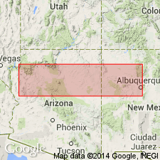
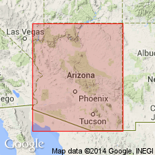
Supai formation crops out in valley east of Cottonwood Pass east of Mule Spring Mountain, NV. Measured section in sec.13 T23S R58E, Clark Co, is 1150 ft thick. Overlies Bird Spring formation; underlies Kaibab limestone. All Permian beds in Goodsprings quad are assigned to Supai formation. Map legend gives age as Permian.
Source: GNU records (USGS DDS-6; Menlo GNULEX).

- Usage in publication:
-
- Supai formation*
- Modifications:
-
- Overview
- AAPG geologic province:
-
- Plateau sedimentary province
Summary:
Supai formation of Aubrey group. In parts of southern Utah the gray Coconino sandstone greatly thickens and occupies the time interval of a large part of the red Supai formation. See under Coconino sandstone. The Supai formation as identified in southwest Utah and southeast Nevada probably includes the time equivalent of Hermit shale.
This formation is now [ca. 1938] classified as Permian and Pennsylvanian(?), because of its contained fossil plants, all of which were classified by David White as of Permian age. There is, however, a possibility some beds of Pennsylvanian age may be present in its basal part in some areas.
Source: US geologic names lexicon (USGS Bull. 896, p. 2090-2091).
- Usage in publication:
-
- Supai formation
- Modifications:
-
- Revised
- AAPG geologic province:
-
- Plateau sedimentary province
- Basin-and-Range province
Summary:
Revised in that two named members recognized in central AZ that have not been used or described in earlier publications. This report is the first publication to use Packard Ranch member as the basal member (of 5) of Supai in the Sycamore Canyon and Fossil Creek areas, southern Yavapai and adjoining parts of Coconino and Gila Cos, AZ in the Basin-and-Range and Plateau sedimentary provinces. This report is the first publication to use Oak Creek member as a member (1 of 5) of Supai in the Fossil Creek area of Coconino Co, AZ, Plateau sedimentary province. Both names attributed to a thesis by Winters (1950), [but attributes of these named stratigraphic units not included in this publication. Therefore, these two members are not adequately defined.] Assigned a Pennsylvanian and Permian age. Cross sections.
Source: GNU records (USGS DDS-6; Denver GNULEX).
- Usage in publication:
-
- Supai formation*
- Modifications:
-
- Areal extent
- AAPG geologic province:
-
- Great Basin province
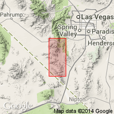
Summary:
Exposures of Supai formation are confined to Spring Mountains, ridges north of Ivanpah fault and to mountains east of Spring Mountains near northern border of Ivanpah 1x1 deg quad, CA and NV. Supai formation of Pennsylvanian and Permian age is mapped 4 mi into San Bernardino Co, southeast CA at south end of Spring Mountains.
Source: GNU records (USGS DDS-6; Menlo GNULEX).
- Usage in publication:
-
- Supai Formation
- Modifications:
-
- Revised
- AAPG geologic province:
-
- Black Mesa basin
- Basin-and-Range province
Summary:
Divided into four members (ascending order): Amos Wash (named), Big A Butte (named), Fort Apache Limestone (newly assigned to Supai), and Corduroy (named), Gila and Navajo Cos, AZ in the Basin-and-Range province and Black Mesa basin. Fossils (mollusks and brachiopods) from Fort Apache described. Thirteen measured sections. Correlation chart. Deposited marginally to an oscillating sea. Includes nonmarine redbeds channel fill deposits. Gypsum beds indicate evaporation after occasional flooding. Overlies Naco Formation; underlies Coconino Sandstone. Of Early Permian age. Amos Wash and Big A Butte are Wolfcampian. Fort Apache and Corduroy are Leonardian.
Source: GNU records (USGS DDS-6; Denver GNULEX).
- Usage in publication:
-
- Supai Formation
- Modifications:
-
- Contact revised
- AAPG geologic province:
-
- Black Mesa basin
Summary:
Upper contact revised in that Supai Formation gradationally underlies the newly named Hunters Point Member of the De Chelly [sic] Sandstone on the Defiance Plateau, Apache Co, AZ in the Black Mesa basin. Assigned to the Permian.
Source: GNU records (USGS DDS-6; Denver GNULEX).
- Usage in publication:
-
- Supai Formation*
- Modifications:
-
- Revised
- AAPG geologic province:
-
- Black Mesa basin
Summary:
Within report area of Black Mesa basin, AZ, Supai divided into five members (ascending): limestone and sandstone member of Pennsylvanian age, Cibecue Member (new) of Pennsylvanian? and Permian age, and sandstone and siltstone member, Fort Apache Member, and limestone and siltstone member, all of Permian age.
Source: GNU records (USGS DDS-6; Denver GNULEX).
- Usage in publication:
-
- Supai Group*
- Modifications:
-
- Revised
- AAPG geologic province:
-
- Plateau sedimentary province
Summary:
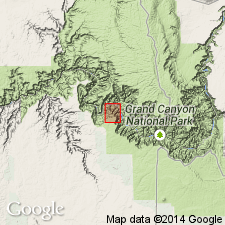
Raised in rank from Supai Formation to Supai Group in Grand Canyon area, Coconino Co, northern AZ in Plateau sedimentary province. Divided into (oldest to youngest): Morrowan and early Atokan Watahomigi (new), Atokan and Des Moinesian? Manakacha (new), and Virgilian Wescogame (new) Formations, and Wolfcampian Esplanade Sandstone (revised from Esplanade Sandstone Member of Supai Formation). Type section for group designated and measured in Havasu Canyon near Supai Village, Coconino Co, AZ where the group is 1.014 ft thick. Location map, measured sections, nomenclature table. Unconformably overlies Horseshoe Mesa Member of Redwall Limestone; unconformably underlies Hermit Shale. Ranges in age from Early Pennsylvanian to Early Permian; Missourian rocks are missing.
Source: GNU records (USGS DDS-6; Denver GNULEX).
- Usage in publication:
-
- Supai Formation*
- Modifications:
-
- Revised
- Areal extent
- AAPG geologic province:
-
- Salton basin
Summary:
Names applied in Grand Canyon area extended geographically to sequence in Big Maria Mountains of southeast CA in the Salton basin. Name Supai Formation used without change of designation. Pennsylvanian? and Permian Supai Formation consist of impure quartzite, subordinate calcite and dolomite marble and varied calc-silicate rocks metamorphosed from variably calcareous and dolomitic redbeds. Rocks mostly white, light gray, and green-gray (fresh); but dark brown (weathered), cliff former. Thickness is 2 to 200 m. Name Supai used throughout region. Contacts revised in that Supai overlies Redwall Marble and underlies Hermit Schist. This part of CA was part of stable craton of North America in Paleozoic and early Mesozoic time. Rocks were intruded by Middle Jurassic granodiorite and metamorphosed in Cretaceous time.
Source: GNU records (USGS DDS-6; Denver GNULEX).
- Usage in publication:
-
- Supai Formation*
- Modifications:
-
- Overview
- AAPG geologic province:
-
- Basin-and-Range province
- Plateau sedimentary province
Summary:
Formation rank used. Mapped along Mogollon Rim along West Clear Creek in Yavapai and Coconino Cos, Basin-and-Range and Plateau sedimentary provinces respectively, and northward in Yavapai and Coconino Cos to northwest border of quad. Three parts mapped. Upper part of Early Permian age thought to be equivalent to upper member of Supai of Huddle and Dobrovolny (1945). Lower ledge-forming limestone beds at base of the upper part are the Fort Apache Member of the Supai. Middle part of Early Permian age is equivalent to middle member and lower part of upper member of Supai of Huddle and Dobrovolny. The lower part of Early Permian and Late Pennsylvanian age unconformably underlies the middle part and is equivalent to the lower member of Huddle and Dobrovolny and with the Naco Limestone of Elston and Di Paolo (1979). Formations of Supai Group recognized in Grand Canyon not recognized in this quad.
Source: GNU records (USGS DDS-6; Denver GNULEX).
- Usage in publication:
-
- Supai Formation, Group
- Modifications:
-
- Areal extent
- AAPG geologic province:
-
- Black Mesa basin
- Plateau sedimentary province
Summary:
Supai Group present throughout west-central, northwest, and north-central AZ west of the Sedona arch to the AZ-UT State line, Plateau sedimentary province. Its four formations (Watahomigi of Morrowan and Atokan age), Manakacha (Atokan age), Wescogame (Virgilian age), and Esplanade Sandstone (Wolfcampian) are absent or unrecognizable east of 111 deg west longitude. The contacts between these formations are difficult to pick even in the Grand Canyon. The group thins rapidly, marker beds disappear, and upper Esplanade overlies lower Supai from Sycamore Canyon to Dry Creek, north of Jerome. Supai Formation of Virgilian, Wolfcampian, and Leonardian age recognized across Mogollon Rim from Fossil Creek eastward, and into adjacent subsurface and north onto Defiance Plateau, Black Mesa basin. The formation can be divided into a lower part (=? to parts of Wescogame to west) and an upper part (previously called Hermit Shale, Amos Wash or Cibecue Member, or middle member of Supai) probably Wolfcampian or Leonardian age. Complex channel deposits which possibly lie near the Pennsylvanian-Permian boundary present near middle of formation. Only upper part present on Defiance Plateau. New name Schnebly Hill Formation used on Mogollon Rim and southern Defiance Plateau for rocks formerly included in upper Hermit, upper Supai, De Chelly Sandstone and Yeso Formation. Cross sections. Nomenclature chart.
Source: GNU records (USGS DDS-6; Denver GNULEX).
- Usage in publication:
-
- Supai Group*
- Modifications:
-
- Age modified
- Biostratigraphic dating
- AAPG geologic province:
-
- Plateau sedimentary province
Summary:
Age of the Supai is modified locally (where the Surprise Canyon Formation underlies the Watahomigi Formation, basal formation of the Supai Group). Conodonts of the upper Chesterian (Upper Mississippian) ADETOGNATHUS UNICORNIS Zone were recovered from marine limestones of the Surprise Canyon Formation in western and central Grand Canyon, Mohave and Coconino Cos, AZ (Plateau sedimentary province). Basal limestones of the overlying Watahomigi Formation contain conodonts of the slightly younger RHACHISTOGNATHUS MURICATUS/ADETOGNATHUS LAUTUS Zone, which indicate either a latest Chesterian or an earliest Pennsylvanian age. Recovery of the Pennsylvanian species DECLINOGNATHODUS NODULIFERUS seventeen meters above the base of the Watahomigi in Quartermaster Canyon suggests that the Mississippian-Pennsylvanian boundary occurs within the lower units of the Watahomigi Formation of the Supai Group. Toward the end of the Chesterian, Surprise Canyon sediments began to accumulate in deep erosional channels cut into the underlying Redwall Limestone. Surprise Canyon deposition ceased during a brief period toward the end of the latest Mississippian. This hiatus probably corresponds to the eustatic fall in sea level during the latest Mississippian observed by many other workers. Deposition of the Watahomigi appears to have commenced [at least locally] before the end of the Mississippian when the channels were almost, but not completely filled.
Source: GNU records (USGS DDS-6; Denver GNULEX).
For more information, please contact Nancy Stamm, Geologic Names Committee Secretary.
Asterisk (*) indicates published by U.S. Geological Survey authors.
"No current usage" (†) implies that a name has been abandoned or has fallen into disuse. Former usage and, if known, replacement name given in parentheses ( ).
Slash (/) indicates name conflicts with nomenclatural guidelines (CSN, 1933; ACSN, 1961, 1970; NACSN, 1983, 2005, 2021). May be explained within brackets ([ ]).