- Usage in publication:
-
- Sunset Creek Intrusive Complex*
- Modifications:
-
- Original reference
- Dominant lithology:
-
- Granite
- Quartz monzonite
- AAPG geologic province:
-
- Lake Superior region
Summary:
Pg. 26-28, pl. 1 (geol. map). Sunset Creek Intrusive Complex. Leucrocratic multi-textured intrusive dikes and irregular bodies ranging from fine aplite through granite to coarse pegmatite, and a smaller number of even-textured quartz monzonite dikes. Dikes terminate northward along an east-west line that closely parallels the later pre-Animikie erosion surface. Dikes occur in Puritan Quartz Monzonite, Whiskers Creek Gneiss, and Ramsay Formation (all new). Age is early Precambrian (Precambrian W); [late Archean].
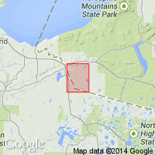
[Type locality]: exposures in large bedrock hill, northeast of Sunset Creek and just east of Black River fault, in NW/4 NW/4 sec. 25, T. 47 N., R. 46 W., [Bessemer 7.5-min quadrangle], western Gogebic Co., northwestern MI.
Source: Publication; US geologic names lexicon (USGS Bull. 1564, p. 167); ; Changes in stratigraphic nomenclature, 1976 (USGS Bull. 1435-A, p. A101).
For more information, please contact Nancy Stamm, Geologic Names Committee Secretary.
Asterisk (*) indicates published by U.S. Geological Survey authors.
"No current usage" (†) implies that a name has been abandoned or has fallen into disuse. Former usage and, if known, replacement name given in parentheses ( ).
Slash (/) indicates name conflicts with nomenclatural guidelines (CSN, 1933; ACSN, 1961, 1970; NACSN, 1983, 2005, 2021). May be explained within brackets ([ ]).

