

- Usage in publication:
-
- Sunrise Peak Monzonite Porphyry*
- Modifications:
-
- Named
- Dominant lithology:
-
- Porphyry
- AAPG geologic province:
-
- Great Basin province
Summary:
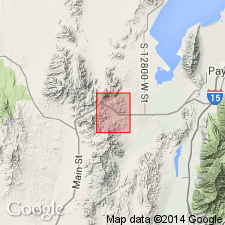
Name applied to porphyritic intrusive rocks in a stock that underlies Sunrise Peak in south-central part of main Tintic district. Includes massive sill-like bodies, one of which is named the Gough sill. Type locality for the Sunrise Peak is the Sunrise Peak stock, Sunrise Peak, 6 mi south of Dividend, sec 17, T11S, R2W, Juab Co, UT in the Great Basin province. Sunrise Peak is chemically, mineralogically, and genetically equivalent to the tuffs and lavas of the Tintic Mountain Volcanic Group (new). The Gough named for exposures near Little Gough and Big Gough Springs in NE1/4 sec 33, T10S, R2W, which is composed of cliff-forming, dark-greenish-gray, fine- to medium-grained porphyritic rock. Phenocrysts in the Gough are 60 to 65 percent plagioclase, 15 percent biotite and augite, 3 to 7 percent sanidine, and 1 to 2 percent magnetite. Phenocrysts make up 50 percent of the rock. Contacts of the Gough sill are intrusive cutting the Copperopolis Latite (new) and the Latite Ridge Latite (new) of the Tintic Mountain Group. The sill is a tongue-shaped mass 500 to 1,000 ft thick. In the Sunrise Peak, biotite is poorly preserved and few sanidine phenocrysts found. The Gough sill is younger than the 32.8 m.y. Packard Quartz Latite and is cut by the 31.5 m.y. old Silver City stock. A middle Oligocene age assigned.
Source: GNU records (USGS DDS-6; Denver GNULEX).
For more information, please contact Nancy Stamm, Geologic Names Committee Secretary.
Asterisk (*) indicates published by U.S. Geological Survey authors.
"No current usage" (†) implies that a name has been abandoned or has fallen into disuse. Former usage and, if known, replacement name given in parentheses ( ).
Slash (/) indicates name conflicts with nomenclatural guidelines (CSN, 1933; ACSN, 1961, 1970; NACSN, 1983, 2005, 2021). May be explained within brackets ([ ]).